

Orlando weather: Rain and storms kick off Super Bowl weekend in Central Florida

Orlando Weather Forecast: Feb. 10, 2023
Orlando and Central Florida will see increased chances for rain on Saturday, with the possibility of severe thunderstorms.
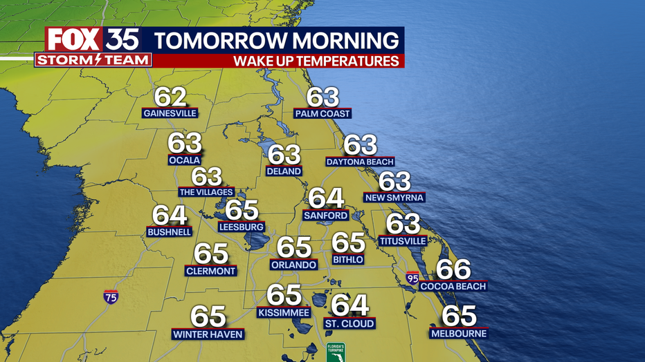
ORLANDO, Fla. - Tonight's low: 65 degrees | Tomorrow's high: 86 degrees | Rain: 20%
Main weather concerns: Friday evening and into Saturday morning, a few showers could develop, but mostly along the Atlantic Coast. Saturday looks very wet with a strong storm risk spreading across the Central Peninsula, this includes the Orlando Metro.
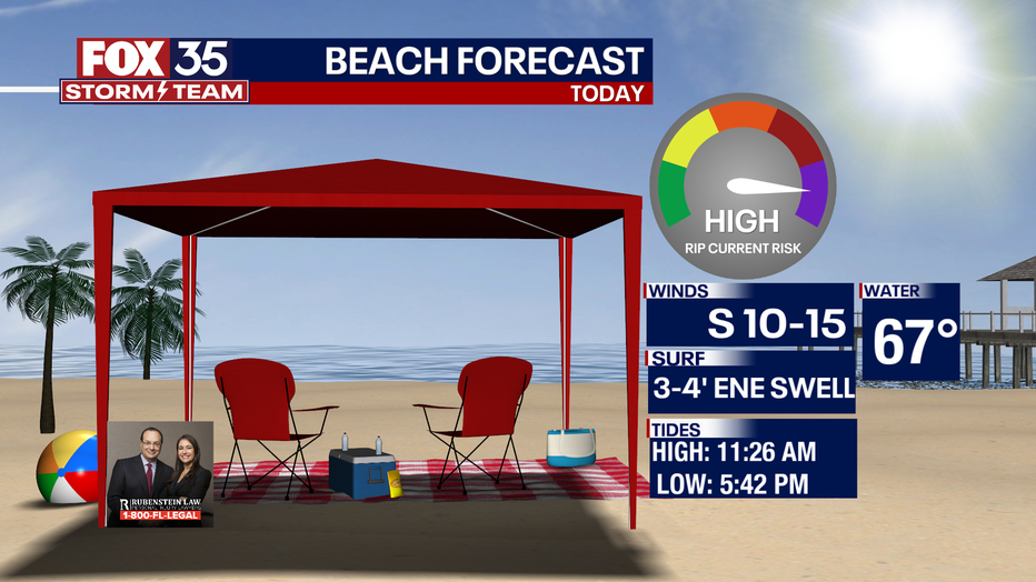
BEACHES:
Most of the afternoon on Saturday will be dry with clouds. Temperatures will reach the mid to upper-70s. Surf is in the 3-4' range in a nice pulse of ENE swell. High risk for rip currents. Local winds will be variable early, shifting out of the southeast around 5-10 mph. Don't forget to reapply sunscreen.
THEME PARKS:
Highs warm to near 83 degrees with partly cloudy skies. Rain chances begin to increase as we move into the early evening hours.
OUTLOOK:
Warm weather will continue on Saturday as highs repeatedly visit the low-mid 80s. Rain chances rise Saturday evening.
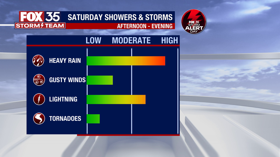
A few thunderstorms will be mixed in, especially in North Central areas-gusty winds, lightning and heavy rain will accompany a few of the storms.
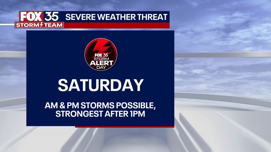
The storm prediction center has marked this area in a "LEVEL-1 POSSIBLE" risk for a few strong or severe storms during this time.
As of right now, it appears that damaging wind gusts would be the primary hazard. The front will finally head South of the area late Saturday night into Sunday.
Colder air will funnel in right behind. Sunday looks dry, mostly sunny and much cooler. Wake up temps Sunday will be around 50 degrees with a PM rebound high of 65 or so.