

Area of low pressure has 60-percent chance of developing along South Carolina coast

Tracking the Tropics: July 8, 2020
FOX 35 Meteorologist Allison Gargaro has the latest tropical activity in the Atlantic Ocean and the Gulf of Mexico.
ORLANDO, Fla. - The National Hurricane Center is keeping an eye on a pocket of low pressure moving through South Carolina Wednesday morning.
This low has been meandering around the southeast states for several days, enhancing rain chances across Florida and southern Georgia. The low will move offshore at some point on Wednesday and remain very close to the shoreline of the Coastal Carolinas.
As the system sits over the warm coastal waters, some development will be possible.
The 2-day development outlook from the National Hurricane Center has climbed to 60-percent and the 5-day chance is at 70-percent.
While the system looks to remain offshore, it will likely enhance the breezes along the Carolina coastline and contribute to rather high rain chances in that area.
RELATED: National Hurricane Center: List of 2020 hurricane names
If the system develops further, it could become Fay, our sixth named storm of the 2020 Atlantic hurricane season.
Elsewhere in the tropics, the Caribbean looks very quiet right now, as well as the Central Atlantic.
TRACK THE TROPICS: Visit the FOX 35 Orlando Hurricane Center for the latest in the tropics, including daily updates, live radar, and severe weather alerts.
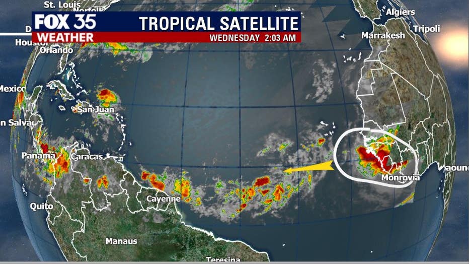
Over the tropical Atlantic, between South America and West Africa, things are a bit more active. We're watching a strong wave of lower pressure moving off West Africa later on Wednesday and this one should be watched. The environment it will enter is marginal at best for development but, regardless, we will keep a close eye on it.
FOX 35's Weather App will have all the latest updates on the 2020 Atlantic hurricane season, in addition to daily forecast reports and severe weather alerts.
CLICK HERE TO DOWNLOAD THE FOX 35 WEATHER APP
Weather updates will also come down LIVE on FOX 35 News.