

Chance of severe weather across Central Florida on Tuesday

Chance of severe weather across Central Florida on Tuesday
A line of storms will sweep through on Tuesday, creating a risk for a possible tornado for counties in the western parts of our viewing area.
LAKE MARY, Fla. - Our next cold front has formed and is quickly moving our way, bringing with it a threat for severe weather.
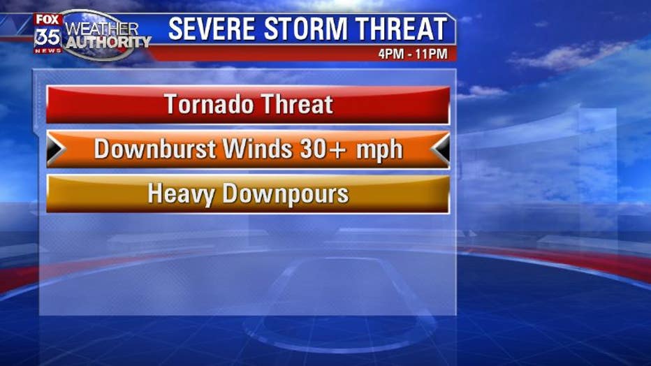
Expect a line of storms to blow through Central Florida from 4 p.m. to 11 p.m. on Tuesday. This line of storms has the potential to produce some isolated rotating storms that could spin up a brief EF-0 to EF-1 tornado during that time frame. The main threat with this setup is for strong downburst winds of 30-plus mph.
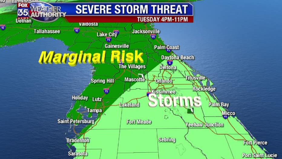
The area that could see the most severe weather stretches from Tampa area to Daytona Beach. Within this marginal risk area there will be gusty winds, heavy downpours and also a slight risk for a tornado. The overall threat is less than the threat we had on Friday night when an EF-1 tornado formed in Flagler county, but it is still enough that we should take this seriously.
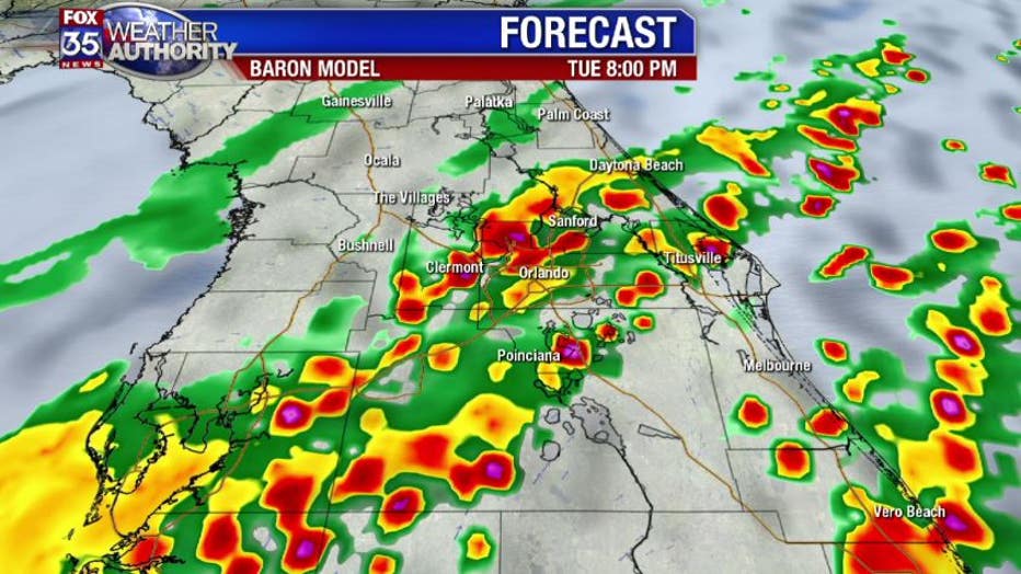
I anticipate that the line of storms will be weakening as it moves through, but there will still be intense, discreet cells that will have the ability to rotate and tap into cold air aloft. This will produce a moderate amount of lightning, along with the risk of a tornado and downburst winds.
The upper-level environment is not cold enough to support large hailstones, but smaller hail is a possibility with a few of the storms on Tuesday evening.
Be sure to use your FOX35 Weather App so you can track the storms on Tuesday and be up to date with any warnings that could be issued. Download here.