

Coolest air Central Florida has experienced in months to arrive this week

Weather Report: September 28
FOX 35 meteorologist Kristin Giannas gives the latest on the weather in Central Florida.
ORLANDO, Fla. - Some real heat relief is on the way to Central Florida.
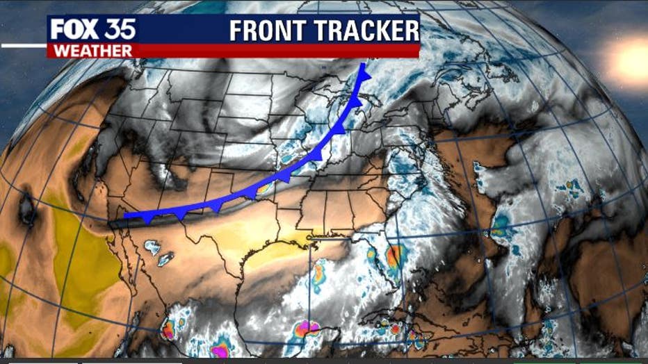
The FOX 35 weather team is currently tracking a strong cold front moving through the Plains States on Monday, drawing closer to Florida by mid-week.
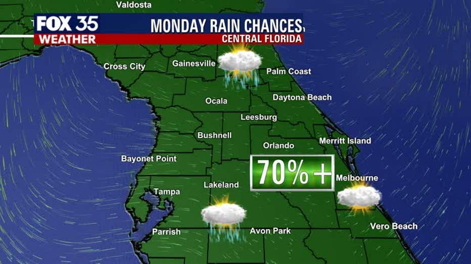
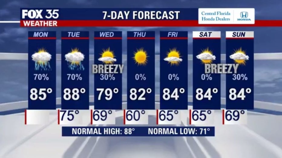
While showers and storms are in the cards for Monday and Tuesday, gorgeous conditions will fill in behind the front by Wednesday and into the latter end of the week. Rain chances are at the higher end, 70 percent, for both Monday and Tuesday.
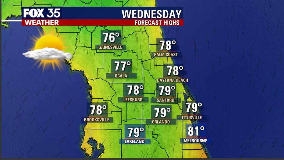
The cooler winds of change will arrive on Wednesday morning as the front heads south and down the Florida Peninsula. While an isolated shower will be possible before 9 a.m. on Wednesday, the general trend of weather on that day will be incredible. Highs will hang out in the mid to upper 70s, reaching the lower 80s along the southern Space Coast. Skies will feature ample sunshine as breezes come in from the north.
WEATHER ALERTS: Download the FOX 35 Weather App to track the tropics on your phone, receive severe weather alerts, and get the latest daily forecasts
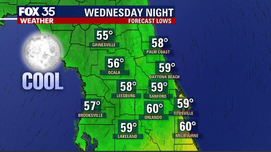
Now for the good stuff: lows fall into the 50s and 60s across the viewing area overnight Wednesday into early Thursday morning. The forecast temps you see here will be the coolest the area has experienced in many months. While it is not a super chill, we are heading for the comfy zone with both actual air temperatures and lower humidity. Skies will be clear late Wednesday into Thursday morning.
Tune in FOX 35 Orlando for the latest on the weather in Central Florida.