

Heavy rainfall, lightning forecasted in Central Florida on Monday as the tropics heat up

ORLANDO, Fla. - After a very quiet two-week run, the tropics are getting active yet again.
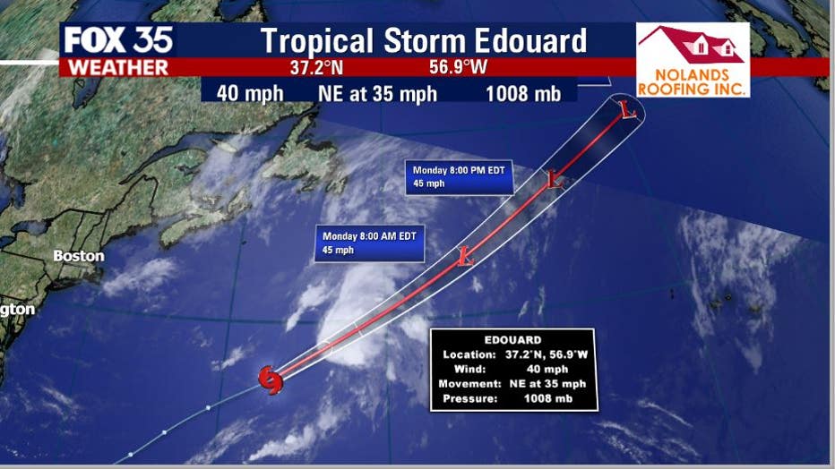
First, Tropical Storm Edouard -- our 5th named Atlantic system of the season -- continues to rapidly accelerate into the far North Atlantic. The system has top sustained winds of 40 mph, with modest intensification possible later today.
The good news is that right now, this system poses no threat to land.
The Northeast Gulf of Mexico is another spot to watch.
TRACK THE TROPICS: Visit the FOX 35 Orlando Hurricane Center for the latest in the tropics, including daily updates, live radar, and severe weather alerts.
A small low-pressure system located in this region will move ashore the Florida Panhandle. Little development is expected on Monday. The low is forecasted to move through the deep South and back out over the Atlantic, east of the Carolinas, over the next few days.
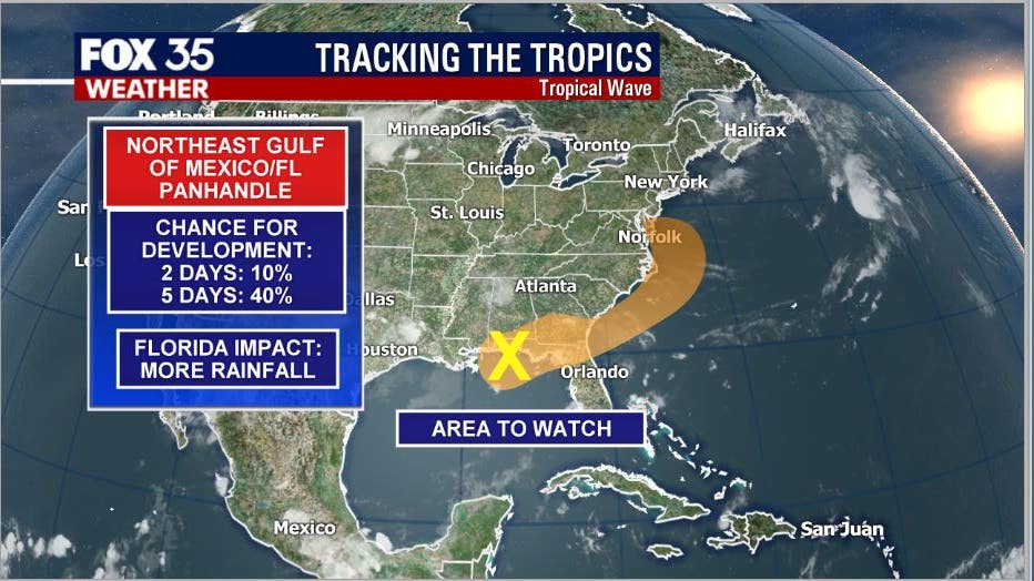
Over the next five days, the National Hurricane Center (NHC) has indicated the possibility of this system developing with a 40 percent chance. The impact on Florida will be limited, with rainfall likely.
WEATHER ALERTS: Download the FOX 35 Weather app for severe weather alerts, live radar, daily forecast reports, and more.
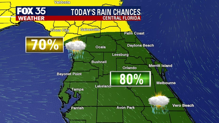
Monday will see heavy rainfall and lightning into the afternoon, with 80 percent coverage after 1 p.m. around Orlando. Around an inch of rain accumulation is possible.
FOX 35 meteorologist Jayme King has more on what to expect this Monday in Central Florida.

Weather Report: July 6
FOX 35 meteorologist Jayme King gives the latest on the weather in Central Florida.
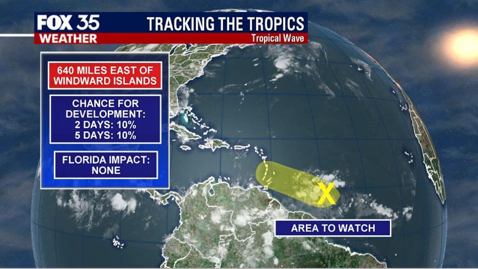
Then, over the distant Atlantic, a wave of weak low pressure is moving towards the Windward Islands. This system has very little developmental potential. Near term and longer-term outlooks have this system at a 10 percent chance of developing before conditions become very unfavorable.
Tune in to FOX 35 Orlando for the latest Central Florida news.