

Jackets required! Cold blast to drop temperatures into the 30s this weekend

Orlando. FL - Expect a return of bright Central Florida sunshine is on tap today as the atmosphere dries out. Wednesday brought widespread clouds and chilly temps.
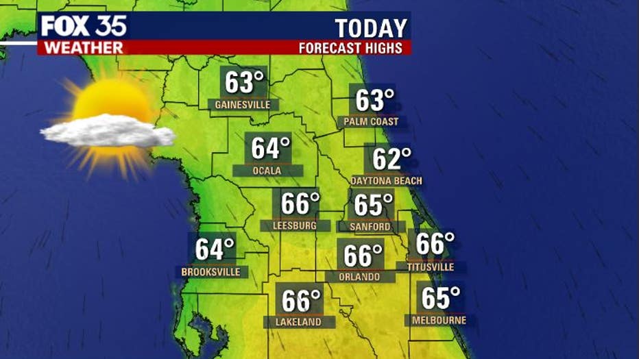
Today brings warmer temps, approaching the mid-60s in many locations.
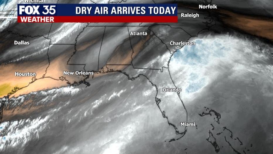
You can see the dry air moving into the State from the North and that trend will be with us until Friday afternoon and evening. An approaching cold front will bulk up the clouds a bit Friday afternoon with a few showers developing as the front moves on top of Florida by Friday evening.
WEATHER ALERTS: Download the FOX 35 Weather App to track the tropics on your phone, receive severe weather alerts, and get the latest daily forecasts
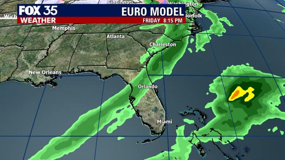
The latest forecast modeling coming into the FOX 35 Weather Center shows the ribbon of showers arriving after 5 pm Friday. Rain amounts look to be extremely light. The rain will move through quickly and pave the way for an incoming blast of chilly weekend air.
Cold weather lovers will be delighted both Saturday and Sunday!
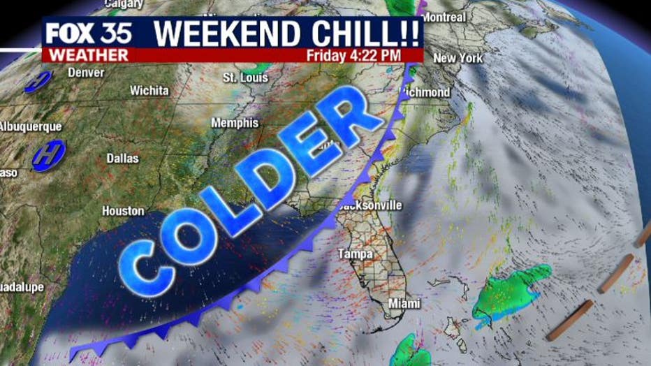
The cold airmass will filter in Friday night. This means clearing skies into Saturday morning and not much of a warm-up on both Saturday and Sunday afternoon.
Expect highs around 60 degrees and breezy winds. Definitely a little chilly outlook despite near full sunshine.
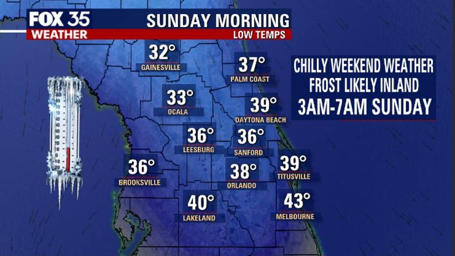
The coldest temperatures over the next 7-9 days will set up on Sunday morning.
Widespread 30s are expected away from the Coastal barrier island areas. Expect some frost development inland as conditions will be perfect for that. Maybe think about covering up any tender plants in the garden and if you've got tropical plants in containers, bring those in, outdoor pets as well. Lastly, be very careful with space heaters if you choose to warm yourself that way.
Watch FOX 35 News for the latest on Florida's changing weather.