

Orlando Weather Forecast: Rain chances stay high for Monday

Weather Forecast: September 18, 2022
FOX 35 Storm Team Meteorologist Brittany Lockley has a look at the forecast.
Tonight's low: 74 degrees
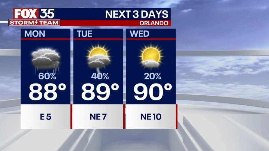
Tomorrow's high: 88 degrees
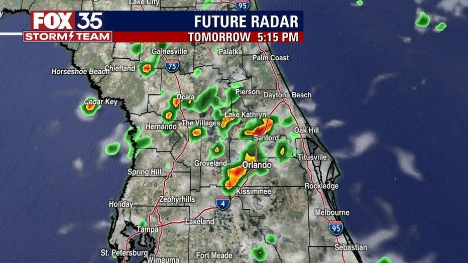
Rain: 60%
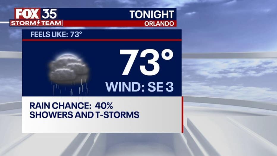
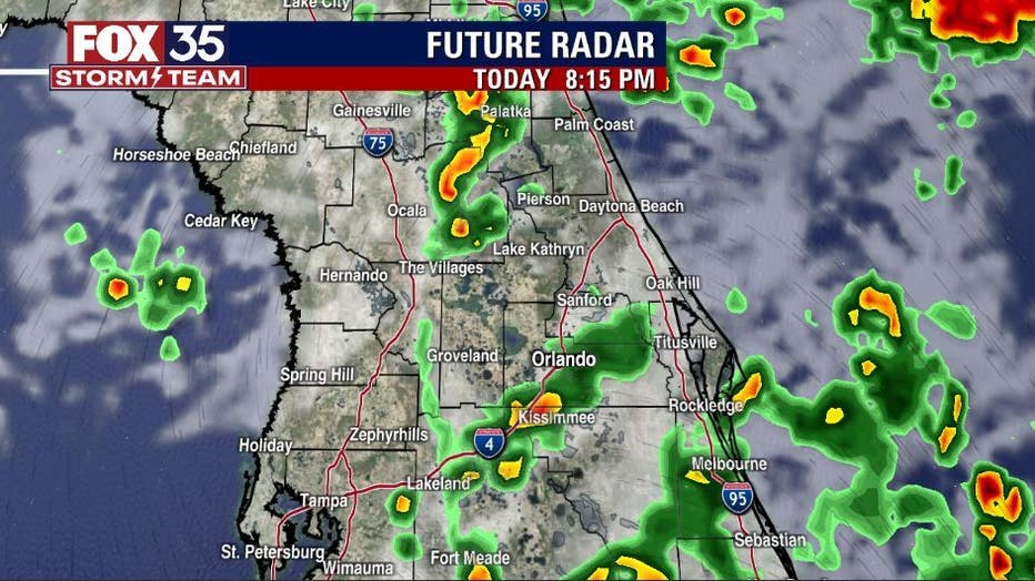
Main weather concerns: A slow start to the rain this afternoon. Showers and a few storms will start on the coast and track inland. The heat of the day will spark showers a few more showers in the late afternoon throughout the evening. These showers are going to move over places that have already seen heavy rainfall this week, so this can quickly lead to ponding and localized flooding. Coverage hangs in the 80% range.
BEACHES
Showers and thunderstorms will be the story after 2pm for the beaches on Monday. There will be a 60% chance of rain. High temperatures peak at 85 degrees tomorrow. Surf will be around 3 ft with the rip current risk being moderate. Make sure to swim next to a lifeguard stand.
THEME PARKS
Get to the parks early to get a full day in. Rain chances are highest between 2 pm- 7pm with a 60% chance of rain. Heavy rain and lightning will accompany the stronger storms. Afternoon highs will reach the upper 80s. Make sure to take breaks inside and stay hydrated.
EXTENDED OUTLOOK
Rain chances stay high for Monday and gradually decrease throughout the week. Conditions ease up as a northerly wind brings drier conditions to our area just in time for the first day of fall on Thursday. Keep the umbrella handy for Monday and download the FOX 35 STORM TEAM app to stay up to date with the current radar!
TROPICS
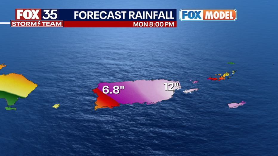
Tropical storm Fiona is located 70 miles South of St. Croix. Fiona is slowing down as it tracks West at 9 mph towards the Virgin Islands and Puerto Rico. Fiona is bringing torrential rain 19.46" of rain was recorded in the past 24 hours in the mountains in Guadeloupe. A hurricane warning is now in effect for Puerto Rico, and hurricane watches are in effect for the Virgin Islands. The next few days can bring life-threatening flooding and mudslides for the Islands. The latest track has Fiona strengthening to a hurricane as it passes over Puerto Rico and through the Mona Passage (the body of water between Puerto Rico and the Dominican Republic). Our exclusive FOX MODEL shows winds speeds over 75 mph passing through these islands. As of right now, there is no direct threat to Florida. You can always depend on the FOX 35 Storm Team for the latest updates.
Our EXCLUSIVE FOX MODEL is very much inline with the current FIONA forecast from the NHC. Tracking has FIONA intensifying to a hurricane before making landfall in Puerto Rico and then heading to the NW past the Dominican Republic.
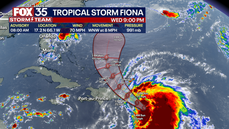
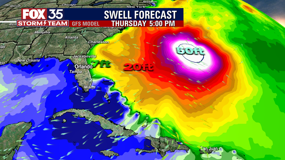
From there our FOX MODEL takes the system to the north and heading in the direction of Bermuda. Only impact locally will be higher surf and rip current risk this week.
You can depend on the FOX 35 STORM TEAM when it comes to tracking the tropics. Our FOX MODEL updates through the day and as those updates come in, we will share the latest with you!