

Record heat before possible storms later this week

Orlando, FL - Expect another toasty day for Central Florida on this Tuesday.
Highs will have no problem getting into the upper 80s inland, low-mid 80s along the beaches. The standing high temperature record in Leesburg out in Lake County is 87 degrees for the date and could be threatened by this afternoon.
Skies will feature a blend of sun and clouds, humidity will also creep up a bit today compared to days past.
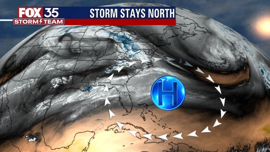
For now, an active weather pattern will stay North of Florida. High pressure is in control of the local weather at this time. This means very warm temps and a continuation of dry conditions.
The high will slowly begin to break down through midweek, allowing a cold front to draw closer to the Sunshine State.
MORE NEWS: ‘Frozen’ alligators spotted sticking noses through ice to survive in Oklahoma
The approach of the front will spark gusty Southerly winds and very hot temps on Thursday. Many locations inland will reach 90 degrees or higher, even the coastal locations could see some upper 80s. High temperature records could fall on Thursday afternoon! Rain chances will increase slightly on Thursday afternoon and evening. A few isolated strong storms could fire up during this time.
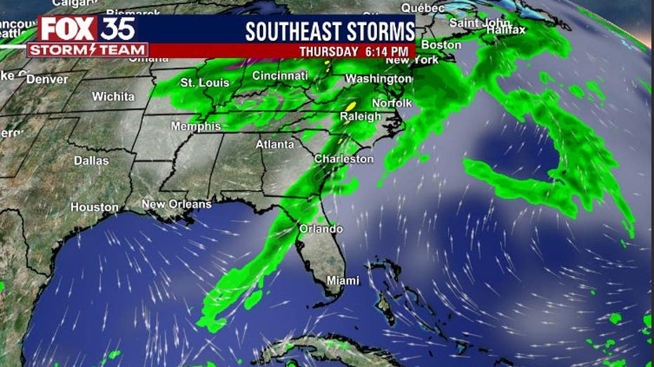
The latest forecast models are indicating that a band of showers and storms associated with the approaching front will move in by late afternoon and early evening Thursday.
The threat of the strongest storms will remain North of our area but we'll be tracking regardless!
WEATHER ALERTS: Download the FOX 35 Weather App for live radar, severe weather alerts, and daily forecast reports on your phone
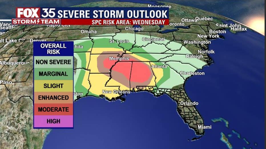
The severe weather risk will be quite high over the deep South by Wednesday, especially in the afternoon hours.
MORE NEWS: ‘Space hurricane’ discovered above Earth for the first time ever
While parts of the Western Florida Panhandle are outlined for a severe weather threat, much of the energy will reside over Alabama and Mississippi. Damaging winds and long-lived tornadoes will be possible in these risk areas.
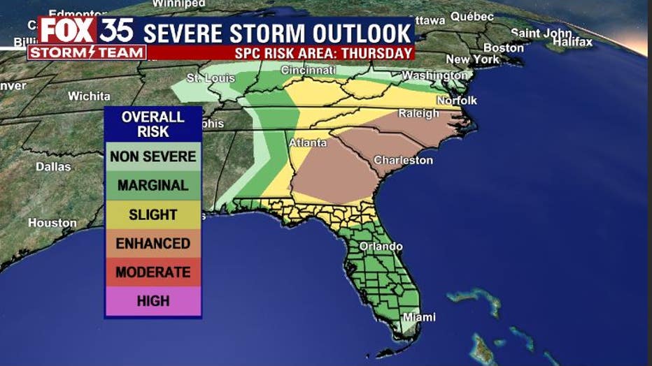
By Thursday, a MARGINAL RISK of severe storms is outlined for the Florida Peninsula and a SLIGHT RISK for severe storms can be found across far North Florida.
While the activity on the Peninsula looks rather isolated, don't rule out a few storm cells popping up and perhaps producing some gusty winds and heavy downpours.
Stay with the FOX 35 STORM TEAM for further details concerning the weather over the next couple of days.
Watch FOX 35 News for the latest weather updates.