

Widespread rain targeting Central Florida by Mother's Day

Weather Forecast: May 8, 2020
FOX 35 Chief Meteorologist Glenn Richards gives you the latest on the weather in Central Florida.
Orlando, Fl - If you've got outdoor plans across Central Florida on Sunday for Mother's Day, you may want a plan "B."
A current look at satellite data reveals an incoming cold front over the Gulf South and a pocket of developing low pressure over the Southwest Gulf of Mexico. Looks like these two features will unfortunately meet up right on top of Florida this weekend.
This means rain chances will begin rising mainly after 8am on Sunday, bad news for any outdoor plans you may have.
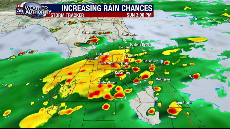
Current forecast modeling is suggesting a large "shield" of rain increasing in coverage as we go through the late morning and into the afternoon hours.
The 3 p.m. timeframe looks quite active with ongoing showers and just a few isolated storms. Strong or severe storms are NOT expected but, a soaking rainfall is. Accumulations could exceed an inch is some areas, especially South of Orlando.
RELATED: Winter Park closing Park Ave. to allow restaurants to expand dining for Mother's Day
In North Central Florida, far removed from the low pressure area crossing South Florida, rainfall amounts and duration will be lessened. This could change if the track of the low moves a bit more North than anticipated, talk about fine details!
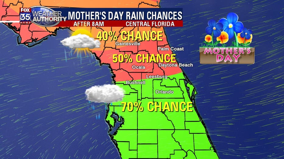
Notice the rain chances are much lower as you move out of Orlando Northbound. Rain chances closer to Marion, Flagler, Northern Sumter, and Volusia Counties will reside in the 50% range, even lower as you head into the WOGX FOX 51 viewing over North Central Florida (Dixie, Gilchrist, Alchau and Putnam Counties).
Coverage there may only stand near 40% with mostly cloudy skies and some scattered showers.
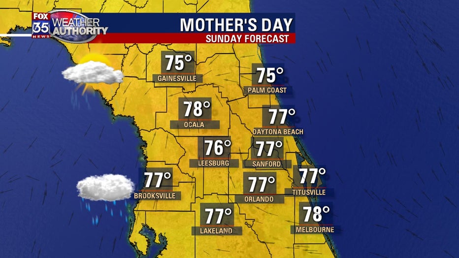
Of course with the clouds and rain chances blossoming, area high temps on Sunday will be squashed down into the 70s. Lows by Sunday evening will fall into the 60s but, not until after 2am.
Be sure to have the FOX 35 Weather App downloaded to be the first to know when harsh weather is heading for your area.