

2 Atlantic tropical systems could bring heavy rain, strong winds to Caribbean: Any impacts to Florida?
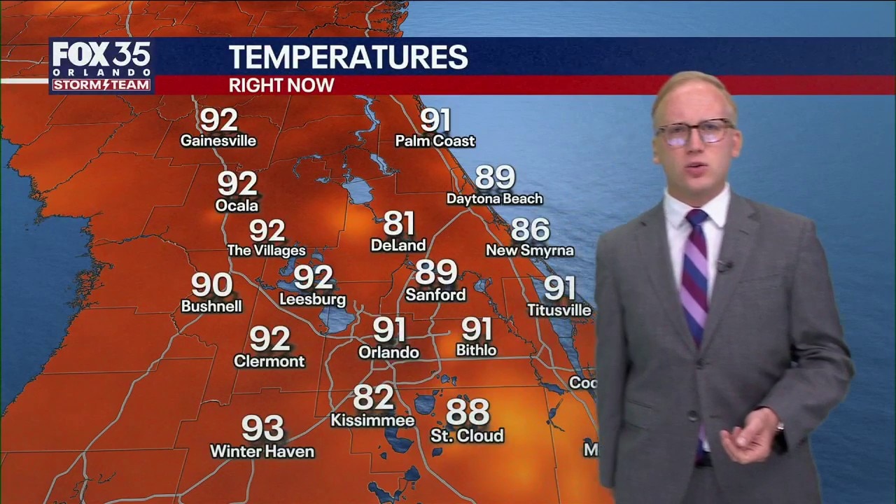
Orlando Weather Forecast: Tracking storms and heat
Scattered showers and storms are around this evening and more storms are expected for Friday afternoon and evening. FOX 35 Storm Team Senior Meteorologist Noah Bergren is tracking hotter weather next week.
ORLANDO, Fla. - The FOX 35 Storm Team is monitoring two tropical systems in the Atlantic, including one expected to bring heavy rain and strong winds to parts of the Caribbean even as its chances of developing decline.
The systems have been designated Invest 92L and Invest 94L.
Where is Invest 92L?
What we know:
Invest 92L was about 1,000 miles east of the Lesser Antilles on Thursday, according to the National Hurricane Center.
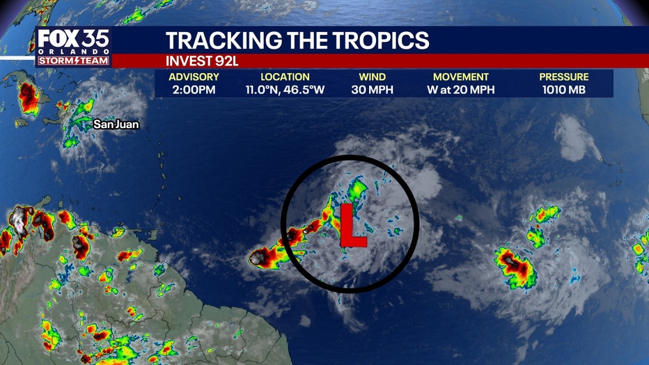
Showers and thunderstorms associated with the system have become less organized, lowering its chances of becoming a tropical depression or storm.
Regardless of development, the system could bring gusty winds and periods of heavy rain to the Lesser Antilles beginning Friday night and continuing into Saturday.
The system is expected to continue west toward the Caribbean, with unsettled weather potentially spreading toward the Greater Antilles through the weekend and into Monday.
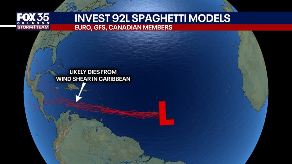
Forecasters expect the system to weaken as it moves farther west.
Where is Invest 94L?
What we know:
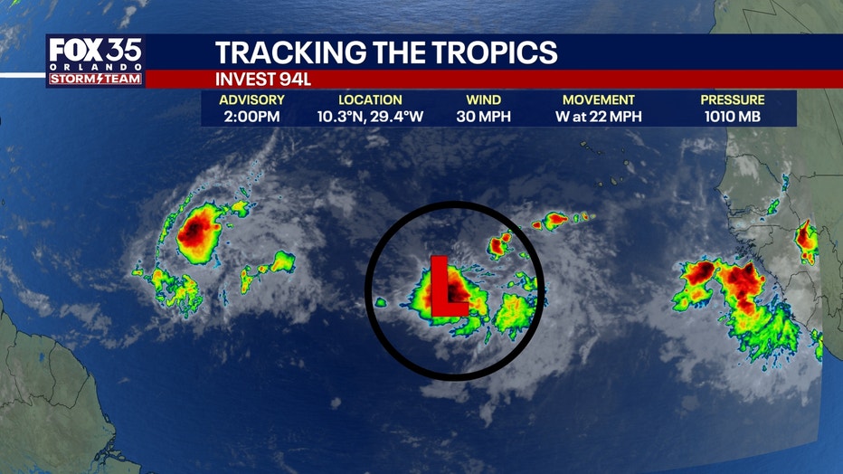
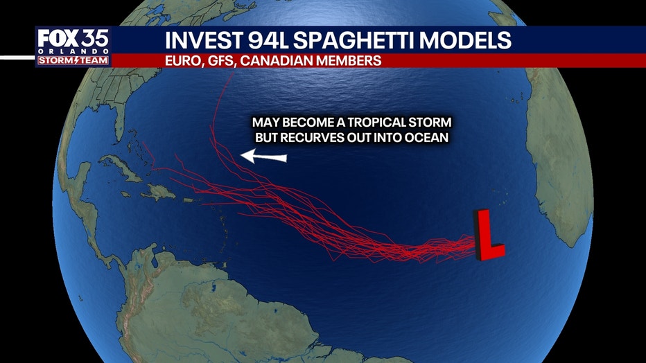
Another tropical wave, INvest 94L, located farther east in the Atlantic also is being monitored. Conditions could allow that system to gradually strengthen as it moves west or west-northwest over the next several days. A tropical depression could form late this week or during the weekend, forecasters said.
Meanwhile, strong winds and dangerous seas are expected in parts of the southern Caribbean. A gale warning is in effect for waters near Colombia and the Gulf of Venezuela beginning Friday night, with waves potentially reaching 13 feet.
Could Invest 92L, Invest 94L impact Florida?
What they're saying:
The National Hurricane Center urged people in the Lesser Antilles to continue monitoring Invest 92L because heavy rain and strong winds remain possible even if the system does not become a tropical depression or storm.
The NHC believes conditions are now less favorable for that to happen; however, forecasters believe Invest 94L will strengthen into a tropical depression by the weekend. Both systems will encounter wind shear and dry air and that means little risk to Florida.
Gulf remains calm
Elsewhere, generally calmer conditions are expected across much of the Gulf, while scattered showers and thunderstorms are possible near the Bahamas.
The Source: This story was written based on information shared by the National Hurricane Center and analysis by the FOX 35 Storm Team.