FOX 35 Weather Impact Day: Central Florida could experience severe weather on Sunday

Orlando Weather Forecast: Dec. 9, 2023
The FOX 35 Storm Team has declared Sunday a Weather Impact Day with increased chances for heavy rain, wind gusts, and lightning.
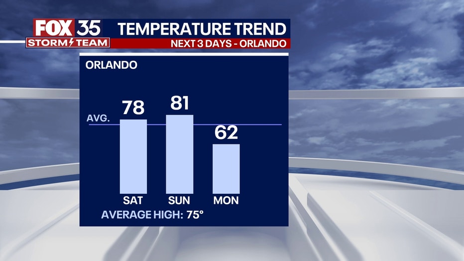
ORLANDO, Fla. - We are calling Sunday and FOX 35 Weather Impact Day because a cold front could impact your outdoor plans. At this time, severe weather is possible in the late afternoon and early evening hours. It will turn much cooler after that system passes with lows dropping into the 40s by next Monday night into Tuesday morning.
Tonight's low: 64 degrees | Tomorrow's high: 80
BEACHES: The beaches see mostly cloudy skies with a few passing sprinkles possible. High temps seaside head for the 70s, so much warmer than days past. Surf is in the 2-4' range with a healthy mix of medium to longer period swell in the water. By late afternoon, storms will begin to move into Central Florida.
THEME PARKS: Mostly cloudy at the attractions, with a few passing sprinkles in the afternoon. Highs at the parks head for the mid-70s. By late afternoon, storms will begin to move into Central Florida.
OUTLOOK: Following the potential for severe weather on Sunday, cooler air arrives with lows dipping into the 30s and 40s over much of the region. Highs on Monday will reach into the 50s and 60s.