

Gusty winds with storms possible Tuesday night

Weather Forecast: March 31, 2020
FOX 35 Chief Meteorologist Glenn Richards gives you the latest on the weather in Central Florida.
LAKE MARY, Fla. - A cold front will sweep a line of storms across Central Florida Tuesday with some wind gusts up to 40 mph, said FOX 35 Chief Meteorologist Glenn Richards.
Storms will stay below severe threshold, but can still put out a damaging wind gust.
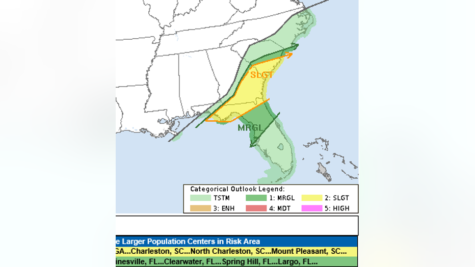
The Tornado Watch for north Florida will expire at 9 p.m. and is not expected to be extended any farther south into Central Florida, Richards said.

The threat for tornadoes remains along the Interstate 10 corridor and north into Georgia.
In this zone, the upper-level temperatures are colder and the jetstream winds are stronger.
That combination will not be shifting south Tuesday evening.
The threat for gusty winds will arrive between 10 p.m. and 1 a.m. in metro Orlando as the front begins to move through Orange and Seminole Counties.
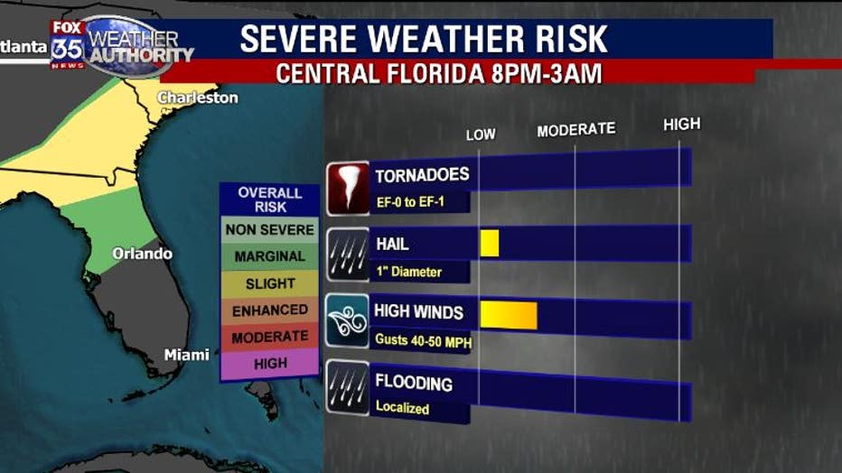
Total rainfall is only expected to be 10 inches or less due to the quick forward motion, Richards said.
The showers will clear our east coast in Brevard county by 3 a.m.