

Heat builds this week before storms, cold return on Thursday

Weather Forecast: March 3, 2020
FOX 35 meteorologist Jayme King gives you the latest on the weather in Central Florida.
ORLANDO, Fla. - Here we go! Yet another surge in Central Florida temperatures returns Tuesday.
Expect breezy winds from the South and mixed skies. Highs hit near the mid-80s around Orlando, coastal locales will bask in highs closer to 80 as a beautiful beach day unfolds. Skies will remain dry, the exception could be late tonight in North Florida as a few showers develop there after 1 a.m.
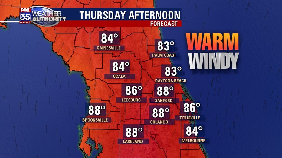
Our next cold front will approach the area late Wednesday night into Thursday.
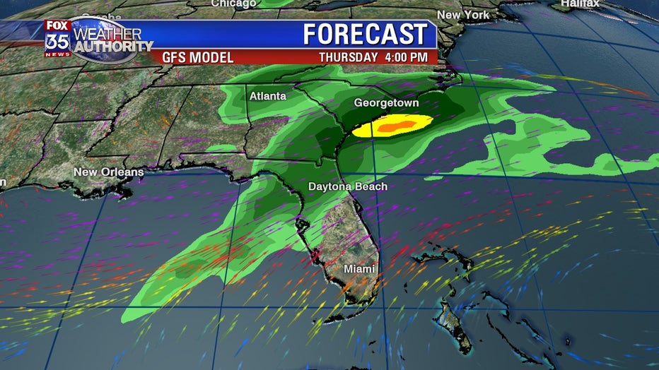
Winds will increase again promoting windy conditions and very warm temperatures. We're talking about highs around Orlando approaching 90 degrees before clouds really increase and afternoon rain chances rise. Right now, it looks like the main push of rain won't come until mid-afternoon (after 2pm) with a scattering of showers and storms.
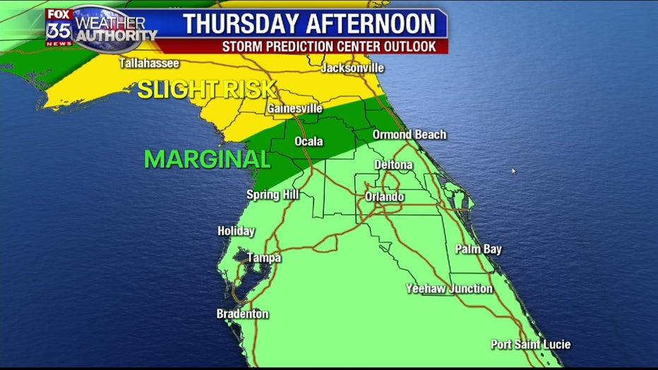
Some of the storms could get strong or even severe containing damaging winds or a possible isolated tornado. The highest risk across the viewing area will be over far North Florida where a slight risk of severe sets up, South of that, a marginal risk of strong storms includes Marion and Flagler Counties, again, much of this risk will play out during the afternoon and evening hours.
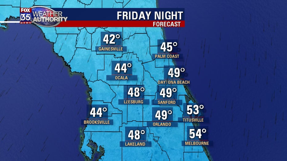
Behind the front on Thursday night into Friday will be a delight for cool weather lovers. Cooler highs in the low 70s for Friday afternoon, plenty of sunshine expected. Friday night into Saturday morning will offer up the coldest temps over the next several days. 40s and 50s are expected during this time.
Be sure to download the FOX 35 Weather App to be the first to know the weather conditions for your area.