

NHC: Hurricane Erin weakens into Cat 3 storm, as it churns in the Atlantic
Hurricane Erin forecast: Latest path, cone, track
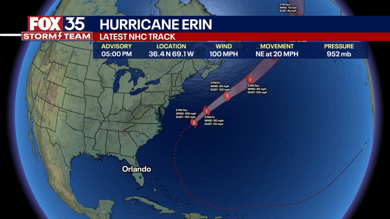
Hurricane Erin weakened slightly Monday night but remained a Category 4 storm with sustained winds of 130 mph as it churned northwest, bringing dangerous surf and renewed concerns about beach erosion along Florida’s Atlantic coast.
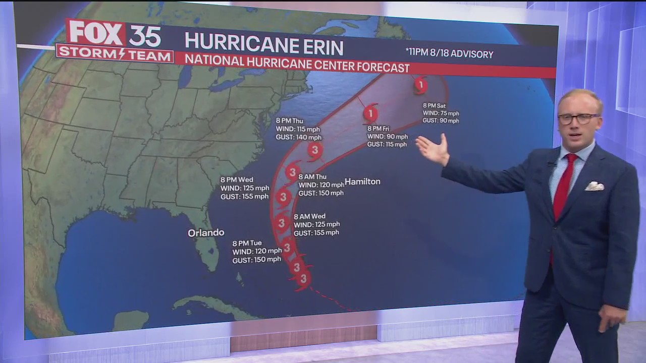
ORLANDO, Fla. - Hurricane Erin weakened into a Category 3 storm in the Atlantic Ocean, according to the National Hurricane Center.
Tropical storm warnings and watches were issued late Monday for the Bahamas and the Carolinas.
CLICK TO DOWNLOAD THE FOX LOCAL APP
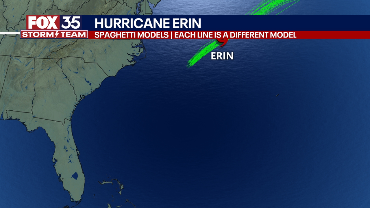
Hurricane Erin tracker: Where is the storm?
As of 11 p.m., Hurricane Erin was 690 miles southwest of Bermuda and 780 miles away from Cape Hattereas, North Carolinas, and was moving west-northwest at 8 mph. A Category 3 hurricane, Erin had maximum sustained winds of 125 mph.
"On the forecast track, the core of Erin is expected to move away from the southeastern Bahamas and the Turks and Caicos Islands tonight and move east of the remainder of the Bahamas on Tuesday. The hurricane is then expected to move between Bermuda and the east coast of the United States by the middle of the week," the NHC said.
Erin is expected to get a bit stronger, though not expected to reach Category 5 status, according to the latest projections.
Hurricane Erin to bring dangerous surf, rip currents to Florida, U.S.
Hurricane Erin is expected to bring life-threatening surf and dangerous rip currents to beaches along the United States' eastern coastline, including Florida, this week.
CLICK TO DOWNLOAD THE FOX LOCAL APP
NHC tracking disturbances behind Hurricane Erin
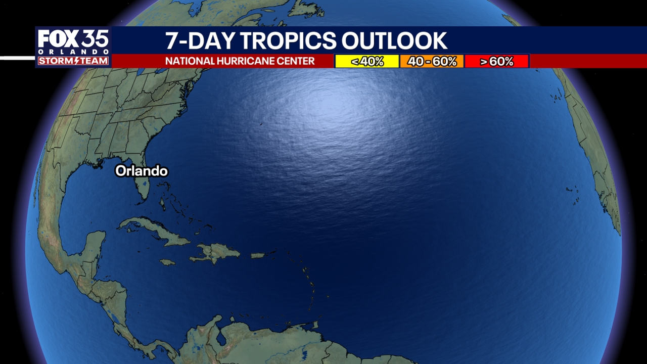
The National Hurricane Center has flagged a disturbance in the eastern Atlantic Ocean, behind Hurricane Erin, and given it a medium chance (60%) for development over the next week.
The tropical wave is located over the eastern Atlantic Ocean and is producing disorganized showers and thunderstorms, the NHC said. Gradual development is possible this week, where a tropical depression could form, according to the NHC.
It is moving northwestward at about 20 mph.
Another tropical wave emerging off the coast of Africa has a low chance of development over the next week (10%).