

Orlando weather: Hottest weekend of the summer approaches, with heat index in the triple-digits
ORLANDO, Fla. - Some of the hottest temperatures of the summer are expected to arrive this weekend in Central Florida, paired with near-dangerous heat indexes. A heat advisory is in place for the majority of Central Florida from noon to 6 p.m.
Here's a look at what to expect from the weather today, this weekend and looking forward to next week.
What will the weather look like tonight?
What to expect:
A small chance of a thunderstorm or two remains Friday evening west of the I-4 corridor, but otherwise the region will stay hot and humid overnight.
The timing of the rain looks to take place later in the day than usual and will extend into the evening.
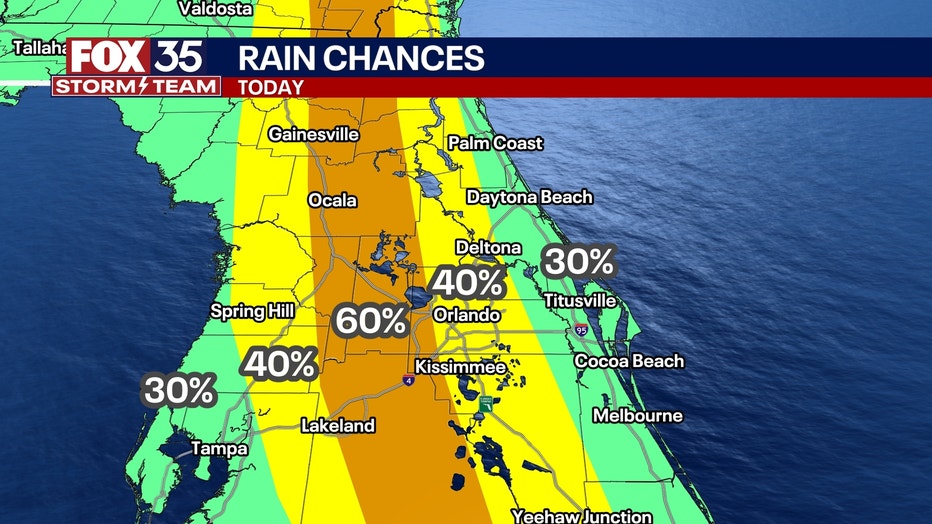
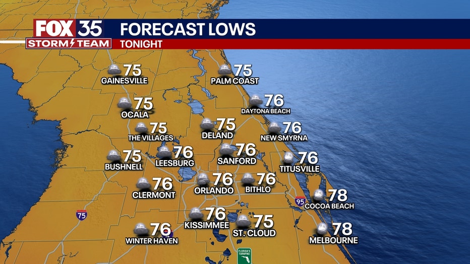
Any leftover showers will fade overnight. We stay very warm and muggy. Plan for lows in the mid-to-upper-70s.
Hot, humid weekend with minimal storm chances
What's next:
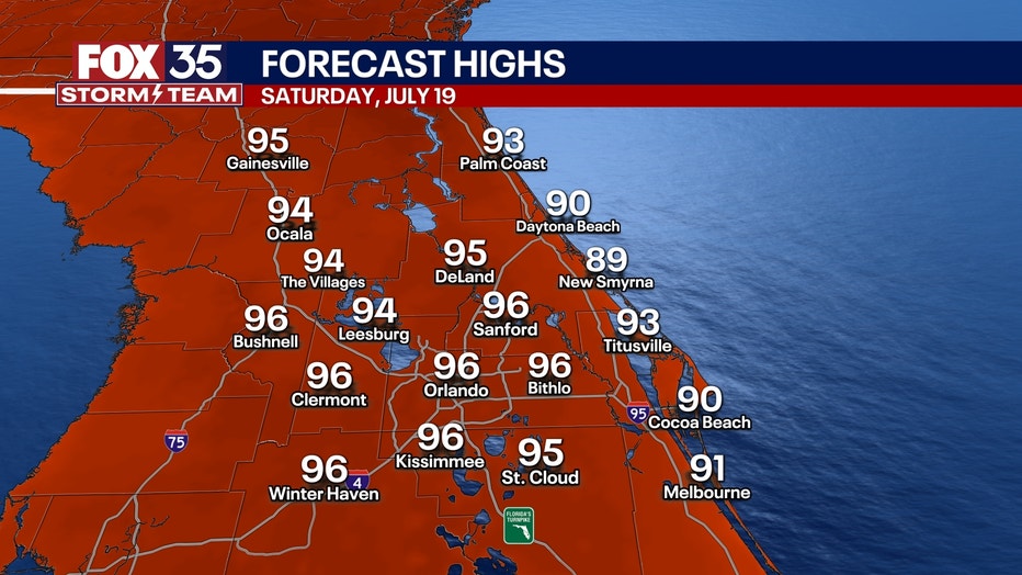
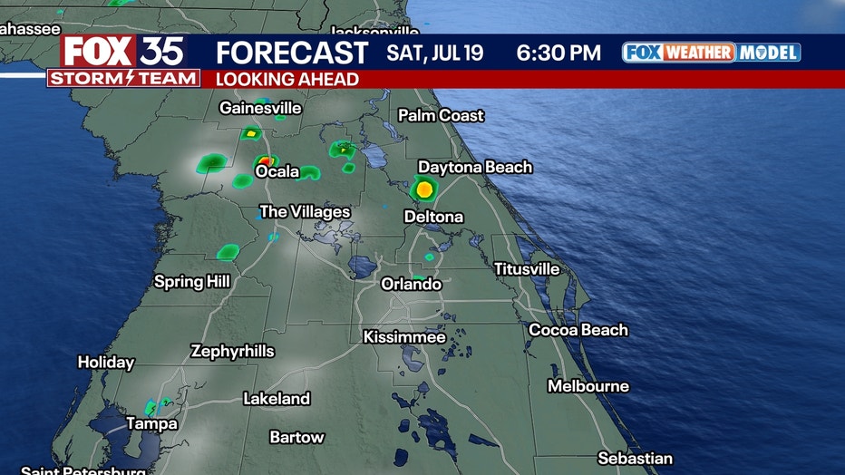
We'll see lower chances of showers and storms for both Saturday and Sunday, with only a 20-30% chance of a few isolated hit-and-miss downpours and storms. Some of the hottest temperatures of the summer will arrive on Saturday.
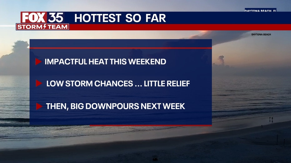
Saturday's high temperatures will reach the upper 90s, with heat index values soaring between 105 and 110 degrees across inland areas.
A slight chance of isolated thunderstorms remains in Lake, Marion, Sumter, Alachua and Polk counties.
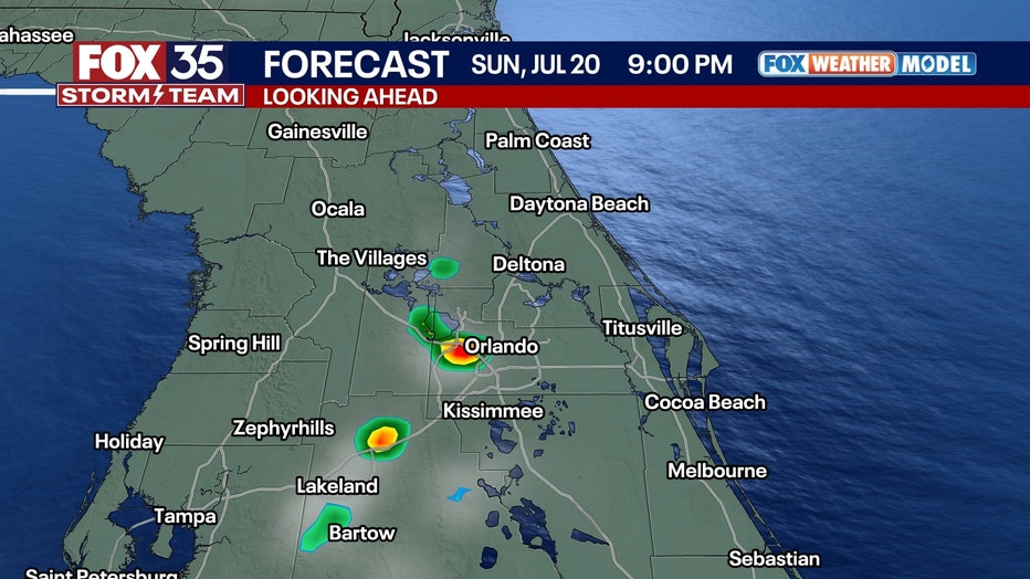
Looking ahead to Sunday, conditions will remain extremely hot, potentially even a touch hotter than Saturday. Inland highs will again push into the upper 90s, with heat index values between 105 and 110 degrees. A few isolated storms may develop in the Orlando area during the afternoon.
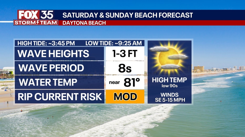
If you plan on heading to the beach to cool off, the water temperatures are hovering around the 80s with a moderate risk of rip currents.
What will the weather look like next week?
Looking Ahead:
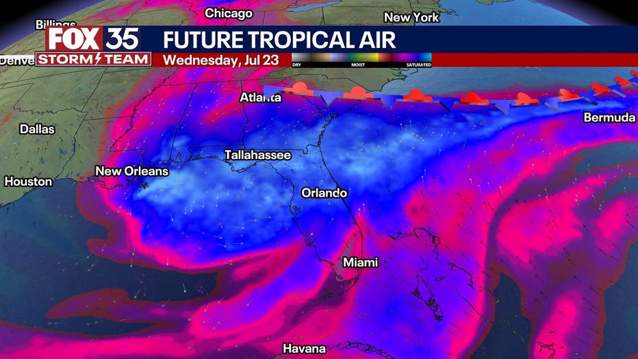
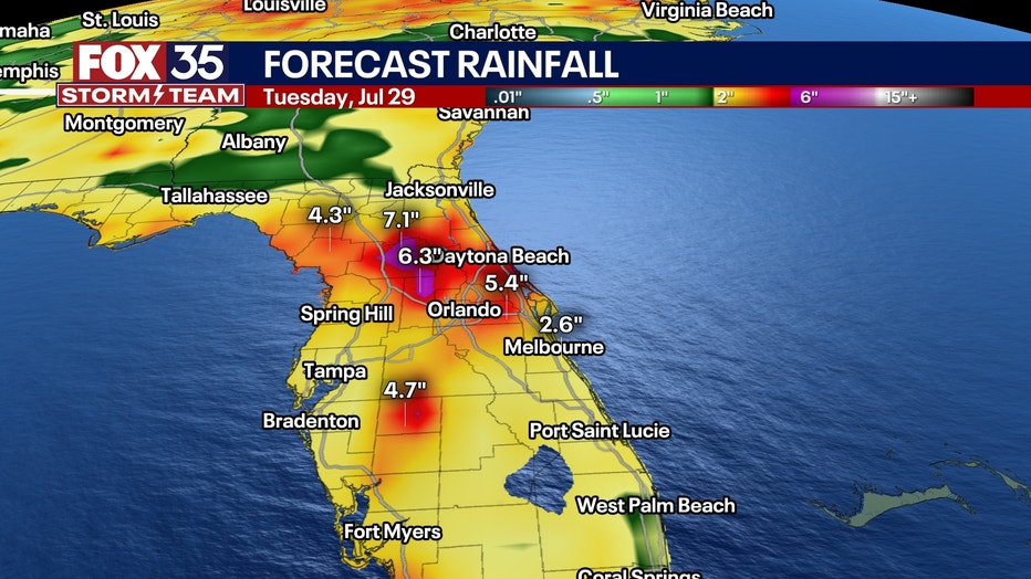
The remnants of Invest 93L look to bring more heavy rain our way into early next week.
The system has moved inland into Louisiana and will push eastward where it could loop around and swing back down into Florida. This would bring another slug of deep tropical moisture our way for the first half of next week. This means repeated rounds of heavy rainfall are growing more likely in the Sunshine State.
This could lead to additional inches of rainfall over areas in Central Florida that are already fairly water-logged. There are still some questions as to where exactly the heaviest rain will set up, so be sure to stay close to the forecast for more.
By Monday, scattered storms are expected to increase, but the more significant weather shift arrives Tuesday, when a surge of tropical moisture could bring widespread slow-moving showers and thunderstorms across the region.
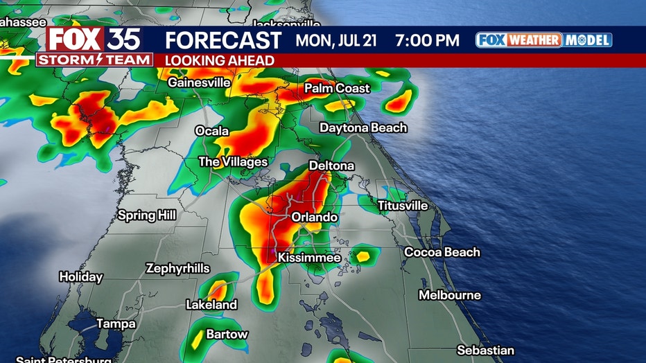
Forecasters warn that some areas may experience substantial rainfall totals and localized flooding, though not all communities will be affected equally.
Orlando 7-Day Weather Forecast

FOX 35 Storm Tracker Radar and Live Weather Cameras
Track live when storms move across your area using the FOX 35 Storm Tracker Radar below. You can also watch as heavy rain moves across Central Florida on our Live Weather Cameras' page here.

More radar maps from FOX 35 Storm Tracker Radar
- Brevard County
- Flagler County
- Lake County
- Marion County
- Osceola County
- Orange County
- Polk County
- Seminole County
- Sumter County
- Volusia County
- U.S./National Radar
The Source: This story was written based off information shared by the FOX 35 Storm Team on July 18, 2025.