

Orlando weather: Valentine's Day will be pleasant across Central Florida after cold start

Orlando Weather Forecast: Feb. 13, 2023
Cooler temperatures are in store for the next few days with highs breaking into the low 70s and lows in the 40s across much of Central Florida.
ORLANDO, Fla. - Clouds will gradually break apart and move out overnight, and rain and temperatures will tumble, with 30s in Ocala and Gainesville for lows!
VALENTINE'S DAY: A sweet-looking forecast with abundant sunshine and very few clouds. The upper 60s along the beaches and the low 70s in central areas. A lighter breeze is only 5-15 mph from the northeast. Humidity will be exceptionally low, too – you'll notice it will feel very crisp for Florida standards.

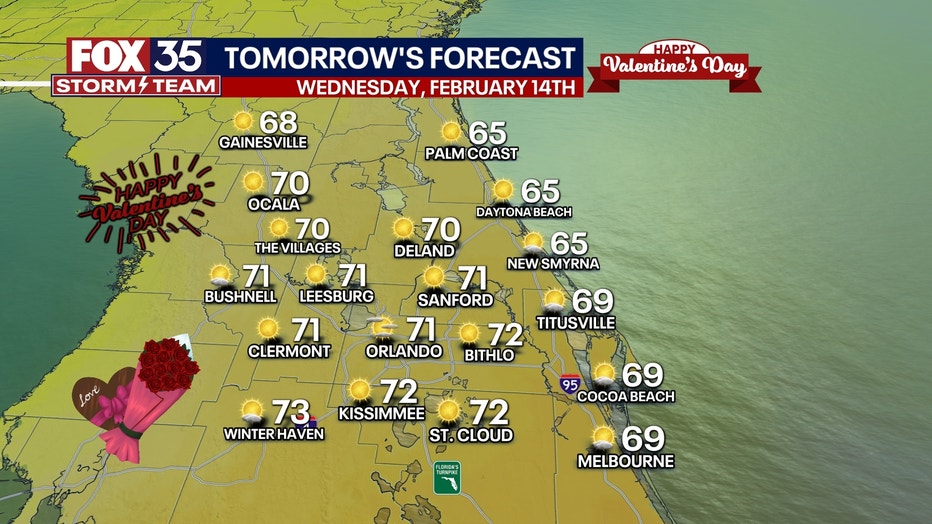
BEACH FORECAST: Surf about 1–3 feet with low to moderate rip current risk. High tide in the 11 a.m. hour along east coast beaches.
THEME PARK FORECAST: Wonderful Wednesday (grab a light jacket and sunglasses) before much cloudier weather returns Thursday into Friday, but it will remain dry throughout!
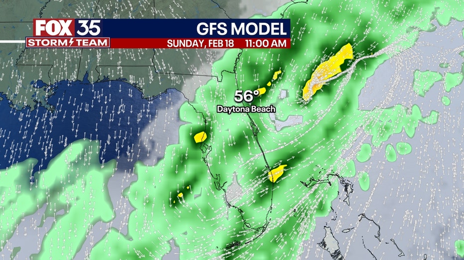
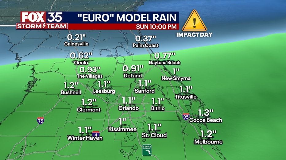
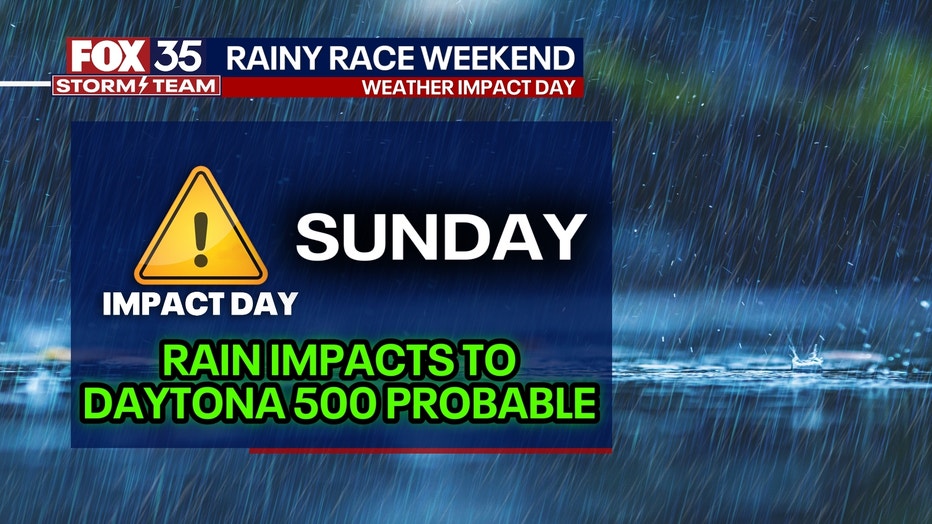
LONG RANGE: The weekend will be very unsettled. There are lots of showers and some heavier bursts of rain, too. Rain will start in north Florida from Saturday morning into midday and work its way southward closer to Orlando by later Saturday afternoon and evening. Rain continues in waves of varying intensity all night through Sunday morning.
The tricky part is determining when the rain ends in the Daytona area. Some models push the rain out (it still remains cloudy, though, regardless) by early afternoon, meaning maybe just a rain delay for the Daytona 500.
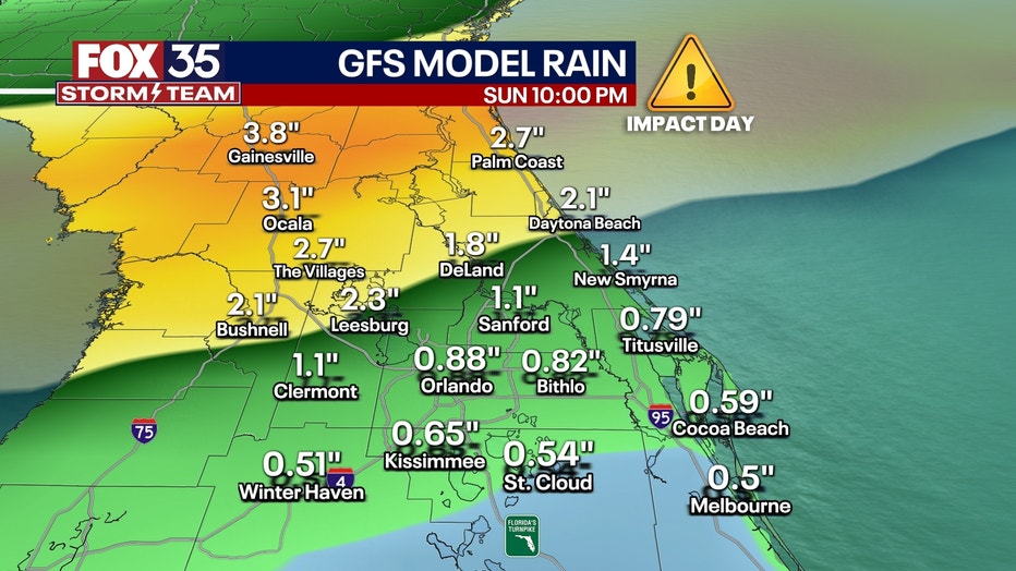
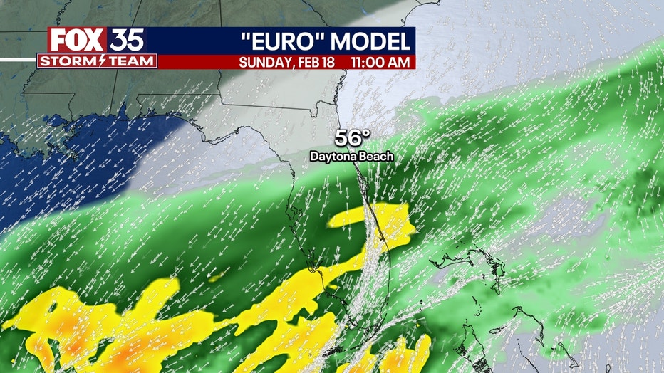
Other models, like the European model, suggest light to moderate rain lingers into the evening Sunday in Central Florida, probably causing the Daytona 500 to be postponed to Monday. We'll hope the rain ends even sooner and the race can go on as scheduled, but it appears more likely than not, at least some impact will occur from the rain. Specific amounts are 0.5" to 2" area-wide for the entire weekend. A narrow corridor of 2-4" of rain could set up if thunderstorms can form, but the chances are low for now. Severe storms are not expected in central Florida due to too much cloud cover and insufficient storm fuel ("CAPE") to support severe storm formation.
Winds will get gusty from the north from Sunday into Monday, so even when the rain does end, it will feel quite raw, damp, and cold Sunday evening and night. So if you plan on heading to the 500 a jacket or heavier sweatshirt would be recommended. We should know much more about the timing and amounts of this weekend's rain by Thursday morning.
Daytona 500 Weekend Forecast
While we are still around five days out from the Daytona 500 race, we've already issued a FOX 35 Weather Impact Day for Sunday. Regardless of whether it rains or not, it'll be cloudy and cool all day with temps in the 50s for most of the day and only briefly reaching around 60°F, warranting this Impact Day.
Hundreds of thousands will be outside for the Daytona 500. It'll be a lot colder than previous days (15°+ below average), and anyone out on the track for an extended period will need cold weather clothes plus ways to stay dry.
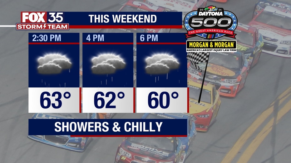
Daytona does not allow umbrellas, so ponchos will also be a must because the only thing less comfortable than being cold is being wet and cold.
Even though we're still five days away, Sunday features an all-day on-and-off light rain.
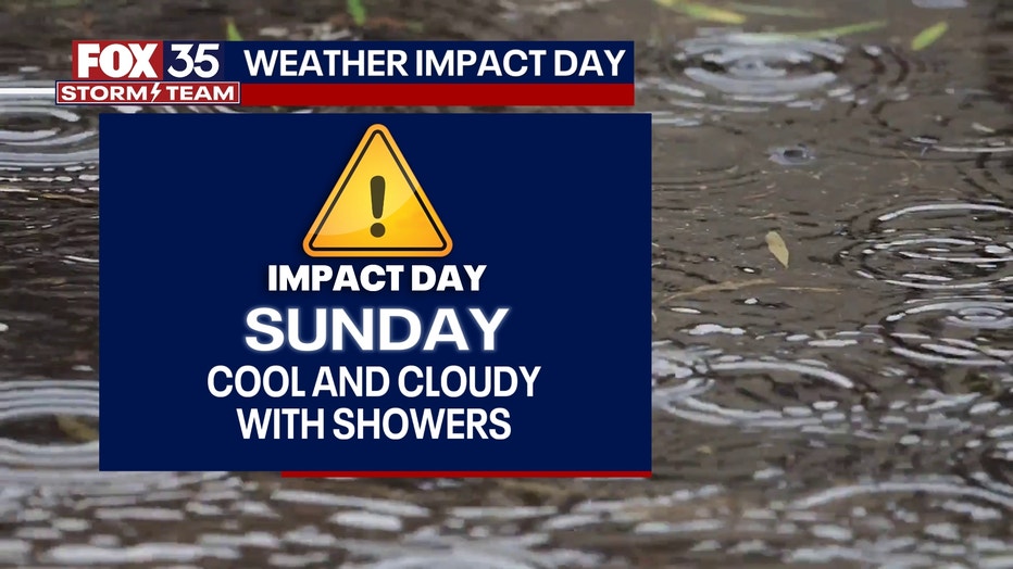
It may not end until Monday. There's still a chance the rain ends before the Daytona 500 begins, but most computer models keep the rain here through Sunday night.
The FOX 35 Storm Team will continue to update the forecast as the weekend nears.