

Orlando weather: Heat advisory through evening, scattered showers and storms possible

Orlando PM Weather Forecast: August 1, 2025
The heat wave continues across Central Florida! Meteorologist T.J. Springer has when we get at least a little relief from the warmth and when we could see more widespread showers and storms.
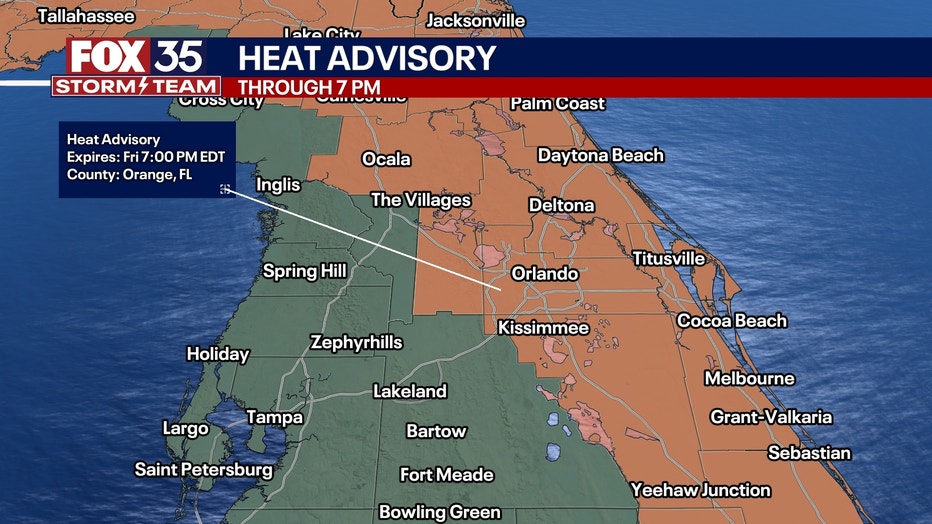
ORLANDO, Fla. - A heat advisory is still in effect through the evening across Central Florida. Some scattered showers and storms are also possible as the evening continues.
Here's a look at what the weather will look like tonight, this weekend and looking ahead to next week.
What will the weather look like tonight?
What to expect:
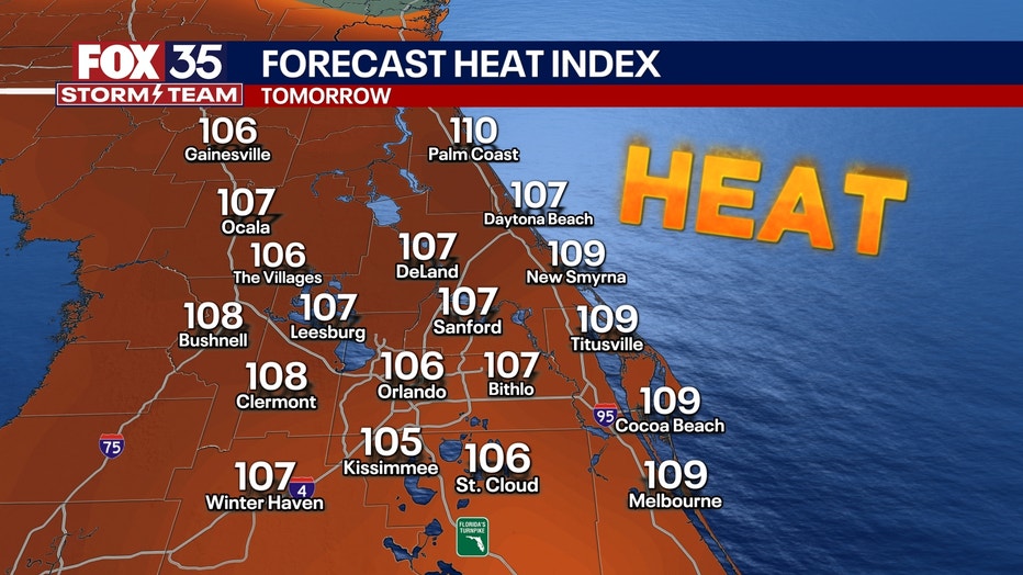
Heat advisories will remain in effect through 7 p.m., with heat indexes up close to 110°. Be sure to stay hydrated if you're heading out.
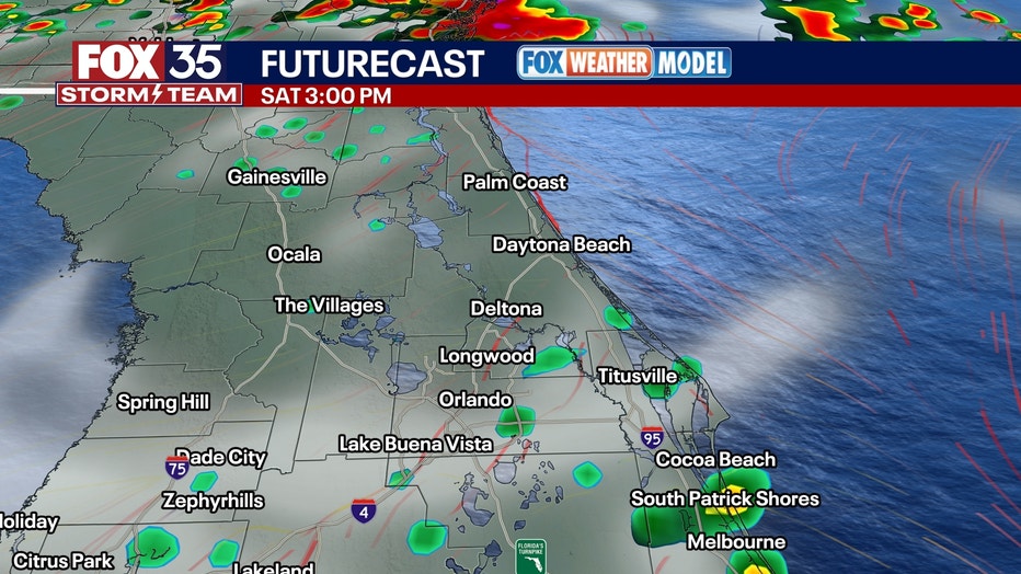
The heat and humidity are also aiding in scattered showers and storms. These are on the table through the remainder of the evening into early tonight with the help of the sea breezes moving inland and eventually colliding. This, as well as outflow from older storms, leads to erratic motion of the downpours before they fizzle out. The slow-moving nature could make for some ponding on the roadways, so be careful if you're driving.
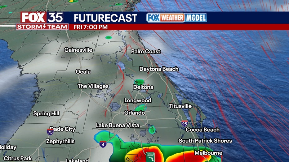
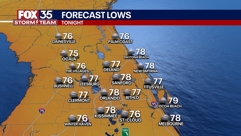
Any lingering boundary could spark a storm or two late this evening as temperatures start to slowly come down. Tonight, any activity fades away with a mix of clouds and stars on tap. Lows stay warmer than normal, in the middle-to-upper-70s.
What will the weather look like this weekend?
What's next:
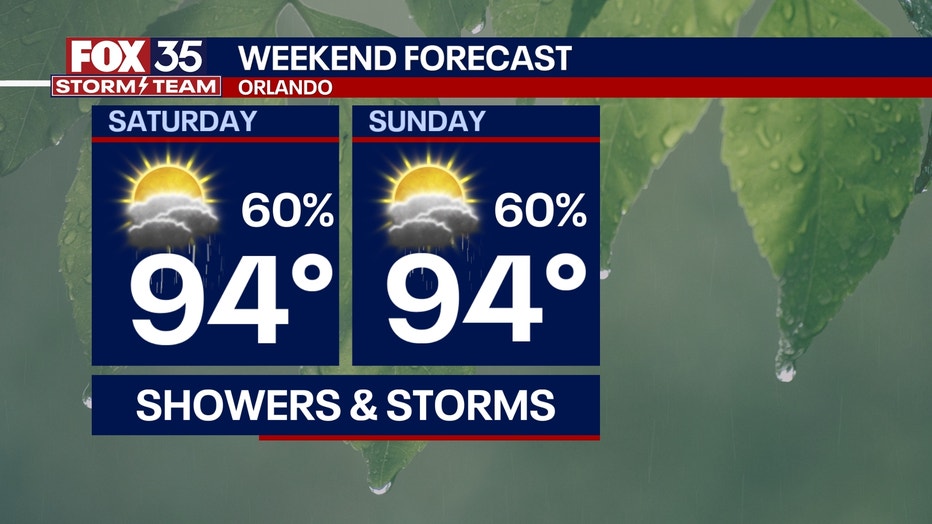
Essentially, it's a wash-rinse-repeat set-up for Saturday as this ridge of high pressure still holds in the vicinity.
CLICK TO DOWNLOAD THE FOX LOCAL APP
However, it does start to break down at least a little bit, which will start to aid in bringing our temperatures down slightly.
It will also help bring our rain chances up a touch. Saturday will be nowhere near a washout, but similar to Friday. We'll see hit-or-miss showers and storms developing in the heating of the day. A couple of stronger storms with gusty wind and frequent lightning are on the table, along with torrential rain.
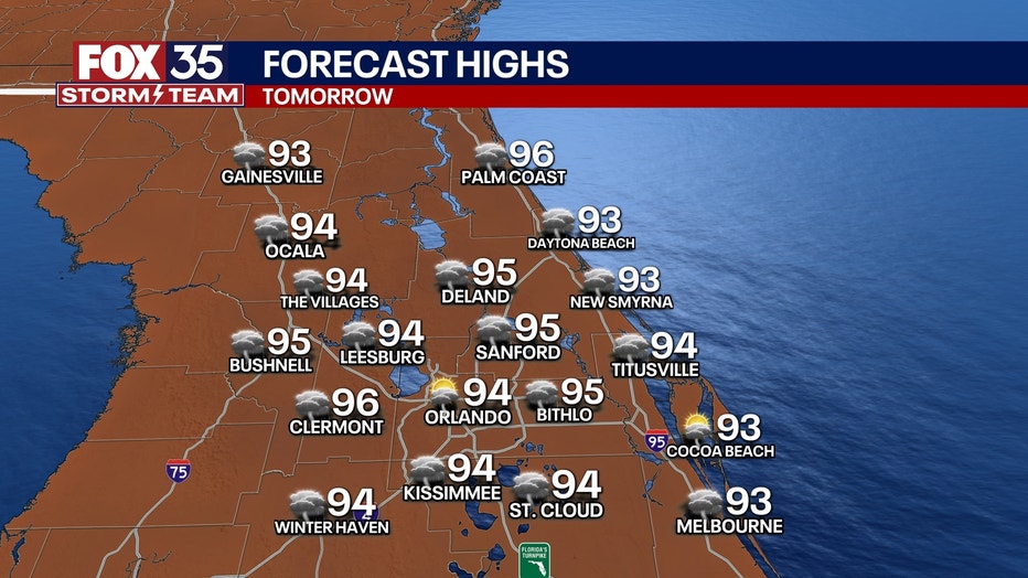
Feels-like temperatures will be up close to heat advisory criteria, topping out near 105-107.
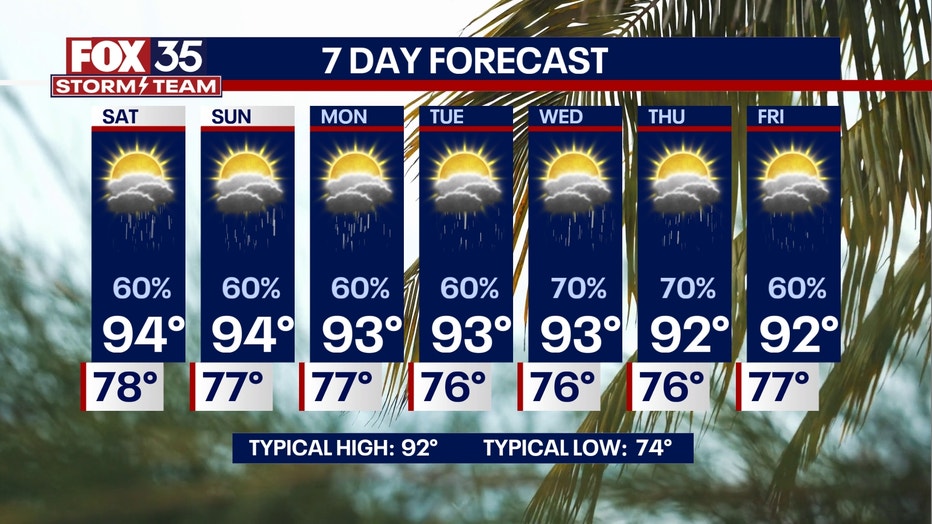
Sunday into the start of the workweek looks to be a lot more typical weather-wise for this time of year.
Daily chances of afternoon showers and storms are on the docket, with the help of the wind flow coming back around from the southeast. That, along with a stalled front to our north, will likely bring more widespread showers and storms for the latter half of the day. The heaviest rain does look to be focused to our north, near the stalled boundary, but either way our weather pattern becomes more unsettled.
SIGN-UP FOR FOX 35'S BREAKING NEWS, DAILY NEWS NEWSLETTERS
The plus is that more clouds and moisture will mean slightly cooler temperatures. It likely won't be terribly noticeable, but at least we'll be cooler.
Highs look to top out around 92° next week, which is average for this time of the year.
Tracking the tropics
Dig deeper:
Tropics-wise, the water temperatures have climbed back above normal in the basin, and with a little less dust, any tropical wave over the next few weeks will need to be monitored.
The Climate Prediction Center (CPC) still has a couple of areas in the Atlantic under a 20% risk of development, and long-range data is continuing to hint at this as well.
Stay tuned for more updates!
The Source: This story was written based on information shared by the FOX 35 Storm Team on Aug. 1, 2025.