Orlando weather: Heavy rain and scattered storm chances on the rise, expected through weekend

Orlando Weather Forecast AM: Oct. 2, 2025
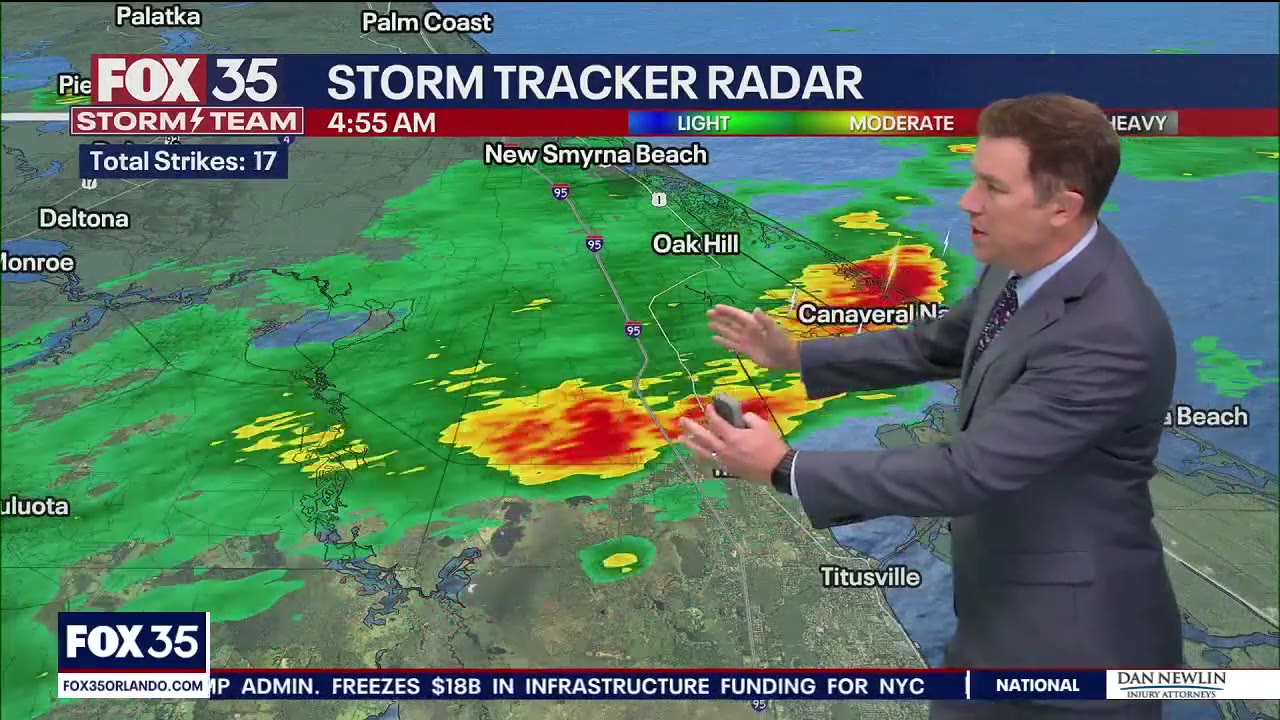
FOX 35 Storm Team Meteorologist Brooks Garner has a look at our weather forecast on Thursday as the Central Florida area braces for rain.
ORLANDO, Fla. - Thursday's weather will be filled with overcast conditions, scattered showers and heavy rain across Central Florida. As we finish out the week and head into the weekend, the chances of rain will continue to increase, bringing threats of flooding.
In addition, the FOX 35 Storm Team has its eyes on a weak area of low pressure that could form near the Bahamas and track over Florida this weekend and possibly early next week.
What will the weather look like today?
What To Expect:
Scattered showers and heavy rain are filtering into the area Thursday morning.
CLICK TO DOWNLOAD THE FOX LOCAL APP
With very slow-moving downpours repeatedly moving onshore, areas near the coast should prepare for isolated pockets of ponding on the roadways for the morning commute. Roadways in general for the morning drive will be damp, if not wet, in most spots, so it's important you give yourself extra time to make it to your destinations safely.
Our rain today as a whole will be intermittent and scattered through the early afternoon before eventually sinking into Osceola and Brevard counties this evening. These areas could see rainfall totals of more than 2 inches in some spots.

Temperatures today will be generally below normal with highs in the mid-80s.
It will be breezy at times today too, as gusts reach speeds of 25–30 mph.
What will the weather look like tonight?
What's next:
A few scattered showers will still linger across isolated areas into Thursday night.
SIGN-UP FOR FOX 35'S BREAKING NEWS, DAILY NEWS NEWSLETTERS
Temperatures will fall into the low-and-mid-70s, with patchy fog possible.

What will the weather look like for the rest of the week?
Looking Ahead:
An unsettled pattern takes hold the rest of this week and into the weekend.

Rain and storm chances will gradually increase over the next few days thanks to a boundary and moisture leftover from Imelda. It's growing increasingly likely that heavy rain will impact our coastal counties for this weekend and into the early parts of next week.
Flooding will be possible, especially near the coast. This is where rainfall totals could rise beyond 3 inches, with some spots possibly picking up more than 6–8 inches.

A weak area of low pressure could form near the Bahamas and track over Florida this weekend and possibly early next week. Even though it has been outlined with a 10% chance of development by the National Hurricane Center (NHC), if a low were to form, it would most likely be non-tropical. If this happens, it will only help to increase our potential for heavy rain. Regardless, low-lying areas especially will need to monitor this threat.

This unsettled trend looks to hold into early next week, with highs staying in the upper-80s.
The rough surf and high rip current risk will also remain for much of the week. Larger than normal breaking waves will be likely into the weekend.
The Source: This story was written based on information shared by the FOX 35 Storm Team on Oct. 2, 2025.


