

Orlando weather: Cold front to bring rain, storms and cooler temps

Orlando Weather Forecast: January 17, 2025
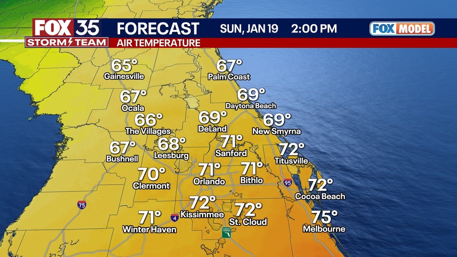
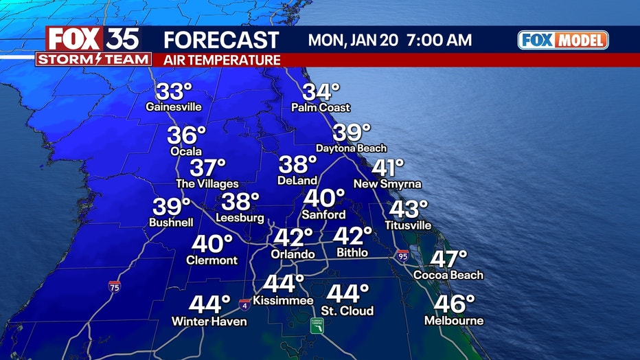
Saturday will be mostly cloudy but warm, with highs in the mid-to-upper 70s despite limited sunshine. A brief rain shower is possible. Sunday brings a strong cold front to Florida, with a line of showers and storms moving through the area from mid-morning to mid-afternoon. Some storms could be strong, and an isolated severe storm is possible. Behind the front, temperatures will plummet, dropping into the 30s and 40s by Monday morning.
ORLANDO, Fla. - Expect a small chance of showers with typical mid-January temperatures in the overnight hours.
Saturday will be mostly cloudy but warm, with highs in the mid-to-upper 70s despite limited sunshine. A brief rain shower is possible.
Warm weekend with rain, turning cooler next week
What we know:
Big changes are on the way for this weekend.
Sunday brings a strong cold front to Florida, with a line of showers and storms moving through the area from mid-morning to mid-afternoon. Some storms could be strong, and an isolated severe storm is possible.
It won't rain all weekend long, or all day Sunday, but pockets of heavy downpours and some windy conditions will be possible. Highs on Sunday will hover around the upper 60s to low 70s.
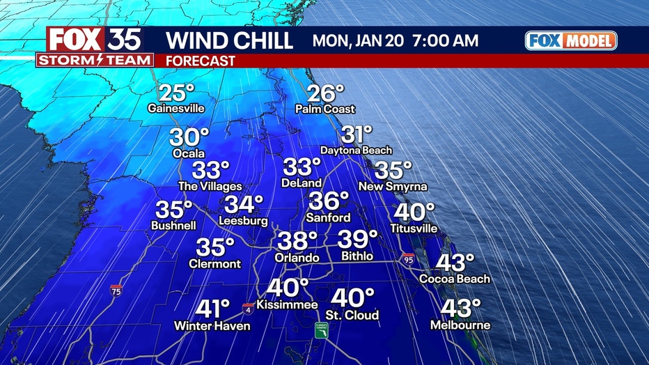
LOOKING AHEAD: Behind the front, temperatures will plummet, dropping into the 30s and 40s by Monday morning. On Tuesday, daytime showers are expected but are unlikely to be significant. However, after sunset, a low-pressure system will track across Florida, interacting with Arctic air moving south.
Snow in Florida next week?
Looking ahead to next week, Florida may see a rare chance of snow thanks to an Arctic cold front that is moving down from the north.
What we don't know:
This could result in a rare band of rain, ice, and snow setting up over central and northern Florida overnight into Wednesday morning.
The Global Forecast System (GFS) and European models differ as to what will be snow and what will be freezing rain. Read more here.

Orlando 7-Day Weather Forecast

FOX 35 Storm Tracker Radar
Track live when storms move across your area using the FOX 35 Storm Tracker Radar below.

More radar maps from FOX 35 Storm Tracker Radar
- Brevard County
- Flagler County
- Lake County
- Marion County
- Osceola County
- Orange County
- Polk County
- Seminole County
- Sumter County
- Volusia County
- U.S./National Radar
Stay connected with FOX 35
- Download the FOX 35 News app for latest news, weather, and traffic alerts
- Download the FOX 35 Storm Team Weather app for live, interactive radar
- Visit FOX35Orlando.com/weather for interactive radar, plus updated weather graphics, maps, and images
The Source: This story was written based on information shared by the FOX 35 Storm Team.