Orlando weather: Chilly start to Wednesday across Central Florida with highs breaking into the 70s

Orlando Weather Forecast: March 19, 2024
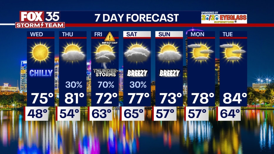
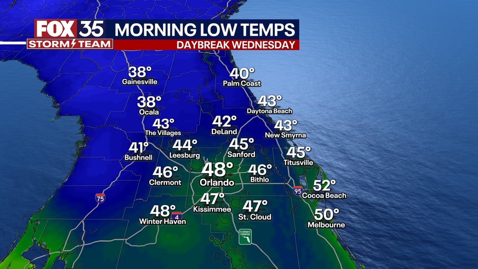
Central Florida will see some near-record cold temperatures on Wednesday morning before a gradual warmup and increased chances for rain.
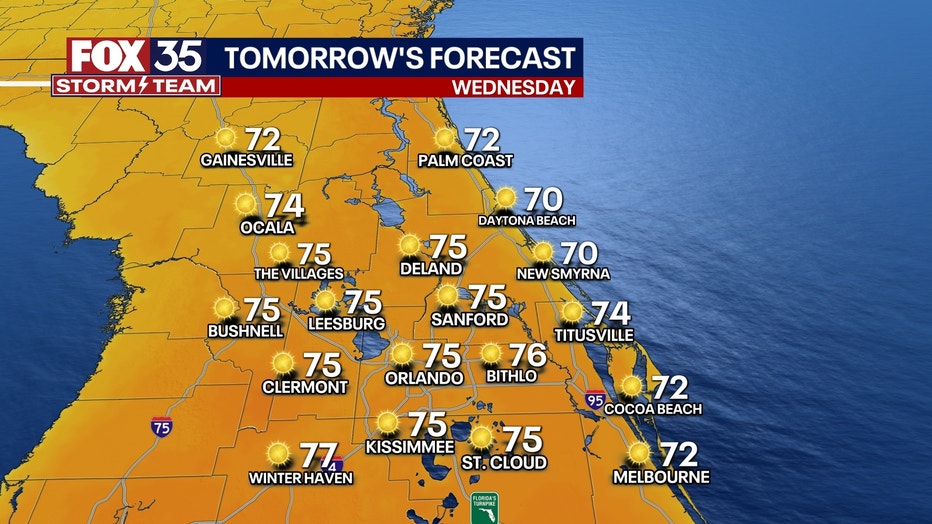
ORLANDO, Fla. - Tonight's forecast calls for a low of 48°F, followed by a high of 75°F on Wednesday.
Expect a chilly start on Wednesday, with temperatures in the 40s for most areas and dropping to the 30s from The Villages to Gainesville. Wednesday will see abundant sunshine, with mostly sunny conditions continuing into Thursday, though clouds may return late in the day. Highs on Thursday will hover around 80°F.
BEACH FORECAST: On the beaches, Wednesday will bring chilly weather, a moderate risk of rip currents, and surf heights of 1–3 feet on the East Coast. High tide is expected in the early evening, with low tide in the late morning.
THEME PARK FORECAST: Theme park attendees can anticipate bright but chilly conditions on Wednesday, warming up and remaining dry on Thursday.
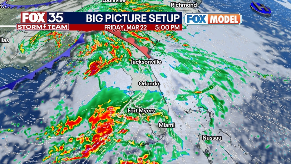
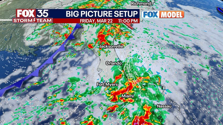
LATE THIS WEEK AND UPCOMING WEEKEND: Looking ahead to late in the week and the upcoming weekend, Friday has been designated a "Weather Impact Day" by FOX 35 due to the potential for showers, storms, and possibly severe weather affecting central Florida.
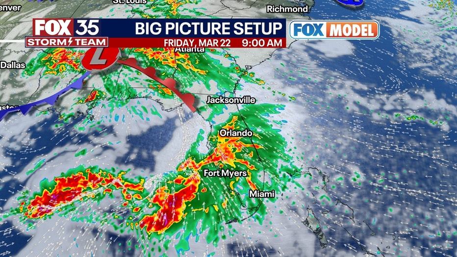
There is uncertainty regarding the track of a low-pressure system moving across the Gulf and into Florida. A more northerly track increases the risk of severe weather in central Florida. Updates are advised on Wednesday for further clarity.
Saturday, lingering clouds may be present in some areas as a low-pressure system remains off the east coast of Florida, accompanied by breezy northerly winds.
High temperatures over the weekend will reach only the low to mid-70s, making it less than ideal for beachgoers. However, sunshine and warmer conditions are expected to return early next week.