

Weather Forecast in Orlando Florida: How long will the rain last?

Orlando Weather Forecast: March 22, 2024
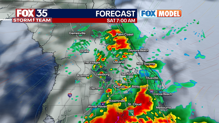
Showers and storms are expected to fire and be scattered during the morning and midday on Saturday. A few strong storms are possible. Then, a brief window of clearing and sunshine moves through central Florida in the mid-afternoon into early evening.
ORLANDO, Fla. - Showers and storms are expected to fire and be scattered during the morning and midday on Saturday. A few intense storms are possible. Then, a brief window of clearing and sunshine moves through central Florida in the mid-afternoon into early evening.
Then, after 6:30 p.m., we will watch the northern horizon for additional but more isolated showers and storms, this time moving north to south. This is with a secondary cold front. Areas closer to the beaches and north of Orlando have the best chance to see this activity.
BEACH FORECAST: Poor swimming weather Saturday through Tuesday with rough surf forecast. Wave action 7-12' with large breaking waves maybe causing some minor to moderate beach erosion and coastal flooding at times of high tide.
THEME PARK FORECAST: Bring rain gear for Saturday, a hat, and sunglasses for Sunday and beyond.
SUNDAY AND BEYOND: Sunday, some clouds may linger along the immediate East Coast beaches during the day. Inland areas around Orlando may be partly to mostly sunny, while immediate coastal locations could be kind of cloudy most of the day. Point being, there will be a large spread west to east, based on where you are in terms of the amount of sunshine Sunday.
Monday and Tuesday will be mostly sunny, with highs in the lower and middle 80s. Winds will continue to be gusty over 20 miles an hour at times. Wednesday of next week offers the next chance of rain, with a cold front coming in late in the day and going into Wednesday overnight. More showers and storms are probable with that across Florida.
The timing may change as we get closer, so check back for updates.
That should clear out and give all of Florida beautiful weather by next Friday at the end of next week, with an abundance of sunshine, humidity, and comfortable air.