

Florida rainfall forecast: Tropical moisture pushes into Central Florida
Orlando Forecast: Daily showers, storms for next week
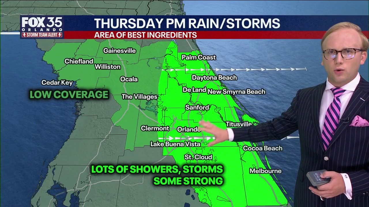
Florida's "rainy season" has started with showers and thunderstorms possible for the next week, according to FOX 35 meteorologist Noah Bergren. Scattered showers and thunderstorms are possible Thursday afternoon and evening for those along Interstate 4 and Interstate 95. Here is the latest forecast and timeline.
ORLANDO, Fla. - Scattered showers and thunderstorms are expected Thursday afternoon across Central Florida, primarily along Interstate 4 and Interstate 95.
It's the start of a multi-day stretch of daily showers and thunderstorms through at least next Wednesday.
Thursday night Forecast
What to expect:
The highest chances of rain Thursday afternoon and evening are expected along the I-4 and I-94 corridors, pushing east-to-west, towards the Atlantic coast.
That includes portions of Brevard County, Flagler County, Orange County, Osceola County, Seminole County, and Volusia County, specifically Daytona Beach, Titusville, Melbourne, Orlando, and Sanford.
How much rain could fall?
By the numbers:
What are the main weather threats?
- Strong wind gusts
- Heavy rain & localized flooding
- Lightning
- Small hail
Live radar: Orlando and Central Florida

- Brevard County
- Flagler County
- Marion County
- Osceola County
- Orange County
- Polk County
- Seminole County
- Sumter County
- Volusia County
- U.S./National Radar
Weekend rain
No major changes in the weather pattern, as deep tropical moisture persists. It won't be quite as widespread as Thursday and Friday, but it's still prevalent. Highs in the mid-to-upper 80s. Your best bet for outdoor activities will be in the mornings.
Daily afternoon showers and storms look likely, with heavy rain, frequent lightning, and gusty winds at times. None of these days look like total washouts, but the pattern will feel much more like August than early June.
Hurricane season begins
Hurricane season officially begins Monday, June 1, and runs through November 30. No systems are forecast to form over the next 7 days.
One model, the GFS, has occasionally hinted at something trying to organize. That is worth watching, but it is not enough by itself to raise alarm bells.
Early season tropical setups are messy. Sometimes models pick up on broad tropical moisture and try to turn it into a more organized system too quickly. That does not mean a storm is coming.
Right now, the more reliable signal is a surge of deep tropical moisture, not a clearly developing tropical system.
That distinction matters.
Gulf waters are warm, but warm water alone does not create a tropical storm. Wind shear still looks strong enough to make organization difficult, slow, or possibly prevent it altogether.
The Source: The information in this story was provided by the FOX 35 Storm Team.