

Orlando weather: Weekend temperatures on the rise in Central Florida with chance of scattered showers

Orlando Weather Forecast: Dec. 22, 2023
Central Florida will see a few passing showers into the overnight hours. Temperatures will be milder than in previous nights.
ORLANDO, Fla. - This weekend will feature a mix of clouds and sunshine with high temperatures in the 70s. Winds will still be breezy with gusts up to 20 or so MPH. A few showers are possible along the I-95 corridor each day on Saturday and Sunday. Sprinkle chances are very low inland areas.
Tonight's low: 59 degrees | Tomorrow's high: 73
BEACHES: The beaches start off on a cool note today and remain fairly cool overall for the afternoon. Highs will hit near 70 in the Northern coastal counties, a little warmer in the lower 70s in coastal Brevard. Skies will feature a blend of sun and clouds. Winds will remain Northeasterly today.
Seas and surf remain elevated. Breaking surf will be in the 2-3'+ range with a moderate rip current risk. Surf temps have dropped into the mid-60s in Volusia and Flagler Counties, lower 70s in Brevard. A few spotty showers will be possible, passing by at anytime today. Chances looks low however, right around 20%.
THEME PARKS: Expect mixed skies and highs around 72 degrees out at the attractions this afternoon. A few showers could be lurking mainly for the PM, coverage looks low at 20%.
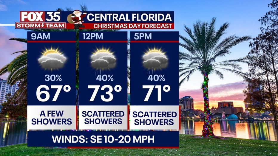
OUTLOOK: Christmas Day showers arrive during the afternoon and evening hours. Temperatures this year will be nearly 30 degrees warmer than last year on Dec. 25th when it was the 2nd coldest on record in 2022.
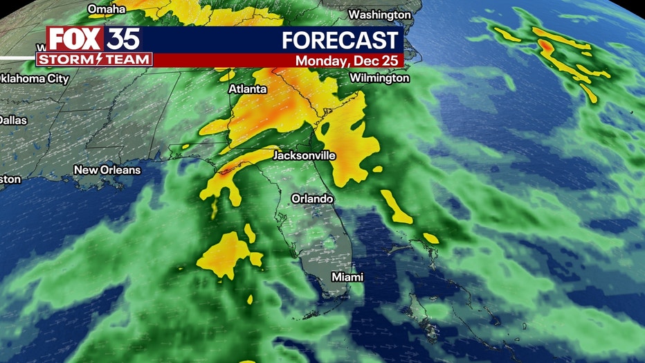
Showers will linger into Tuesday morning before some drier weather arrives Tuesday afternoon. A front arrives Wednesday next week with one more higher chance of showers before a major drop in temperature arrives for the end of next week.
Much of the timing depends on the progress and forward speed of the incoming front. Temperatures during this time will be rather mild with highs in the 70s, lows in the mixed 60s. Stay tuned for updates and with the FOX 35 STORM TEAM