

Orlando weather: Dry start to work week ahead of wet weekend

Orlando Weather Forecast: May 29, 2023
Orlando and Central Florida will see wet weather for the latter part of the week and into the weekend.
ORLANDO, Fla. - Tonight's low: 68 degrees| Tomorrow's high: 87 degrees
Main weather concerns: Our great stretch of weather continues into Tuesday with lots of sunshine. We can't completely rule out a stray shower/storm this afternoon off the seabreeze south of Cocoa Beach. A high rip current risk continues for the Atlantic coastline. Afternoon highs will pump into the upper 80s inland, closer to the beaches, low-mid 80s. Rain chances near Brevard County are in the 20% or less range.
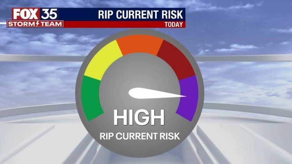
BEACHES: The beaches see warm temps and a mix of sunshine and clouds. Rip current risk will stage in the high range. Highs hit near 83 or so. Surf is in the 1-3' range as some residual ENE swell slides into the local surf zone.
THEME PARKS: More fantastic weather to hit the parks! Mixed skies and warm temps on tap today. Bring that sunscreen, you'll need it!
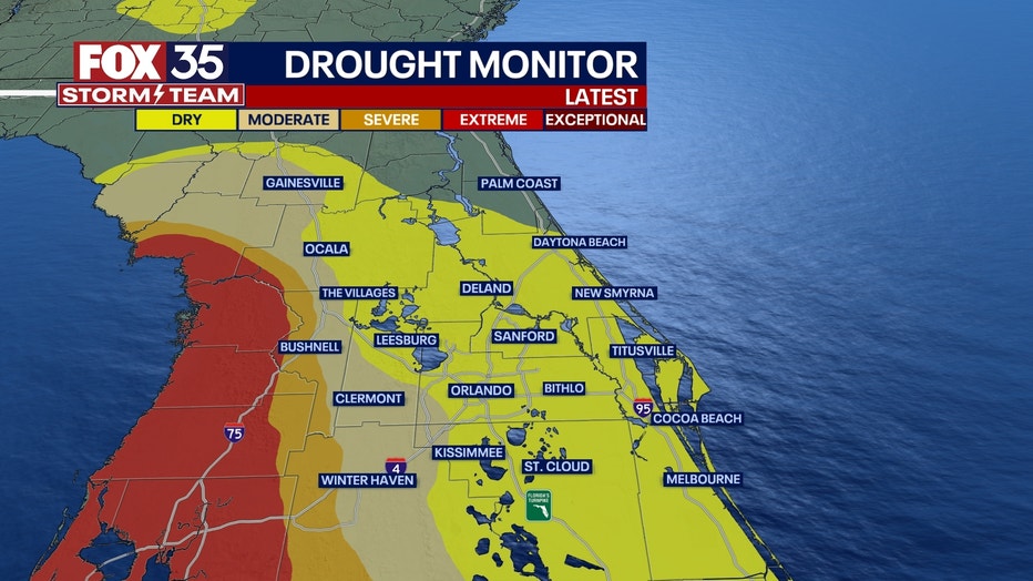
DROUGHT MONITOR: Though the first half of May was mainly dry, recent widespread heavy rainfall beginning mid-month helped put an end to drought conditions across Central Florida.
Rainfall totals from May 17-26 ranged from 3 to 6 inches across much of the area, with higher totals of 7 to 8 inches across portions of the Orlando metro, according to the National Weather Service.
OUTLOOK: Looks like an increase in moisture for the area through mid-week. Low pressure will draw closer to the region by Thursday and Friday. Rain chances will return to the 70% range during this time. Seems like half of the forecast models develop the low in the Gulf, while others develop the low East of Florida. Either way, breeze and rain chances will increase with locally heavy rain possibly in the cards. Stay tuned, we'll be tracking!