

TIMELINE: Central Florida braces for possible second round of overnight storms

Orlando Weather Forecast: May 10, 2024
Central Florida residents are advised to stay vigilant overnight as there's a slight chance of encountering another round of storms and showers.
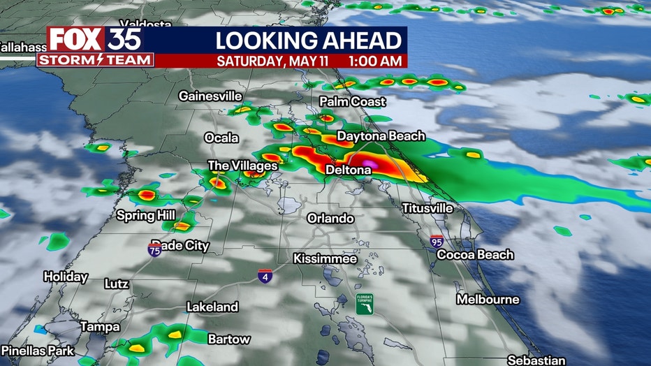
ORLANDO, Fla. - Central Florida residents are advised to stay vigilant overnight as there's a slight chance of encountering another round of storms and showers.
If these storms materialize, they may bring the threat of large hail and frequent lightning. The anticipated timing for these storms would be after 10 p.m. and continuing through 4 a.m.
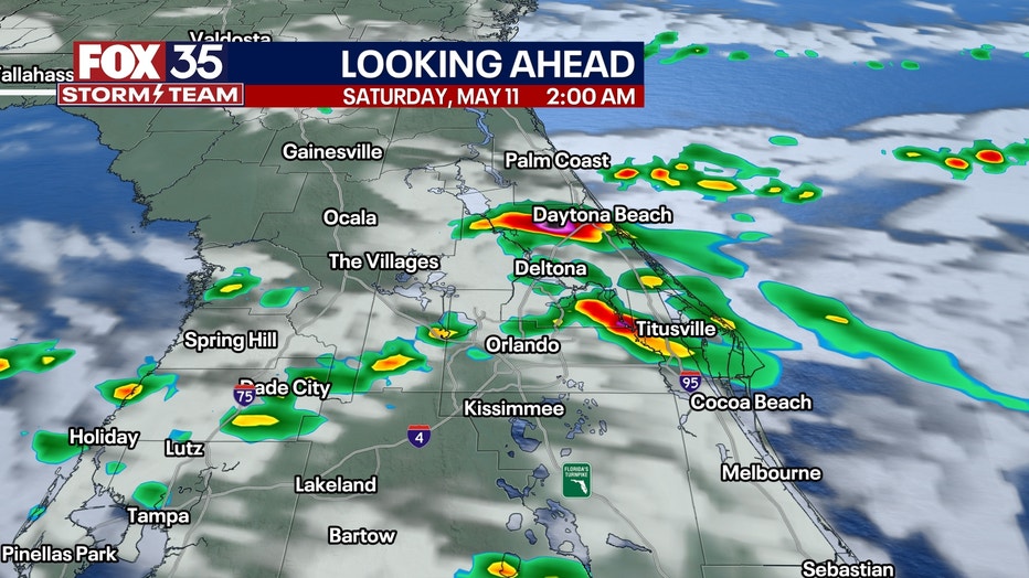
By daybreak on Saturday, the front causing these disturbances is expected to dissipate, heralding a promising start to the weekend. Saturday promises to be pleasant, albeit breezy, with northern winds blowing at 10-20 mph.
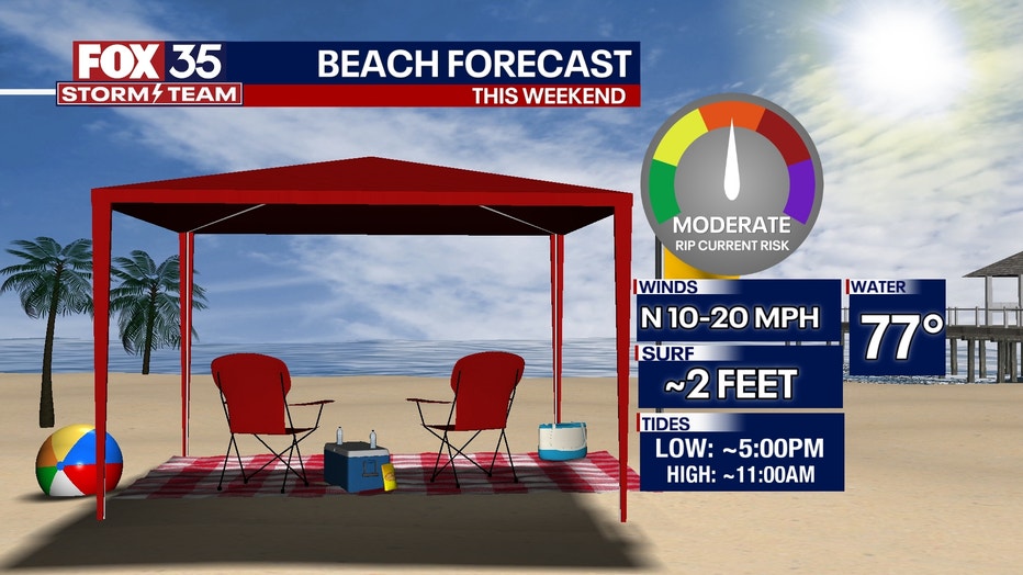
Saturday will be rain-free, offering ideal conditions for outdoor activities. While Sunday carries a minimal 10% chance of a passing shower, it remains favorable mainly for Mother's Day celebrations.
Looking ahead to the coming week, an unsettled weather pattern looms, though specifics regarding the day with the highest rain chance and expected rainfall amounts remain uncertain. A clearer picture is anticipated by Sunday evening or Monday morning at the latest.
FOX 35 Storm Tracker Radar
Watch live as storms move across Florida using the FOX 35 Storm Tracker Radar below:

Next week that front comes back northward and parks over the state. It'll focus on periodic downpours and storms for much of next week. Its clouds and rain will keep temperatures slightly lower, with highs generally in the upper 80s. That said, it'll be more humid and very likely represent the start of the rainy season.
Orlando 7-Day Weather Forecast

More radar maps from FOX 35 Storm Tracker Radar
- Brevard County
- Flagler County
- Marion County
- Osceola County
- Orange County
- Polk County
- Seminole County
- Sumter County
- Volusia County
- U.S./National Radar
Stay connected with FOX 35
- Download the FOX 35 News app for latest news, weather, and traffic alerts
- Download the FOX 35 Storm Team Weather app for live, interactive radar
- Visit FOX35Orlando.com/weather for interactive radar, plus updated weather graphics, maps, and images