

Tracking Invest 95L: System off Southeast Coast could become Tropical Storm Dexter

2pm Tropical update: August 3, 2025
FOX 35 Meteorologist Laurel Blanchard has the latest conditions in the tropics. The 2025 Atlantic Hurricane Season runs thru November 30. Download the FOX Local app for tropical alerts and notifications.
ORLANDO, Fla. - A low-pressure system located about 180 miles off the coast of North Carolina is being monitored for potential tropical development, the National Hurricane Center (NHC) says. The system, designated as Invest 95L, is producing disorganized showers and thunderstorms along a frontal boundary in the western Atlantic.
There are also two other tropical waves being monitored by forecasters. Here's everything we know about the system and its chances of impacting Florida.
Future Tropical Storm Dexter?
What we know:
Forecasters say environmental conditions are favorable for the development of an area of low pressure off the North Carolina coast. A tropical or subtropical depression or storm could form either Sunday evening or Monday as it moves east-northeast — away from the U.S. coastline.
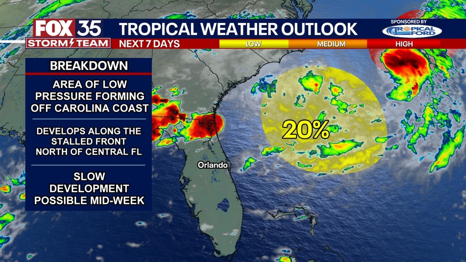
"We now have Invest 95L off the Carolina Coast, and it is expected to become a tropical depression by Monday," said FOX 35 Storm Team Meteorologist Laurel Blanchard. "This system formed off the stalled front draped to the north of Central Florida.
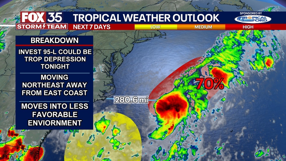
Chances of development drop after Monday as conditions become less conducive.
CLICK TO DOWNLOAD THE FOX LOCAL APP
Currently, the system has a 70% chance of tropical development in the next 48 hours, and a 70% chance of tropical development in the next seven days.
"It's over an area of warmth in the Atlantic and that's fueling the organization and generating more thunderstorms," Blanchard explained.
If the system were to become a named storm, it would be Dexter.
Could the system impact Florida?
Local perspective:
The FOX 35 Storm Team said Invest 95L will be no threat to Florida, as it is likely to continue on an eastward path and away from any major landmasses.
However, there is a lot of tropical moisture in the atmosphere being pushed off the coast of the Carolinas, and that moisture is what will also be raising our rain chances here in Central Florida.
SIGN-UP FOR FOX 35'S BREAKING NEWS, DAILY NEWS NEWSLETTERS
Periods of heavy rain are likely over the next few days, and some flooding is possible. Here in Central Florida, we will still see heavy rain through the afternoon and evening for the next seven days.
Other tropical waves to watch
Looking Ahead:
The NHC is also tracking other tropical waves which have varying percentages of development into better organized systems.
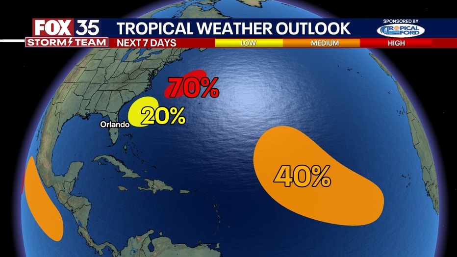
Off the Southeast Coast of the United States, another area of low pressure is also riding along this stalled front that Invest 95L formed off of and could develop off the east coast. The warm ocean water is definitely playing a factor in the chance of development. Some gradual development of this system is possible by midweek. There is a 20% chance of development in the next seven days, according to the NHC.
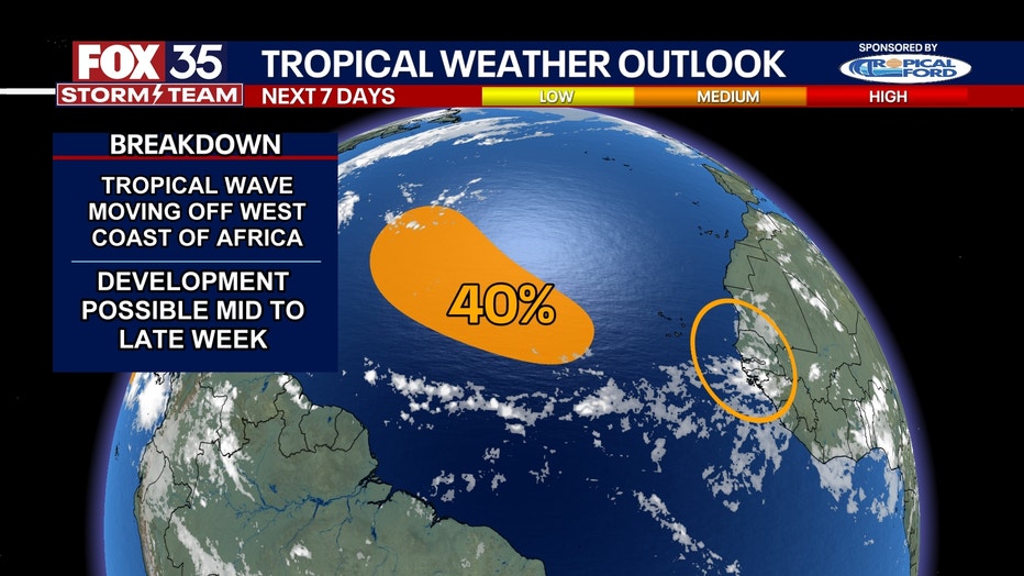
In the Central Atlantic, a tropical wave is forecast to move off the west coast of Africa by late Monday. Environmental conditions could support some gradual development of the wave during the middle to latter part of next week while it moves generally west-northwestward. There is a 40% chance of development in the next seven days.
Quiet hurricane season so far
Big picture view:
While the tropics are calm at the moment, August is typically when tropical activity starts to increase.
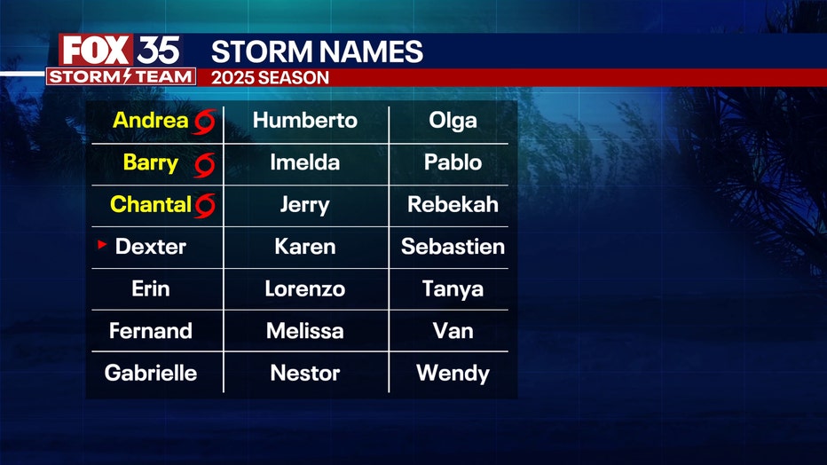
On average, the first hurricane of the Atlantic hurricane season happens within the first two weeks of August, specifically Aug. 11. So far this year, there have been three named storms: Andrea, Barry and Chantal.
However, none have threatened or made landfall in the U.S.
The U.S. Climate Prediction Center (CPC) issues weather outlooks for 2-3 weeks out, while the NHC issues alerts seven days out.
RELATED: Tropical outlook eyes Florida for possibility in mid-August: Climate Prediction Center
In its latest tropical outlook, the CPC is looking at the possibility of tropical activity on either side of Florida sometime between Aug. 6-12.
Since it's outside the NHC's seven-day window, the NHC has not issued any tropical outlooks for the same area.
The Atlantic hurricane season officially runs from June 1 to Nov. 30.
The Source: This story was written based on information shared by the National Hurricane Center (NHC) and the FOX 35 Storm Team on Aug. 3, 2025.