

Lower rain chances means high heat for Central Florida today

Weather Forecast: September 2, 2020
FOX 35 Meteorologist Allison Gargaro gives you the latest on the weather in Central Florida.
Orlando, FL - A combination of high pressure and drier air will turn Central Florida into a furnace today!
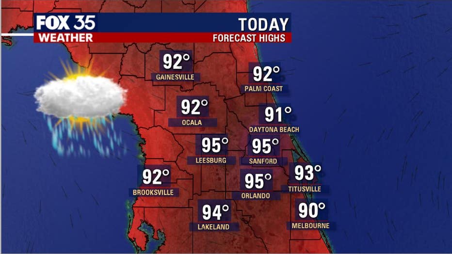
Temperatures will soar into the mid-90s on Wednesday afternoon inland, closer to the beaches. Late seabreeze development will allow highs to hit the lower 90s there. Keep in mind, typical area highs for early September are usually closer to the 90-degree mark -- this clearly won't be the case today through Friday.
RELATED: Tropical Storm Nana to become hurricane, poses no threat to Florida
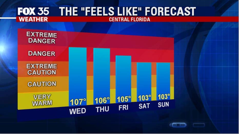
When you factor in the humidity and tropical nature of the air over the area today, the heat index or "feel's like" forecast will rise sharply this afternoon.
Numbers will peak on average around 107 degrees for the inland Counties and closer to 102 degrees along the coastal areas later today. Bottom line, it's going to be a good day to hang out in the A/C or maybe jump in a lake... that's totally up to you though.
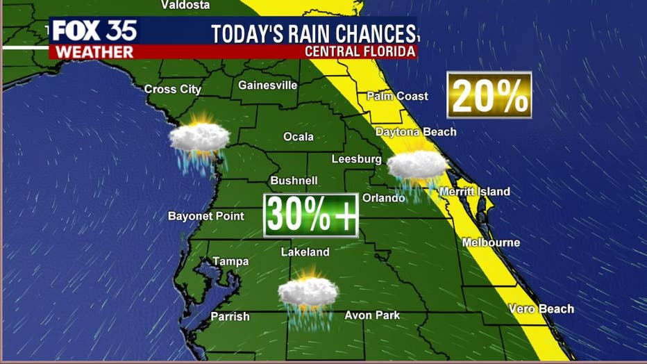
Rain chances were down on Tuesday and that's going to be the case today as well. While there will be distinct areas of heavy downpours and cloud to ground lightning, many of you may not see a drop of rain this afternoon or evening.
The highest coverage will be West of I-95 over the inland Counties, lower along the coastal zones at 20% or less.
Be sure you have the FOX 35 Weather App downloaded and ready for hurricane season.