

Second cold front to move into Central Florida: Timeline, low temperatures expected

Weather Report: Nov. 28, 2021
FOX 35 Storm Team Meteorologist Allison Gargaro gives the latest on the weather in Central Florida.
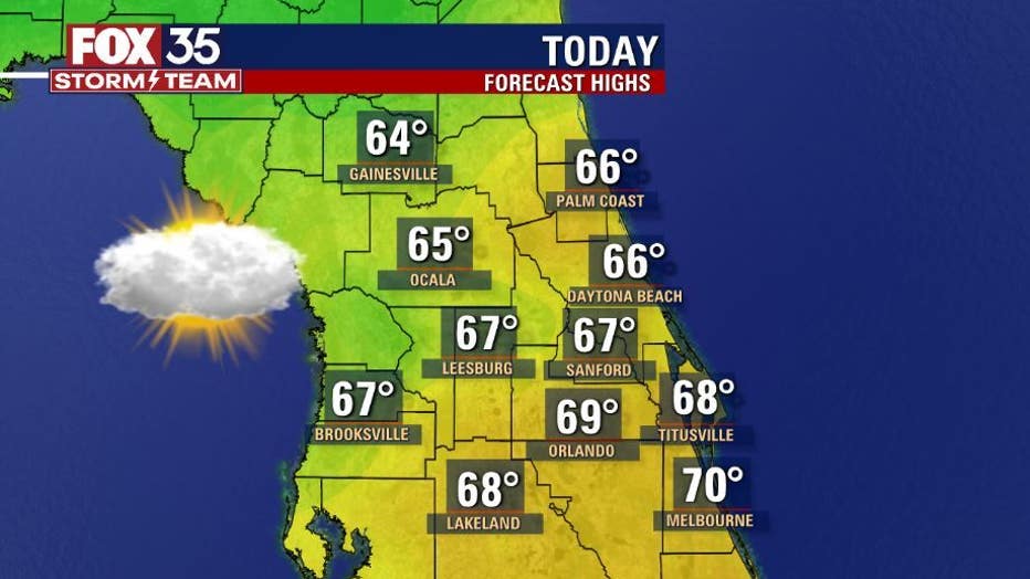
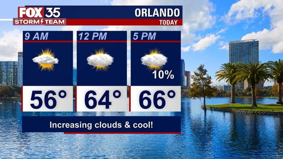
ORLANDO, Fla. - Central Florida is having another chilly start with wake-up temperatures are in the 40s and 50s.
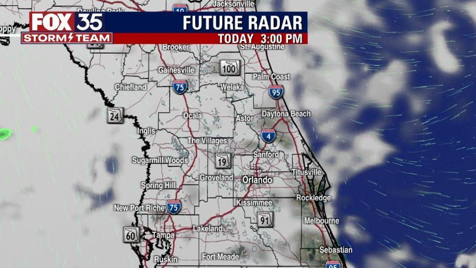
The region is seeing an increase in cloudy cover on Sunday morning and the clouds will stick around into the afternoon, evening hours ahead of our next cold front.
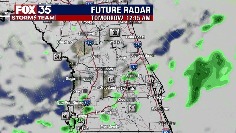
This reinforcing cold front will be limited in moisture but will bring cold air behind it as it moves across the Florida peninsula late Sunday night into early Monday morning.
There is only a 10 percent chance for light rain late Sunday night, but most of the rain will be evaporating before it makes its way to the ground.
WEATHER ALERTS: Download the FOX 35 Storm Team Weather app for live radar, severe weather alerts, and daily forecast reports on your phone
Afternoon highs Sunday will be in the upper-60s but the coldest temperatures this week will be on Monday night — the Orlando metro will dip below 50 degrees!
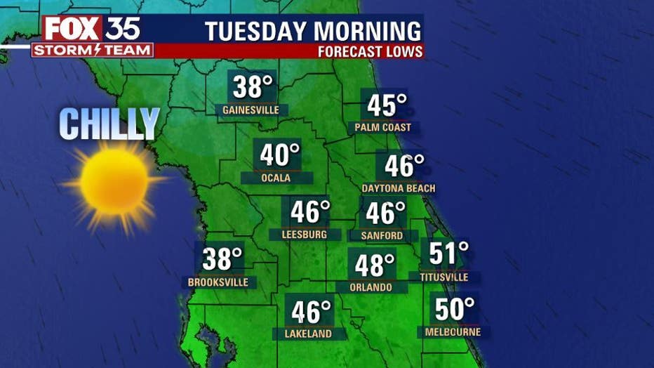
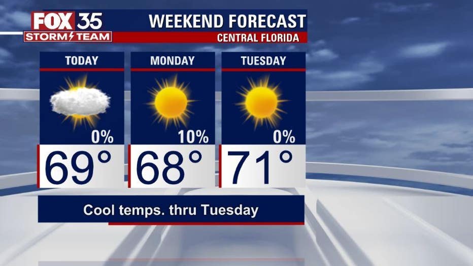
Keep your jacket handy as cold temperatures will be the story through Tuesday. We will then warm back into the 70s by the middle and end of this week.
Watch FOX 35 Orlando for the latest Central Florida news.