

Bone-chilling cold weather hits Central Florida

Weather Forecast: January 18, 2022
FOX 35 Storm Team Chief Meteorologist Jayme King has the forecast.
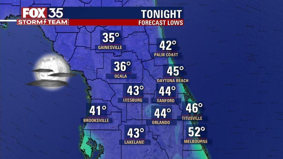
ORLANDO, Fla. - It's another chilly start to the day here in Central Florida, but hang on to hope!
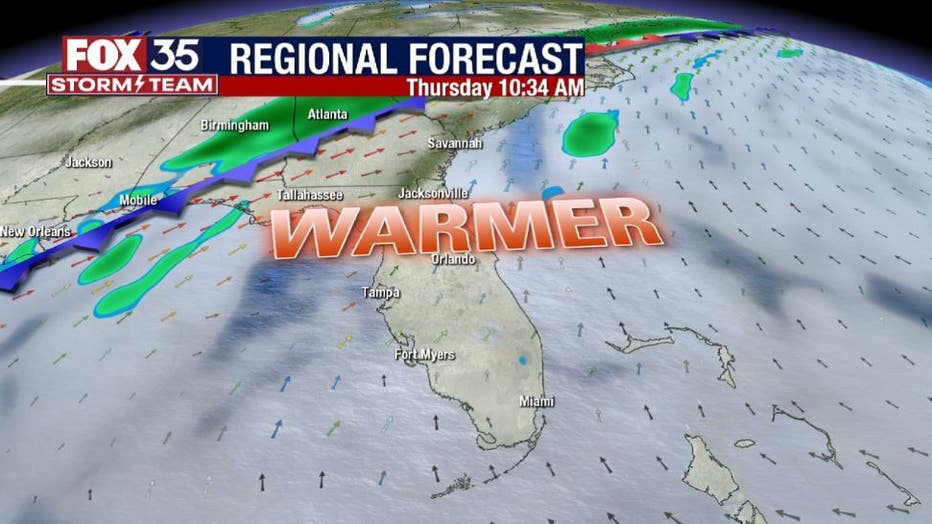
If you don't like the chills, there are plenty of temperature thrills on the way. That means warmer numbers coming up by midweek. Winds will veer to the south during this time in advance of an approaching front.
We're tracking the arrival of highs in the mid-70s complemented with lots of bright Florida sunshine.


We'll see local weather changes yet again by late week with the approach of yet another front. Most of the reliable forecast models are showing a boost in rain chances during this time.
DOWNLOAD: FOX 35 NEWS APP | FOX 35 STORM TEAM WEATHER APP
SUBSCRIBE: FOX 35 NEWSLETTER | FOX 35 Orlando on YouTube
FOLLOW: Facebook | Instagram | Twitter
The rain could become rather focused on Saturday and on the chilly side. Something we all need to watch as weekend outdoor plans could be in jeopardy!
A look at our future weather reveals the possibility of some major cold spilling into the U.S. out of southern Canada. The latest forecast models regarding this cold surge show some fairly impressive numbers spreading steadily South.
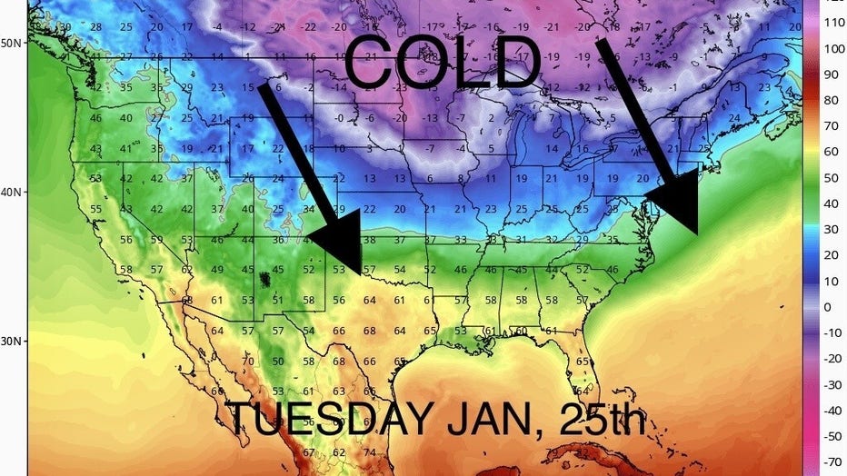
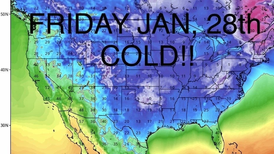
The leading edge of this chill enters the northern U.S. on Tuesday the 25th, heading through the plains, eastward into the upper Midwest and into the Great Lakes regions. From there, the cold slumps south into Texas on the 27th, establishing its reign across the southern states with a slow drift to the southeast coastal areas.


On Friday the 28th, the Arctic air takes over the entire central and eastern third of the nation. In terms of Florida weather during this time, models are generating lows in the 20s and 30s, daily highs would reflect 50s with ease through the period.
Watch FOX 35 News for the latest weather updates. Click here for Central Florida weather, live radar, and Orlando forecast.