

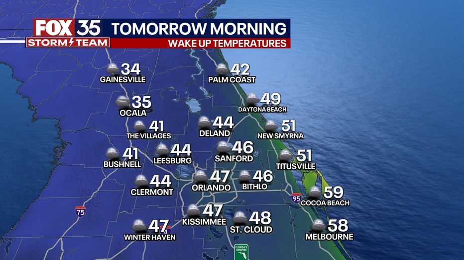
Central Florida waking up to the coldest weather so far this season with temps in the 30s, 40s

Orlando Weather Forecast: November 29, 2023
This morning is a FOX 35 Weather Impact Day due to wake up temperatures in the 30s and 40s. Skies remain clear, allowing temps to drop to some of the lowest values we have felt so far this season.
ORLANDO, Fla. - Today's high: 65 degrees | Tonight's low: 47 degrees
Wednesday morning has been declared a FOX 35 Weather Impact Day due to wake-up temperatures being in the 30s and 40s across Central Florida.
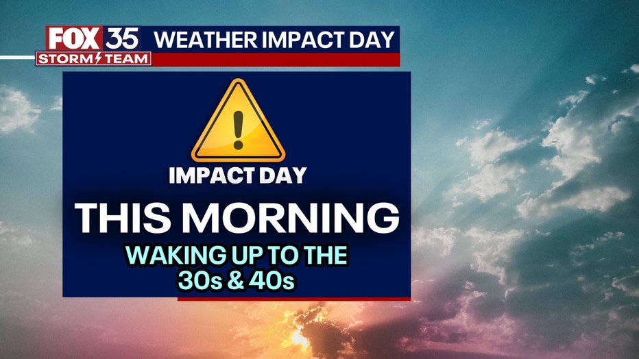
Skies remain clear, allowing temperatures to drop to some of the lowest values we have felt so far this season.
There is a Freeze Warning in Alachua County and a Frost Advisory in Marion County until 8 a.m.
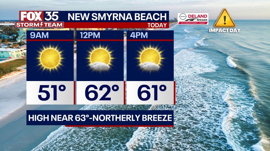
Afternoon highs will peak in the mid-60s. There will be a breeze out of the northwest at 10-15 mph. Don't forget your jackets as you head out the door!
BEACHES:
It will be clear and breezy at all east coast beaches today. High temps will be in the mid-60s. Surf in the 2' range.
THEME PARKS:
It will be a chilly and sunny day the attractions. Highs park-side peak in the mid-60s this afternoon. We remain dry with a light breeze. Keep a jacket handy, especially if you are heading to the parks early on this Wednesday.

OUTLOOK:
Afternoon highs each and every afternoon this week will slowly be warming back to the 80s by Friday and the weather weekend ahead.
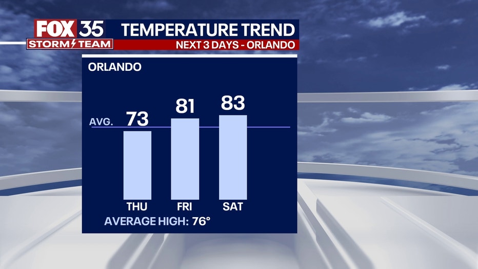
Saturday will be the warmest day this weekend with highs reaching 83 degrees. Rain chances will rise to a 20-30% chance during that time. Download the FOX 35 Storm team weather app so you can track the temperatures where you live.
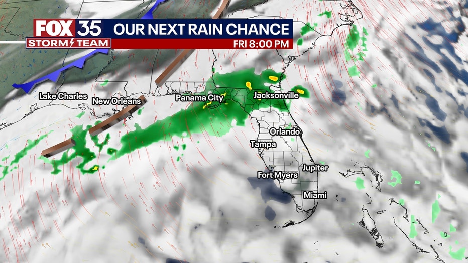
TROPICS:
No tropical activity is excepted this week.
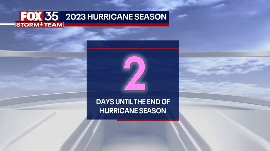
We are closing in on the final days of the 2023 Atlantic hurricane season, which ends on Nov. 30.