

Coldest air of the season brings 20s, 30s to Central Florida before slight warm-up

Weather Forecast: Jan. 24, 2022
FOX 35 Storm Team Meteorologist Brooks Garner has the latest on the weather in Central Florida.
ORLANDO, Fla. - Central Florida is waking up in the chill zone this week!
There was widespread frost reported across the region through mid-morning Monday. We warmed into the 60s this afternoon with plenty of sunshine for all locations, and breezes remained light.
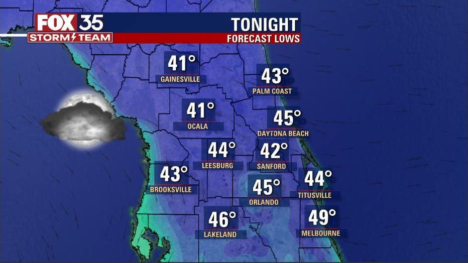
Tonight will not be as cold but still chilly with forecast lows in the 40s. Clouds will increase helping to insulate the area just a bit.
DOWNLOAD: FOX 35 NEWS APP | FOX 35 STORM TEAM WEATHER APP
SUBSCRIBE: FOX 35 NEWSLETTER | FOX 35 Orlando on YouTube
FOLLOW: Facebook | Instagram | Twitter
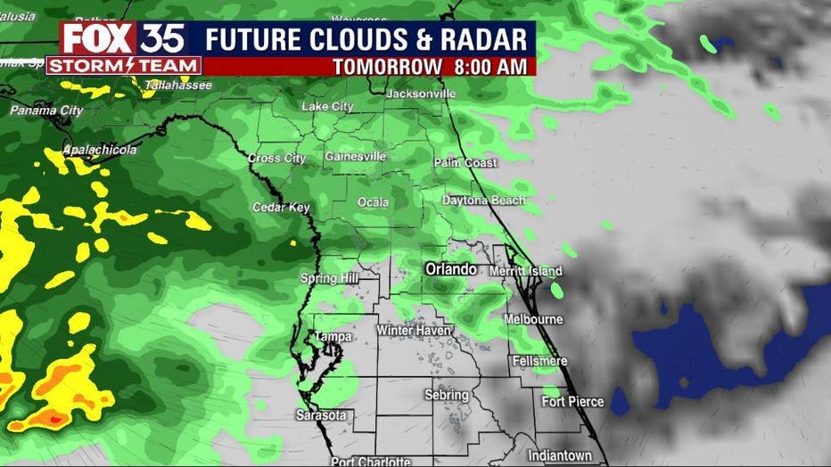
The increasing clouds will also yield rising rain chances on Tuesday. Coverage starts off as slight by mid-morning, increasing as we go into the afternoon and evening hours. There could be a few pockets of heavier rainfall. Strong or severe storms are not expected with this system.
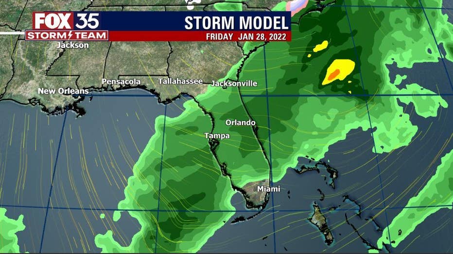
Rain will ease heading into Wednesday morning with coverage falling into the 30-40% range. Yet another storm will move through on Friday as the storm tracks remain active and in close vicinity to Florida. Showers are expected on Friday with another shot of chilly air following close behind for next weekend!
Stay tuned and with the FOX 35 STORM TEAM!
Click here for the most accurate Central Florida weather updates, live radar, and weather forecast for Orlando.
Watch FOX 35 News for the latest launch updates.