

Cool front arrives in Florida, expected to bring coldest temperatures since May

Weather Report: October 17, 2021
FOX 35 Storm Team Meteorologist Allison Gargaro gives the latest on the weather in Central Florida.
ORLANDO, Fla. - Fall has finally arrived in Central Florida.
A cool front swept across the Florida peninsula overnight. There were a few light showers early Sunday morning and they will push south in the afternoon, leaving cooler, drier air in its place.
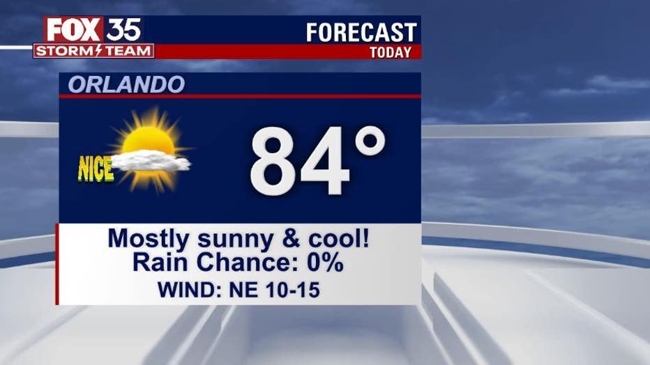
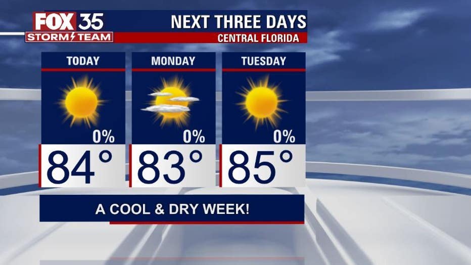
It will be a mostly sunny day with afternoon highs in the low-80s across East Central Florida and upper-70s to our north. Winds will be gusty at times, out of the northeast at 15 to 20 mph.
If you are planning on making Sunday a beach day, know that there is a moderate risk for rip currents at all area beaches. Always swim near an open lifeguard stand.
WEATHER ALERTS: Download the FOX 35 Storm Team Weather app for live radar, severe weather alerts, and daily forecast reports on your phone
In addition, there are so many outdoor events across the region on Sunday and the weather will be near perfect. For example, if you are heading to Biketoberfest in Daytona Beach, there will just be a few clouds overhead.


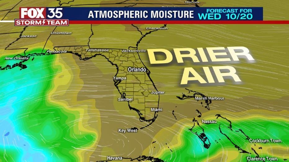
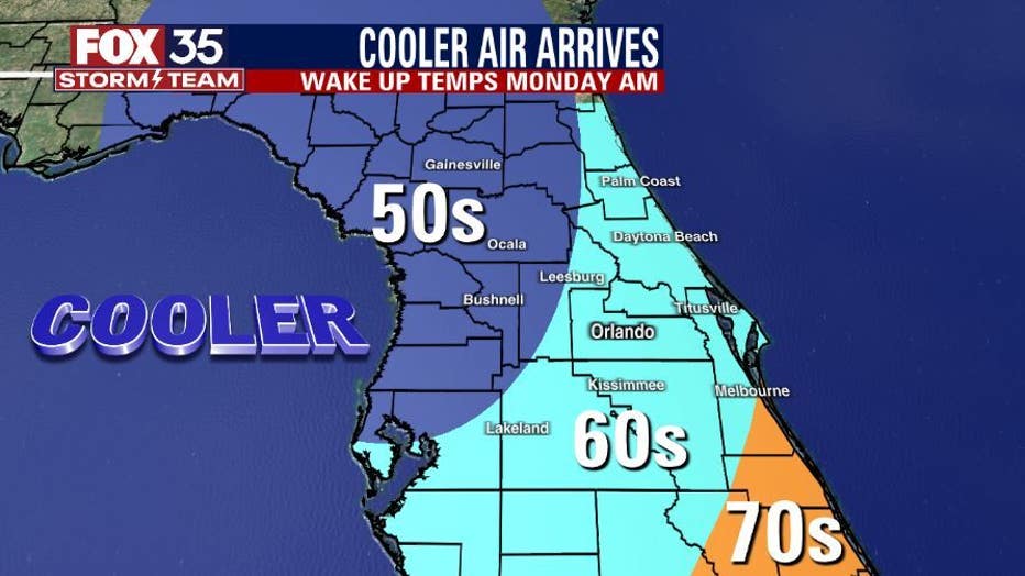
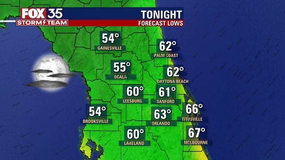
Temperatures overnight will be the coldest that Central Florida has felt since May. There will be a mix of the 50s and 60s with mostly clear skies. It will be a crisp start to your Monday and these dry and cooler conditions will last through the middle of the week.
Enjoy the fall-like weather.
Watch FOX 35 Orlando for the latest Central Florida news.