

Dangerous rip currents at Florida beaches ahead of soaring temperatures this weekend

ORLANDO, Fla. - WHAT IS THE WEATHER FORECAST FOR TODAY AROUND ORLANDO?
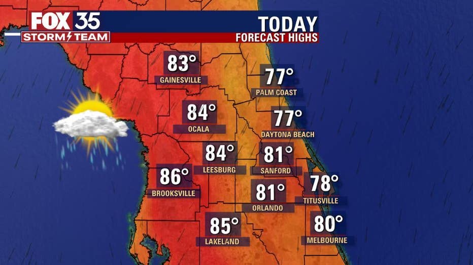
Today’s forecast high: 81 degrees
Tonight's forecast low: 64 degrees
MAIN WEATHER CONCERNS:
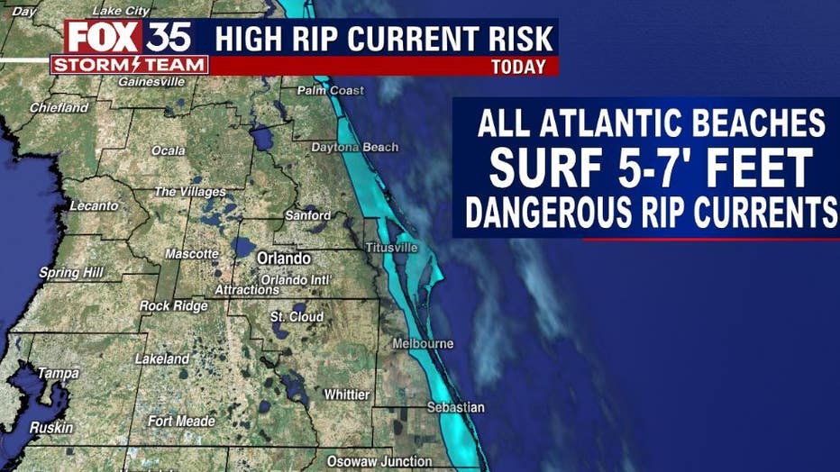
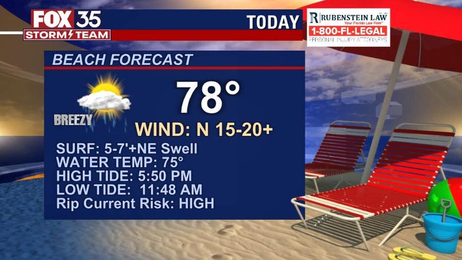
It's a final FOX 35 WEATHER IMPACT DAY for the Atlantic Coast. Gusty winds, a high rip current risk and large-battering breaking waves in the surf zone up to 7' will be the biggest weather concern today along the coast. Expect a mix of sun and clouds and slightly cooler PM highs. Showers will be passing through the area at anytime today along the beaches (40%)-lesser coverage for the inland counties.
WHAT IS THE WEATHER FORECAST FOR WALT DISNEY WORLD, UNIVERSAL, AND SEAWORLD?
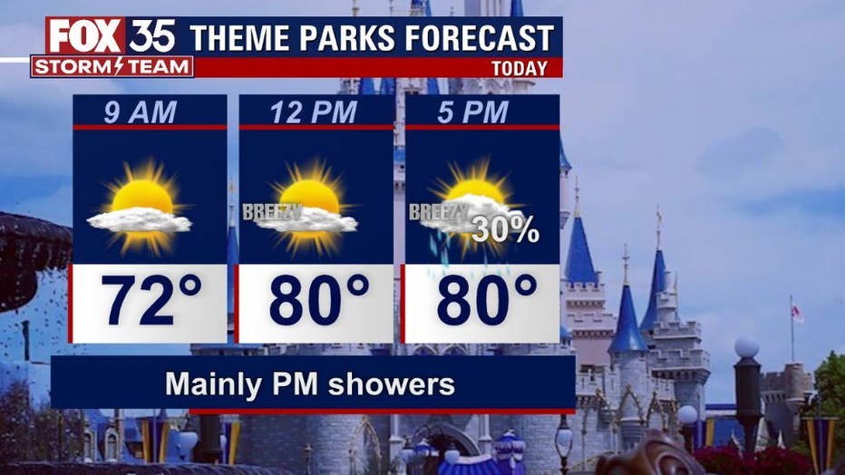
Today will be a great day for the theme parks with temperatures in the low-80s. A showers or 2 could move through after 3pm. PM breezes should keep things relatively comfortable. A good sunscreen will serve you well as the UV INDEX rises to a high level today.
WHAT IS THE WEATHER FORECAST FOR THE BEACHES IN CENTRAL FLORIDA?
Winds will blow in from the North-Northeast at 15-25mph. Passing showers are possible at anytime, not a washout with coverage at 40%. Large breaking waves in the surf zone up to 7' and life-threatening rip currents will be present all day. Best to stay out of the water!
LOOKING AHEAD:
Friday brings a shift in winds and hotter temps. Showers and storms return for the PM Friday with coverage at 50% and mainly for the PM hours.
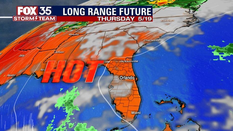
Growing hotter and drier for the weekend with 90s making a return. Rain chances for the area from Saturday through next Wednesday remain at 20% with mid-90s possible by mid-week of next week...stay tuned!