

'Feels like' temperatures over 100-degrees expected in parts of Central Florida

Weather Forecast: June 15, 2022
FOX 35 Storm Team Meteorologist Brooks Garner has the latest on the weather in Central Florida.
ORLANDO, Fla. - The heat wave continues in Central Florida and Wednesday is going to be a real scorcher!
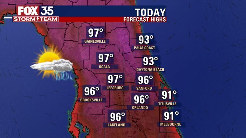
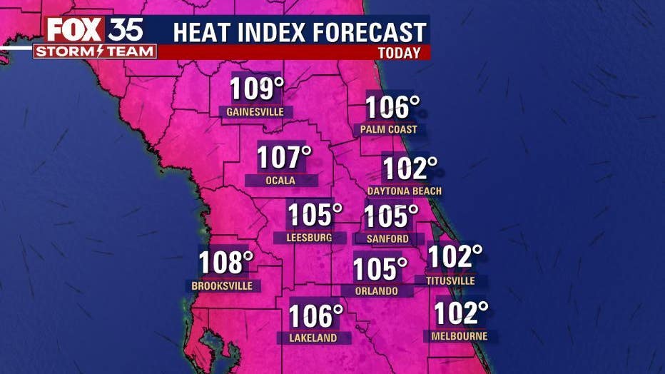
The heat and humidity will be high this week. Afternoon highs will range from the low to mid-90s along the coast to the upper-90s across the interior. Heat index values will range from 103 to 107 degrees through the start of the weekend.
There is a Heat Advisory until 7 p.m. in North Central Florida. Heat Index readings there will range from 106 to 110 degrees.
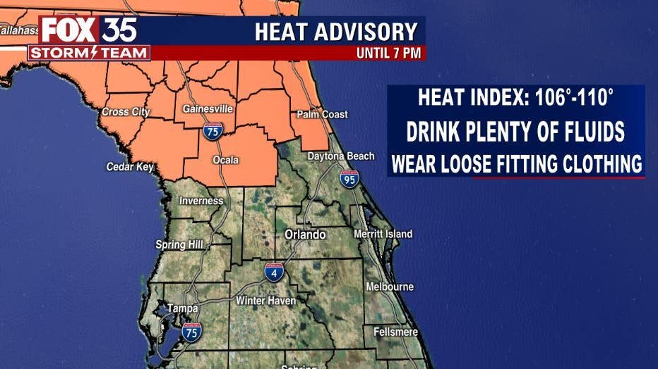
"Stay safe in this heat, drink plenty of water, stay inside the a/c and wear loose fitting clothing," said FOX 35 Storm Team Meteorologist Allison Gargaro.
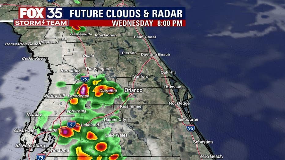
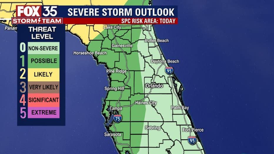
Shower and storm chances will be around 30%-40% this afternoon. Most of the storm activity will happen after 4 p.m. and centered over the middle and western portions of the Florida peninsula and push west. There is an isolated (1/5 risk) for strong to severe storms. Heavy rain, gusty winds and cloud to ground lightning remain the primary hazards.
Theme park visitors can expect high heat and humidity. High temps at the parks will hit near 95+ so make sure you stay hydrated and take breaks in the a/c. There will be the chance for a few storms heading into the early evening hours. Should storms approach, seek shelter immediately.
If you are heading out to the beach today, you can expect mostly sunny skies through the afternoon hours. Highs will be in the low-90s with feels-like temperatures in the triple digits, so pack plenty of water and don't forget to reapply sunscreen. Rip current risk remains in the moderate range.
DOWNLOAD: FOX 35 NEWS APP | FOX 35 STORM TEAM WEATHER APP
Taking a look at our week ahead, hot and steamy conditions will continue through Saturday. Afternoon highs range from 95 to 98 degrees+ with heat index values up to 107 degrees. Saturday will be the warmest day of the week, if not year so far, so make sure you stay safe in this intense heat.
Storm chances are on the rise this weekend. Coverage will be at 40% on Saturday and 60% on Sunday.
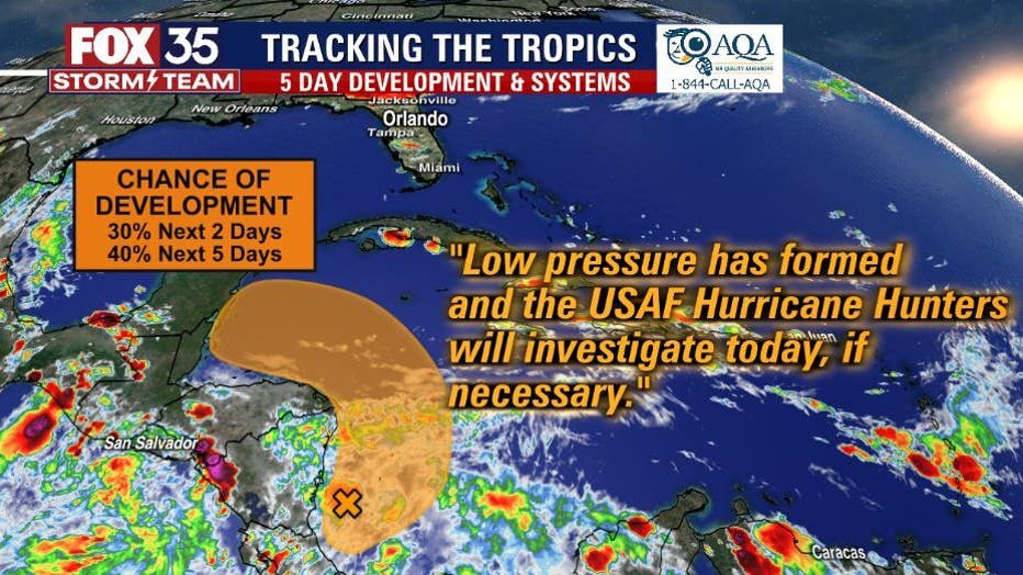
As for the tropics, an area of low pressure has formed in the western Caribbean Sea with a 40% chance for development within the next 5 days. The FOX 35 Storm team continues to track the tropics and will update you if anything changes.