

Tropical disturbance in Gulf moves over Florida

Tracking the Tropics: May 23, 2022
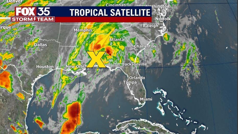
FOX 35 Storm Team Meteorologist Brooks Garner has the latest tropical activity in the Atlantic Ocean and the Gulf of Mexico.
ORLANDO, Fla. - The 2022 Atlantic hurricane season doesn't begin until June 1, but forecasters at the National Hurricane Center (NHC) are already tracking a disturbance that was in the Gulf of Mexico.
The area of low pressure that was over the north-central Gulf has now moved inland about 15 miles west-northwest of Pensacola, Florida.
"That area could be seeing some heavy rain and localized flooding," said FOX 35 Storm Team Meteorologist Allison Gargaro.
"As this system continues to move further inland tonight, tropical cyclone development is not expected," the NHC said. "However, the system continues to produce disorganized thunderstorms and gusty winds across portions of the Florida Panhandle and southern Alabama and this activity is expected to spread northeastward across the southeastern U.S. over the next day or so."
RELATED: 2022 Florida Hurricane Season: How to prepare and safety information to know
DOWNLOAD: FOX 35 NEWS APP | FOX 35 STORM TEAM WEATHER APP
The good news is chances of further formation is at 0-percent, according to forecasters.
Early outlooks are predicting yet another active hurricane season.
The experts at Colorado State University expect the 2022 Atlantic Basin hurricane season to be another one for the record books with tropical cyclone activity expected to be well above average.
Forecasters are predicting 19 named storms, nine of which could become hurricanes. Of those nine hurricanes, four could become major hurricanes of Category 3, 4, or 5 storms, with winds of 111 mph or greater, according to CSU's report. Overall, activity is expected to be between 29% and 36% more active than any normal season.
Hurricane season starts June 1 and runs through Nov. 30.