

FOX 35 Storm Alert Day on Sunday: Strong storms expected before coldest air of the season arrives

Weather Forecast: January 14, 2022
FOX 35 Storm Team Chief Meteorologist Jayme King has the forecast.
ORLANDO, Fla. - We head into the weekend on a positive weather note with gorgeous, comfy temps and plentiful sunshine.
Most locations will harvest highs in the mid-upper 60s, perhaps a few isolated lower 70s South of Orlando.

Sunshine will be out in full force with cloudless skies. It's a perfect day to head outdoors, the comfort factor will be very high! Going to the theme parks? It's going to be perfect day for that as well.
WEATHER ALERTS: Download the FOX 35 Storm Team Weather app for live radar, severe weather alerts, and daily forecast reports on your phone
Tonight brings some more chilly weather. Our fire pit forecast looks wonderful, pleasantly cool through the evening hours with temperatures falling through the 50s. Overnight lows head for the 40s under generally clear skies.
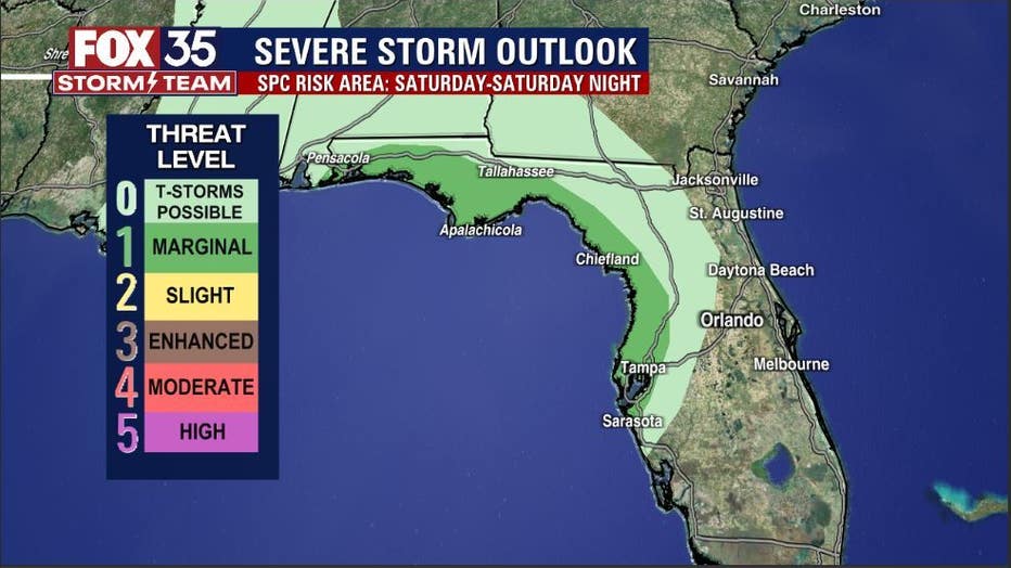
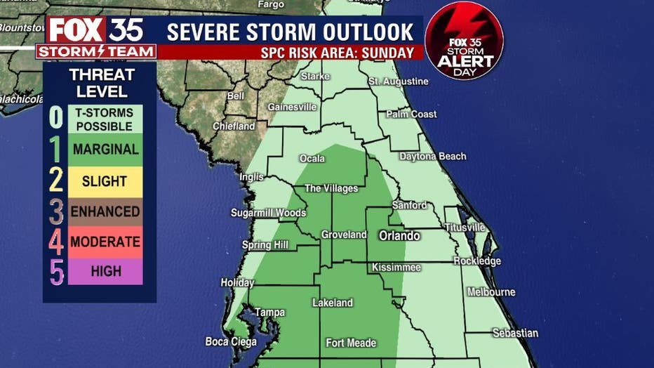
Our advertised strong cold front will close in on the area overnight Saturday into Sunday morning. The severe weather risk will be confined to the Florida Panhandle primarily on Saturday through Saturday evening with a shift into the Peninsula on Sunday.
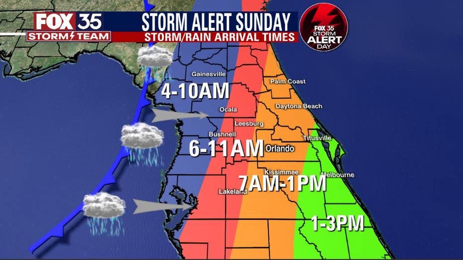
Sunday is a FOX 35 Storm Alert Day with the greatest impacts from the incoming front being felt here locally.
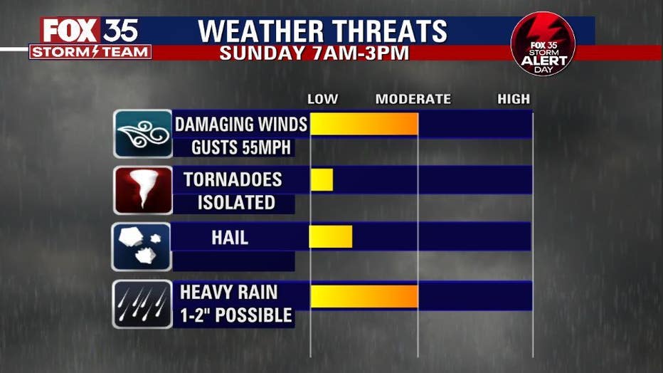
A few of the storms along the front could become strong to severe. The main threats appear to be a few damaging wind gusts and very heavy rain. Tornadoes are not expected. The risk of hail appears to be low as well.
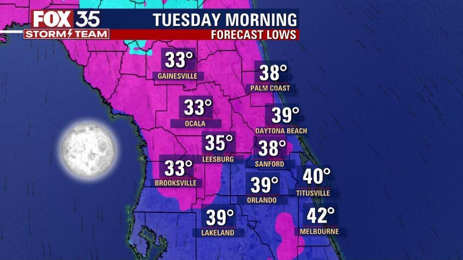
Behind the departing front, colder air will funnel into the region. Numbers look quite chilly with not only the coldest air of the season so far but, the coldest air in nearly a year for the area.
Stay tuned and with the FOX 35 Storm Team for the absolute latest.
Watch FOX 35 News for the latest weather updates. Click here for Central Florida weather, live radar, and Orlando forecast.