

High heat and increasing rain chances for Central Florida

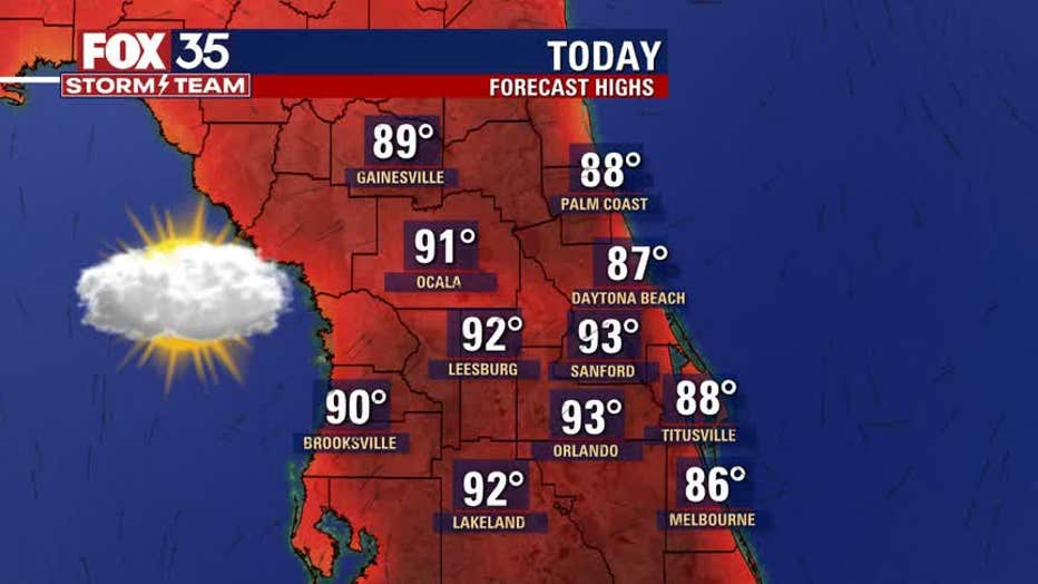
ORLANDO, Fla. - Sizzling sunshine and hot temperatures will greet Central Floridians again on this Tuesday.
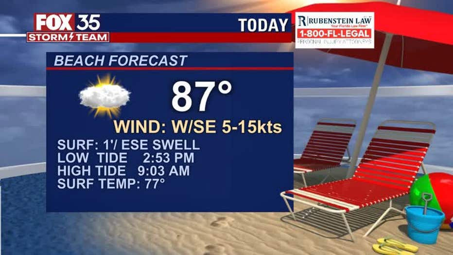
Clouds will increase a bit as we head into the afternoon and humidity remains high. Rain chances will increase to 30% around the I-4 corridor after 3 p.m., lower coverage at 20% or less at the Atlantic side beaches. Factor in the humidity on top of highs in the lower 90s and the heat index will settle around 96 degrees at peak this afternoon.
Wednesday brings a "MARGINAL RISK" of severe storms over the Northeastern Coastal areas of Florida.
WEATHER ALERTS: Download the FOX 35 Storm Team Weather app for live radar, severe weather alerts, and daily forecast reports on your phone
As of right now, it looks like the strongest storms will arrive during the afternoon into the evening hours. Heavy rain, lightning, very gusty winds, and even some small hail will be possible.

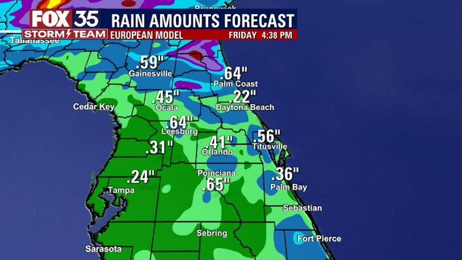
Rain chances will continue rising into Thursday as a front moves into Central Florida. Forecast models currently show a few showers around Thursday morning with more robust coverage likely for the afternoon.
Rain amounts will be enough to put a dent in the current dry streak – which is also some great news. Rain amounts could top ½" of accumulation in some areas.
Watch FOX 35 News for the latest weather updates.