

Hot and humid 90s across Central Florida with some scattered storms

ORLANDO, Fla. - WHAT IS THE WEATHER FORECAST FOR TODAY AROUND ORLANDO?
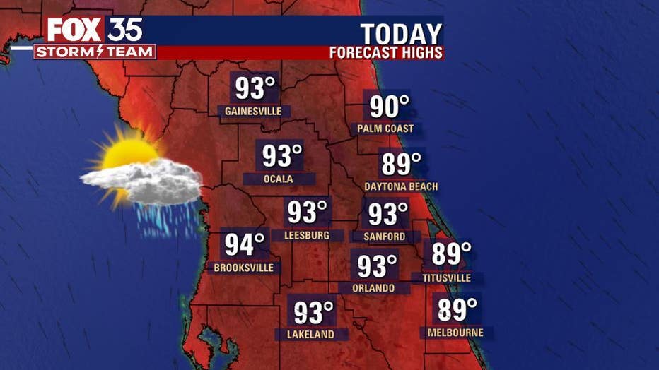
Today’s forecast high: 93 degrees
Tonight's forecast low: 75 degrees
MAIN WEATHER CONCERNS:
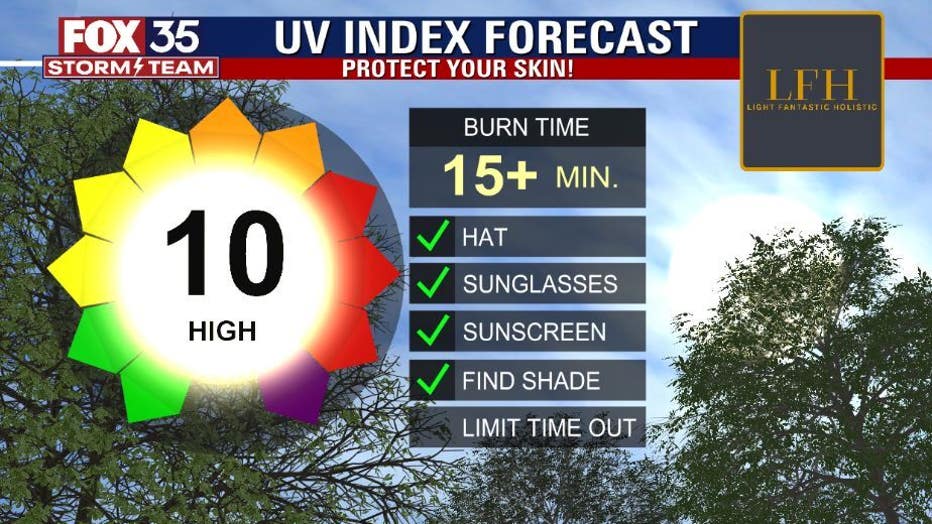
Welcome to summertime in central Florida! The heat and humidity are in the rise this afternoon with highs in the low-90s in Orlando and upper-80s along the coast. The UV Index remains high, so make sure you reapply sunscreen and drink plenty of water.
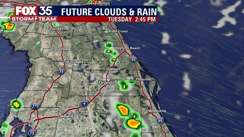
Showers and storms begin as early as 2 p.m. starting west of I-95 and move west across the peninsula by this evening. Coverage remains at 40% today.
WHAT IS THE WEATHER FORECAST FOR WALT DISNEY WORLD, UNIVERSAL, AND SEAWORLD?
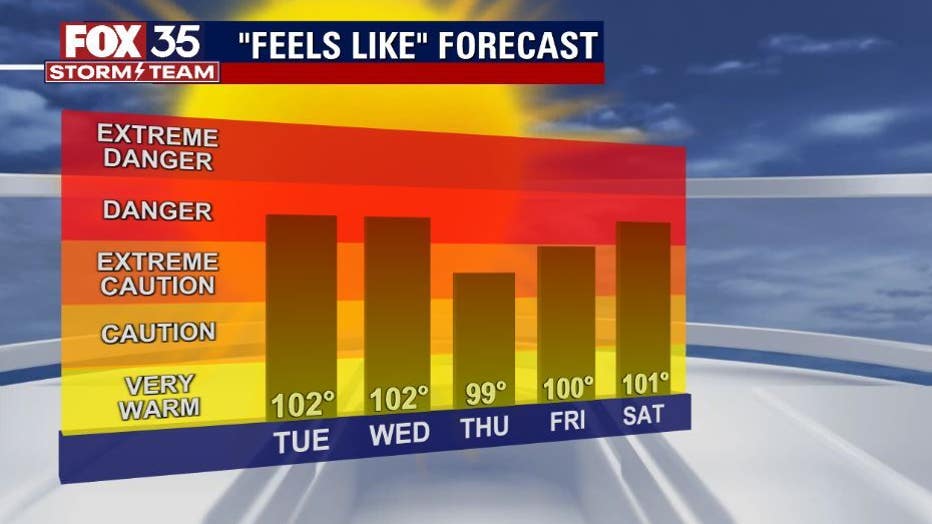
Weather at the theme parks will remain quite this morning, but this afternoon temperatures warm to the low-90s with feels like temperatures in the triple digits. Make sure you stay hydrated. Shower and storm chances are possible early this evening.
WHAT IS THE WEATHER FORECAST FOR THE BEACHES IN CENTRAL FLORIDA?
If you are heading to the beach today, you can expect partly sunny skies to start the day with a mix of sun and clouds this afternoon. As for temperatures, they will reach the upper-80s. There is a moderate risk for rip currents at all east coast beaches, so make sure to swim near an open lifeguard stand.
LOOKING AHEAD:
Temperatures remain in the low-90s through the extended forecast. Rain and storm chances will range anywhere from 40%-70% for the next seven days... hello summer! Make sure you are staying hydrated and weather aware each afternoon. Download the FOX 35 Storm team weather app to track the live radar right on your cell phone.
Tracking the Tropics: There are three areas the FOX 35 Storm Team is watching. The first, Potential Tropical System #2 which is being tracked by the National Hurricane Center and is expected to become a Tropical Depression within the next day or so. The second, an area of disorganized showers and thunderstorms in the Gulf of Mexico will slowly drift westward toward the east coast of Texas over the next few days. This area has a 30% chance for further development. The third is a tropical wave with an area of disorganized showers and thunderstorms with a 20% formation chance within the next five days. Depend on the FOX 35 Storm Team this Hurricane Season.