

Hurricane hunters say Ian flight was ‘worst’ of their careers: ‘dropped 1,200 feet instantaneously’
Pilots who flew through Hurricane Ian as it neared a catastrophic landfall on Florida’s Gulf Coast say it’s the worst flight they’ve ever experienced.
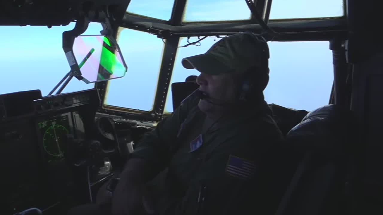
FOX News reporter Madison Scarpino was on board with the U.S. Air Force Reserve’s 53rd Weather Reconnaissance Squadron as they flew over the eye of Hurricane Ian on Wednesday. Kendall Dunn, the aircraft’s commander, said the flight was "the worst thing you could want to happen as a pilot."
"Your first flight was my worst flight ever," Dunn said. "And I've actually been through an airborne tornado called a mesocyclone. But basically today, the storm was rapidly intensifying. We made a shot to cut through the eyewall, but the rain was so intense that the radar was only seeing just beyond our nose.
"And then when it did get a sweep and clear up, we were in horrible turbulence," he continued. "The worst web I've ever seen. I've never seen those formations on the radar themselves. We got rocked, like to say, like a boxer. The aircraft was basically overmatched at one point ... It was a mess. It was the worst thing you could want to happen as a pilot."
READ MORE: Hurricane Ian near Category 5 strength, eyewall moving onshore in SW Florida
The National Oceanic and Atmospheric Administration and the Air Force Reserve both have hurricane hunter planes and crews, tag-teaming missions into and around dangerous storms to gather critical data.
"It was bad enough that NOAA aircraft that fly that same mission ... they turned around and didn’t come through their final pass. They actually turned back," Dunn said. "And I’ll be honest with you, had we not been that far into it I would have turned too. That’s not a knock on them as pilots. I did not want to be where we were, but we made it and we’re smiling .. and we have a war story."
READ MORE: Florida Disaster Fund: How to donate to communities impacted by Hurricane Ian
Nick Underwood, a NOAA engineer and hurricane hunter, said he’s been flying into hurricanes for six years. Ian was also the worst he’s ever seen.
Ian’s "extremely dangerous" eye wall began moving onshore Wednesday afternoon, the National Hurricane Center said. With top sustained winds of 155 mph, Ian may be one of the strongest hurricanes to ever hit the United States. The storm is a strong Category 4 on the Saffir-Simpson scale; only four hurricanes have ever struck the U.S. with stronger winds.
Ian is expected to cause "catastrophic" storm surge, winds, and flooding across the Florida peninsula. Storm surges could push as much as 12 to 18 feet of water over a nearly 100-mile stretch of coastline. Rainfall near the area of landfall could top 18 inches.
Ian is likely to remain intact as it crosses the Florida peninsula, increasing the threat of hurricane-force winds across the state and prompting Hurricane Warnings on the east coast of central Florida, the hurricane center said.
Parts of Georgia and South Carolina also could see flooding rains and some coastal surge into Saturday.
FOX Weather and The Associated Press contributed to this report.