

Invest 91L: Hurricane hunters to check tropical wave near Mexico's Yucatán for possible development

Tropical Update: June 27, 2025
FOX 35 Senior Meteorologist Noah Bergren has the latest conditions in the tropics. The 2025 Atlantic Hurricane Season runs July 1 - November 30. Download the FOX Local app for tropical alerts and notifications.
ORLANDO, Fla. - Forecasters are monitoring a broad swath of tropical activity for potential development near Mexico's Yucatán Peninsula. The National Hurricane Center has designated the tropical disturbance as Invest 91L.
What is Invest 91L, and where is it located?
What we know:
The system could potentially develop further as it moves over warm waters, though current conditions are not favorable for rapid intensification.
A tropical disturbance developing near Mexico’s Yucatán Peninsula is bringing heavy rainfall to parts of Central America, prompting warnings of flash flooding and mudslides, forecasters said Friday.
CLICK TO DOWNLOAD THE FOX LOCAL APP
The system, now labeled Invest 91L by the National Hurricane Center, is producing widespread showers and thunderstorms across northeastern Nicaragua, northern Honduras, Belize, Guatemala, and southeastern Mexico. The storm is expected to continue spreading rain through at least Friday night.
Forecast models currently give the system a 30% chance of forming into a tropical depression or storm within the next 48 hours.
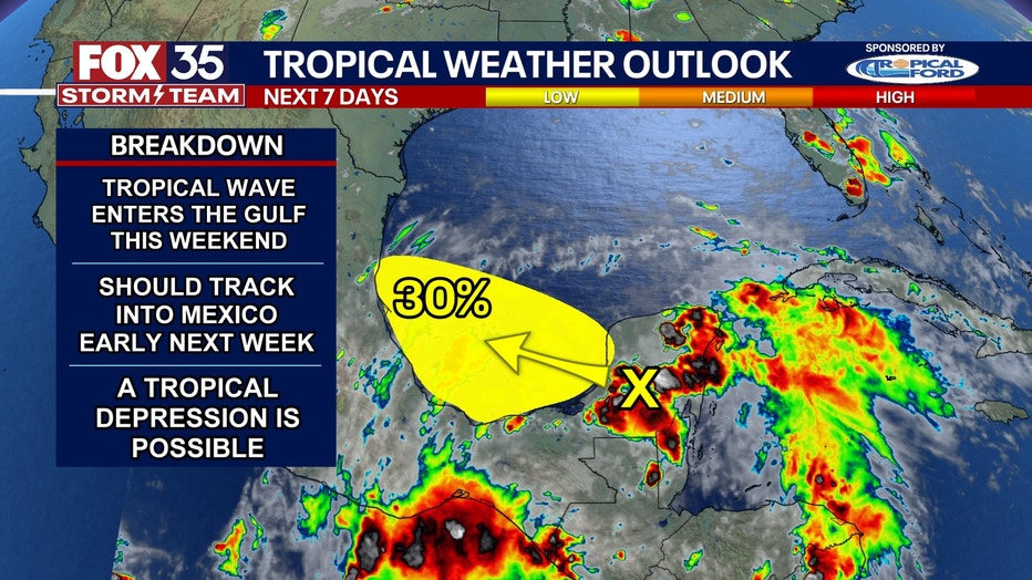
Forecasters said the window for development is narrow. The disturbance is expected to move inland over eastern Mexico by Sunday, which would likely end any further tropical organization.
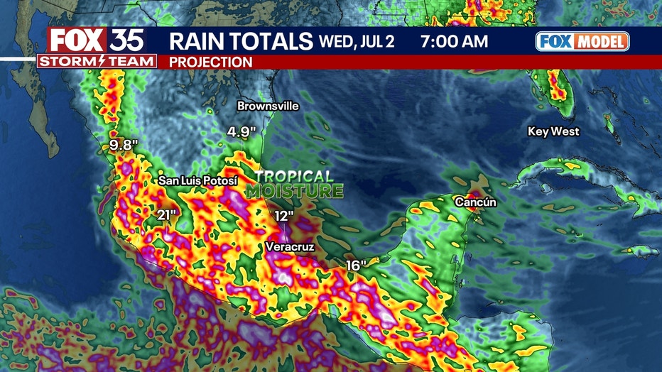
Regardless of development, forecasters warned that locally heavy rainfall is possible across parts of Belize, Guatemala, and southeastern Mexico through next week.
An Air Force Reserve Hurricane Hunter aircraft is scheduled to investigate the area on Saturday if necessary.
What we don't know:
As of now, forecast models are uncertain whether Invest 91L will become a tropical depression or storm. Environmental conditions are inhibiting development.
The backstory:
The Bay of Campeche has a well-known history of rapid storm development due to its warm sea surface temperatures and geography.
SIGN-UP FOR FOX 35'S BREAKING NEWS, DAILY NEWS NEWSLETTERS
However, the broader Atlantic hurricane season so far has been unusually quiet. Forecasters attribute this lull to above-normal surface pressures, dry air, and a hostile upper-level environment influenced by more active Pacific storms.
Heavy rain forecast for Mexico, Central America
Big picture view:
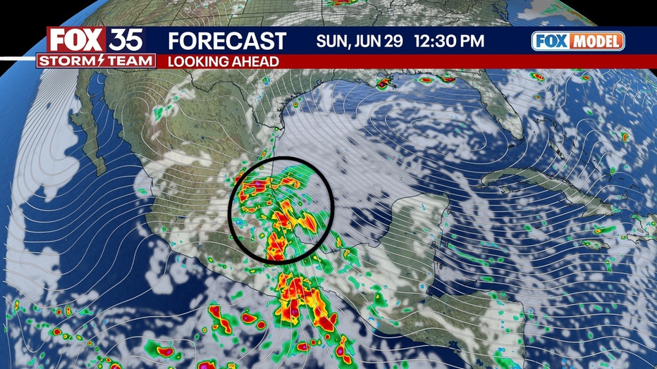
These types of tropical patterns are typical during this time of year, as hurricane season ramps up, according to forecasters. The FOX Model shows a tropical wave with disorganized showers and storms moving into central Mexico this weekend.
What they're saying:
While Invest 91L is unlikely to become a major storm, it is expected to bring beneficial rainfall to drought-stricken areas of Mexico.
"If it develops, a tropical depression is possible. A tropical-storm-level system getting named is unlikely but not impossible," said FOX 35 Storm Team Meteorologist Noah Bergren. "Regardless of development will bring lots of rain and gusty winds, and flooding to Mexico and far south Texas this weekend into early next week."
RELATED: Saharan Dust to blanket Central Florida this weekend
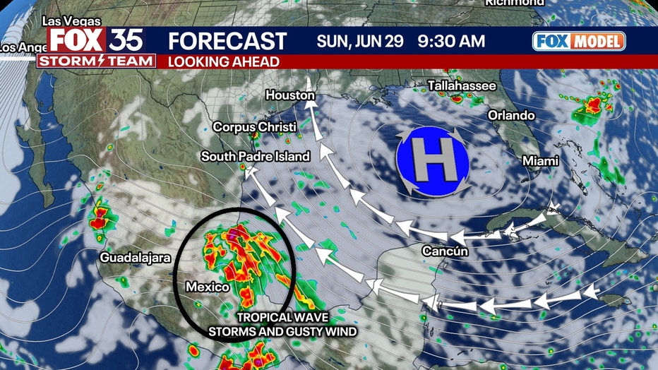
Impacts from any development are expected to stay well south of the U.S. border, near Tampico, Mexico.
"Spaghetti models show individual model potential paths for the system, with the majority taking it into Mexico," Bergren added. "This is no threat to Florida whatsoever thanks to a large area of high pressure that will push the storm away from us."
The peak of hurricane season typically comes in mid-September, so while activity is low now, forecasters caution that this is not an indicator of the full season's potential.
The Source: This story was written based on information shared by the National Hurricane Center and the FOX 35 Storm Team.