

National Hurricane Center: New tropical wave being watched for development; Invest 96-L decreases in strength

Tropical update: August 9, 2025
FOX 35 Meteorologist Laurel Blanchard has the latest conditions in the tropics. The 2025 Atlantic Hurricane Season runs thru November 30. Download the FOX Local app for tropical alerts and notifications.
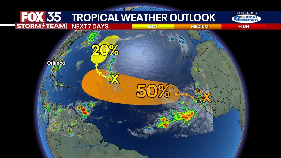
ORLANDO, Fla. - As the Invest 96-L disturbance decreases in its chances of tropical development, the National Hurricane Center (NHC) is now monitoring a new tropical wave emerging off the western coast of Africa for the possibility of development.
Here's everything we know about the developments as we continue to track the tropics.
New tropical wave emerges off coast of Africa
What we know:
A new tropical wave formed off the western coast of Africa on Friday evening.
So far, the NHC has already doubled the odds of the system's development to a 50% chance of the wave developing into a tropical depression or storm over the next seven days, from its initial 20% chance given Friday night.
CLICK TO DOWNLOAD THE FOX LOCAL APP
The wave is producing a large area of disorganized showers and thunderstorms.
Environmental conditions appear favorable for gradual development of this system, and a tropical depression could form by the middle to latter portion of the week while it moves west-northwestward at 15-20 mph across the eastern and central tropical Atlantic. This has the potential to be the first hurricane of the season because of the warm ocean water to fuel development.
Locally, heavy rainfall is possible Sunday and Monday across portions of the Cabo Verde Islands.
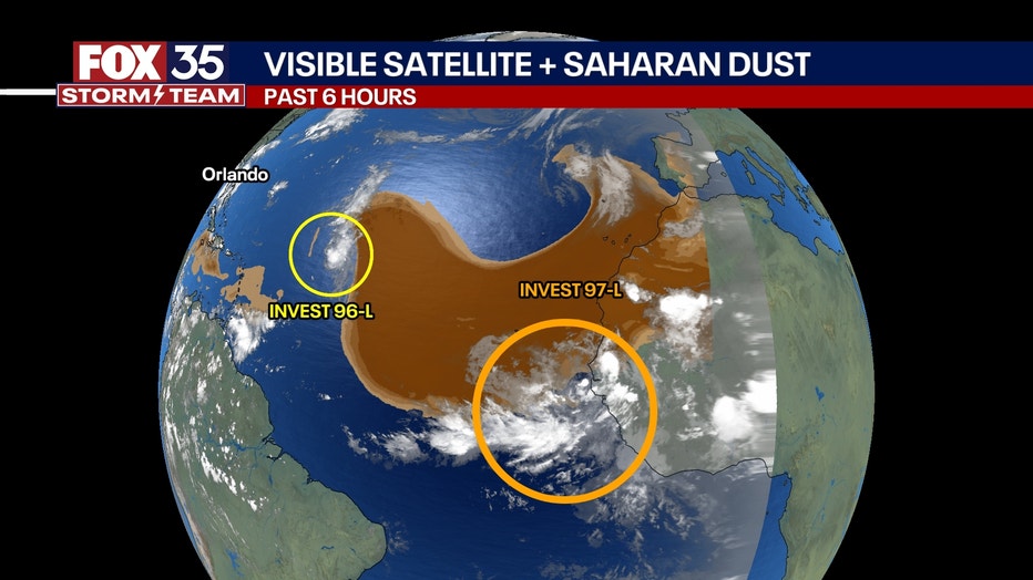
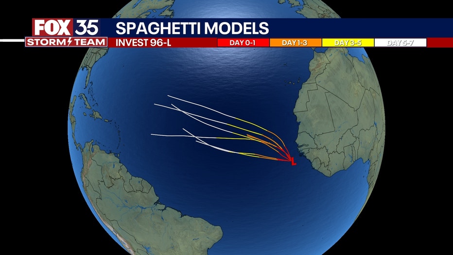
Invest 96-L decreases in strength
Dig deeper:
Meanwhile, Invest 96-L looks to run into a less favorable environment this week with now only a 20% chance of development over the next seven days.
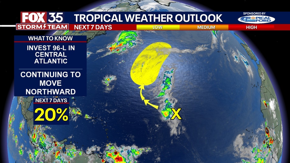
Disorganized showers and thunderstorms are still occurring in association with the tropical wave over the central tropical Atlantic.
SIGN-UP FOR FOX 35'S BREAKING NEWS, DAILY NEWS NEWSLETTERS
Development of this system appears unlikely during the next day or two due to surrounding dry air, but some gradual development is possible during the early or middle part of next week while the system moves northwestward to northward across the central Atlantic.
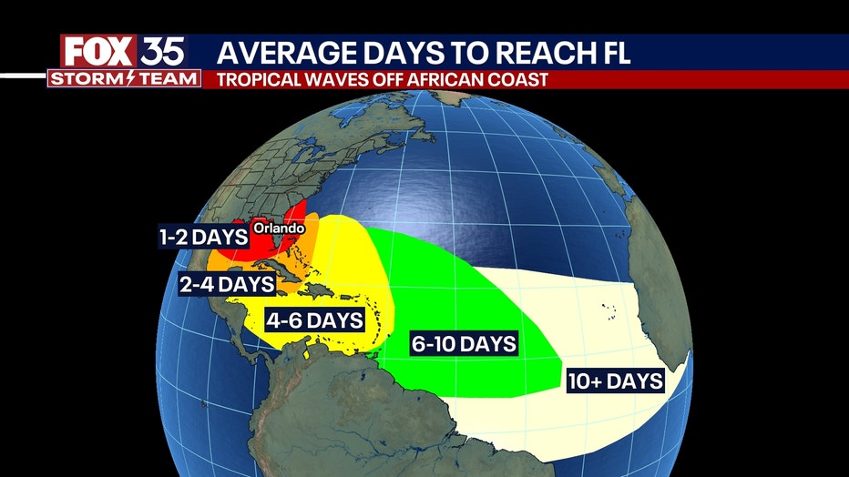
While eyes stay on two tropical areas to watch in the Atlantic Ocean, forecasters are monitoring the possibility of heavy rainfall in Florida, Georgia, Alabama and Mississippi.
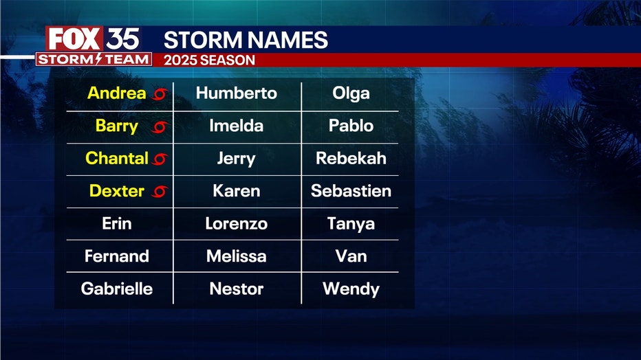
2025 Atlantic hurricane season
Big picture view:
The 2020 Atlantic hurricane season runs from June 1 through Nov. 30.
RELATED: 2025 Atlantic hurricane season: NOAA maintains above-average outlook, lowers storm count
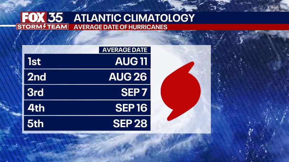
While the season lasts for six months, the most intense period is generally from mid-August to October. The peak in hurricane activity is linked to favorable atmospheric and ocean conditions like warm sea surface temperatures and specific wind patterns. Although the peak is in the later months, storms can form before and after the official season dates.
Forecasters are predicting an above-average hurricane season for 2025, with the potential for more named storms, hurricanes and major hurricanes compared to historical averages.
The Source: This story was written based on information shared by the National Hurricane Center (NHC), FOX Weather and the FOX 35 Storm Team.