

Orlando weather: Chilly start before warm up and rain hit Central Florida

ORLANDO, Fla. - Today's high: 71 degrees
Tonight's low: 55 degrees
Rain: 30% chance of showers late Saturday evening and overnight
Main weather concerns:
Most of Saturday looks great after a cool start to the day. Clouds will increase in the afternoon ahead of an overnight front. Scattered rain showers are possible overnight with the best chances south of I-4. Any rain should clear out before sunrise Sunday.
Temperatures will run 5 degrees cooler Sunday afternoon compared to Saturday.
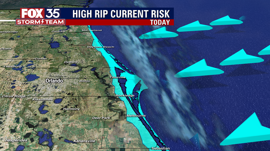
BEACHES:
The high rip current risk continues today all along our entire east coast. Surf is around 2-3'. Temperatures beach side hit in the upper-60s, with water temps near 70. It is not recommended to enter the surf today. Make sure you are staying safe at the beaches this weekend.
RELATED: Long-range holiday forecast shows 20s, 30s in Florida during Christmas weekend
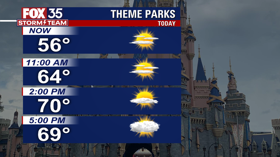
THEME PARKS:
It is a perfect day to head to the theme parks. Skies will be partly cloudy with more clouds late in the day. Enjoy the beautiful winter weather in Florida!
OUTLOOK:
Our weather pattern remains plenty active in the week leading up to Christmas Day. After a cool start to the week with lows in the 40s Monday morning, our next system will track towards Florida out of the Gulf late Tuesday.
Heavy rain and gusty winds will be possible into Wednesday morning. Another strong front is looking likely late in the week before Christmas weekend. Friday could be blustery with truly cold air possible for the holiday weekend.