

Orlando weather: Stormy weekend before drier weather returns to Central Florida
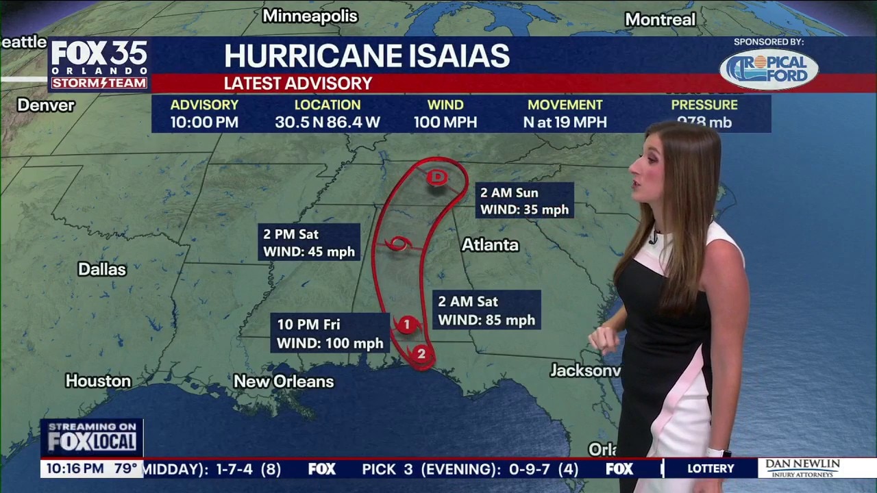
Tropics forecast: Hurricane Isaias moves inland as heavy rain, flooding continues
Hurricane Isaias was moving farther inland Friday night after making landfall near Destin, but the storm continued to bring dangerous winds, flooding, and heavy rain to parts of Florida and the Southeast.
ORLANDO, Fla. - Hurricane Isaias made landfall at 9:30 p.m. on Friday, near Destin, as a Category 2 storm.
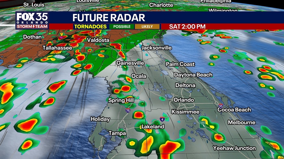
Our direct connection to deep Caribbean moisture continues Saturday and Sunday, with southerly winds feeding another round of afternoon and evening thunderstorms into Central Florida.
Stormy and breezy weekend ahead
Feeder bands flowing into Isaias will move over our region on Sunday, making for a slightly higher chance of rain for the second-half of the weekend.
Saturday will become breezy, with southeast winds increasing to 15–20 knots over nearby Atlantic waters. This'll make for rough beach conditions on the Atlantic side with a high risk for life-threatening rip currents.
Temperatures remain unusually warm and humid, with highs in the upper 80s and lower 90s and heat indices approaching 100-105°.
Rain chances remain elevated at 60–70% both days, with scattered storms Saturday and numerous thunderstorms developing during the afternoon Sunday.
A few stronger storms could produce wind gusts of 40–50 mph, occasional lightning and locally heavy rainfall. Additional flooding remains possible in communities where the ground is already saturated. An isolated tornado is possible on the Big Bend on the western side of our FOX 51 WOGX viewing area.
Drier weather arrives Monday
The pattern finally changes as a weak front moves through Central Florida on Monday, bringing noticeably drier air into the region behind Isaias.
Dew points could fall into the 60s as early as Monday afternoon, ending our prolonged stretch of oppressive tropical humidity.
Tuesday and Wednesday look mostly dry, with substantially lower rain chances, more sunshine and overnight lows falling into the mid 60s to lower 70s.
Afternoon temperatures will still climb well into the 80s, potentially approaching 90°, but the lower humidity should make conditions noticeably more comfortable.
Some moisture may return late next week, although nothing approaching the tropical moisture we've experienced recently.
Hurricane Isaias makes landfall in Florida Panhandle
When did Isaias make landfall?:
Hurricane Isaias made landfall near Destin in the Florida Panhandle on Friday night with sustained winds of 105 mph, bringing dangerous coastal flooding, damaging winds and heavy rain.
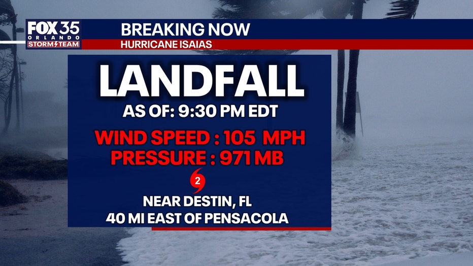
The National Hurricane Center said Isaias reached the coast around 8:30 p.m. CDT. The hurricane was moving north at 19 mph.
At landfall, the center of Isaias was about 40 miles east of Pensacola and 50 miles west-northwest of Panama City.
Will Isaias be felt in Central Florida?
Central Florida impacts?:
Despite Isaias becoming a major hurricane today, the greatest direct hurricane impacts remain well northwest of Central Florida.
Our main concerns continue to be scattered to numerous afternoon thunderstorms, occasional strong wind gusts and localized flooding through Sunday.
The hurricane's influence will help lift our stalled frontal boundary northward while maintaining a deep connection to tropical moisture across the peninsula.
The good news: Isaias will help set the stage for a pattern change early next week, with a weak front arriving Monday and substantially drier air finally returning to Central Florida. It'll feel like fall again.
The Source: The information in this story was provided by the FOX 35 Storm Team.