

Saharan dust heads for Florida: What to expect

Saharan dust tracks toward Florida
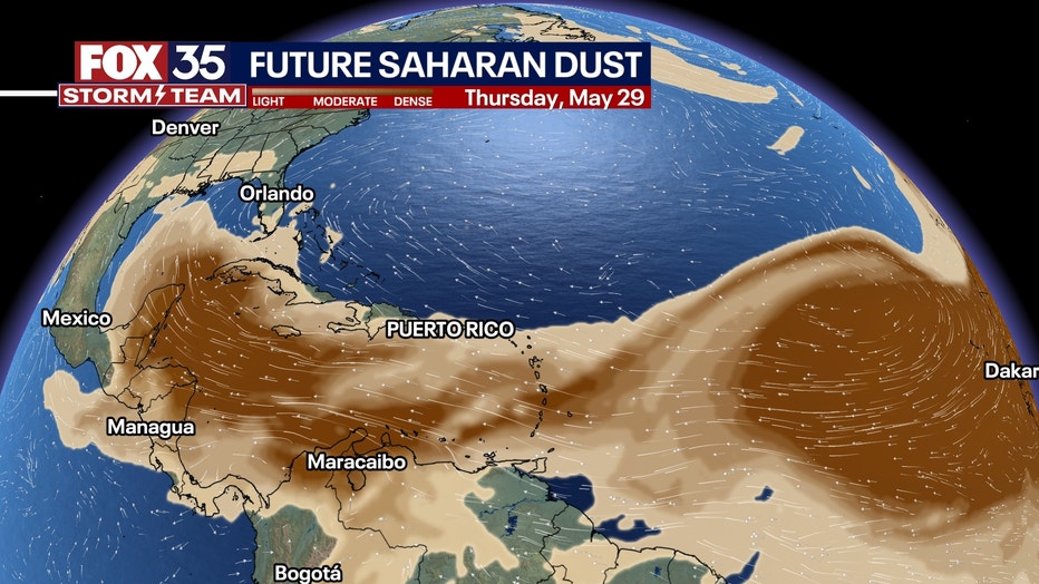
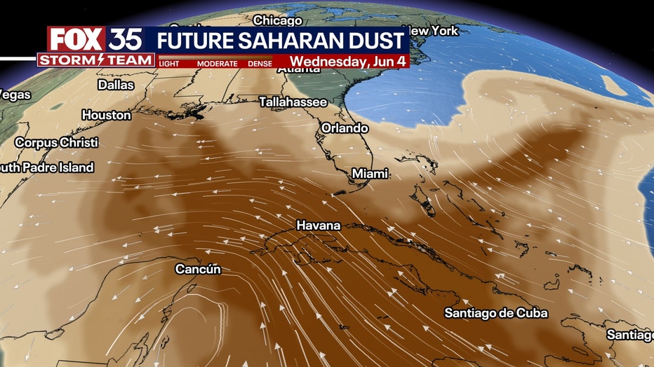
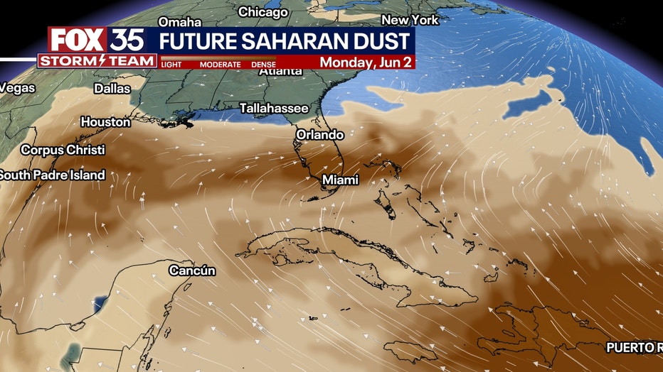
Saharan dust is headed to Florida. It travels to the Sunshine State each summer, causing hazy skies, colorful sunsets, and lower air quality. The dry, dusty air can weaken or block hurricane formation.
ORLANDO, Fla. - Saharan dust is heading toward Florida! Here's what that means for us.
What is Saharan Dust?
What we know:
Every summer, strong winds blow massive clouds of dust off the Sahara Desert in Africa. This is called the Saharan Air Layer, or SAL. These dust clouds ride the wind across the Atlantic Ocean, sometimes traveling more than 5,000 miles all the way to Florida.
Local perspective:
When the dust arrives, it can:
- Create hazy skies and reduce visibility
- Produce beautiful orange and pink sunrises/sunsets
- Lower air quality (especially tough for people with asthma or breathing issues)
Good and Bad Effects
The dust isn’t all bad. It’s full of minerals, like iron, that can fertilize the ocean, especially around places like the Florida Keys. These minerals feed coral reefs and ocean plants, keeping ecosystems healthy. However, the dust may also carry bacteria, fungi, and viruses from Africa. Some scientists think these tiny travelers could affect both people and plants, but research is still ongoing.
MORE NEWS | Tracking The Tropics: FOX 35 2025 Hurricane Season Preview
How does it travel so far?
Dig deeper:
Powerful winds over the Sahara lift the dust high into the atmosphere—up to 15,000 feet or more! Then, strong trade winds carry it westward across the Atlantic like a sky-high highway. That’s how it ends up in the Caribbean and the southeastern U.S., including Florida.
Why does the dust die down later in the summer?
Timeline:
By August and September, Saharan dust storms usually slow down.
More Rain: As the Atlantic Ocean gets warmer, it creates more humid air and tropical rain. These rains help wash the dust out of the sky.
Weaker Wind Systems: The pressure systems that help lift and move dust from Africa weaken later in the season.
Changing Atmosphere: The air becomes more tropical—warm and wet, which is not friendly for dry, dusty SAL air.
The Dust vs. Hurricanes
Here’s something really important: The Saharan Air Layer can actually stop hurricanes from forming or weaken ones that already exist.
How?
Dry Air: Tropical storms need warm, moist air to grow. The SAL is very dry, and when it mixes with a developing storm, it dries out the storm’s fuel source.
Strong Winds: The SAL often travels with strong upper-level winds. These can create wind shear, which is like cutting the top off a storm. That makes it harder for the storm to stay organized and grow stronger.
Dust Particles: All the tiny particles in the air can also reflect sunlight, which cools the ocean surface slightly. Since warm water fuels hurricanes, cooler water means weaker storms.
So while the dust might make the skies hazy, it also acts like a natural hurricane blocker—at least temporarily.
WATCH: Giant manta ray dives under Florida paddleboarder
Big picture view:
Saharan air is a sign that summer is near, and every year its dusty clouds move through the Caribbean, into Florida and up through the Gulf Coast. The SAL is both friend and foe, and yet another example of the wonder of weather and the interconnectedness of the continents.
STAY CONNECTED WITH FOX 35 ORLANDO:
- Download the FOX Local app for breaking news alerts, the latest news headlines
- Download the FOX 35 Storm Team Weather app for weather alerts & radar
- Sign up for FOX 35's daily newsletter for the latest morning headlines
- FOX Local: Stream FOX 35 newscasts, FOX 35 News+, Central Florida Eats on your smart TV
The Source: This story was written based on information shared by the FOX 35 Storm Team Meteorologist Brooks Garner on May 27, 2025.