

Subtropical Storm Josephine forms in Atlantic, expected to move away from U.S. coast, NHC says
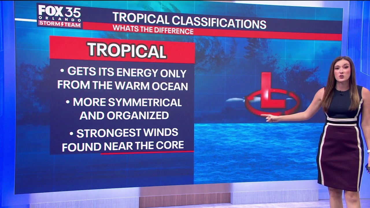
What's the difference between a tropical and sub tropical system?
Subtropical Storm Josephine formed in the Atlantic on Wednesday, but its unusual characteristics set it apart from a typical tropical storm.
Subtropical Storm Josephine (formerly Invest 93-L) formed Wednesday in the Atlantic Ocean, with forecasters expecting the storm to accelerate northeastward and move away from the United States, according to the National Hurricane Center.
As of early Wednesday evening, Josephine was located about 265 miles south of Nantucket, Massachusetts, and 585 miles southwest of Halifax, Nova Scotia. The storm had maximum sustained winds of 65 mph and was moving north at 6 mph.
Subtropical Storm Josephine
Tracking the Tropics:
Forecasters expect Josephine to turn northeastward Thursday and increase its forward speed. The storm is forecast to remain south of Nova Scotia and Newfoundland as it moves away from the U.S. coast.
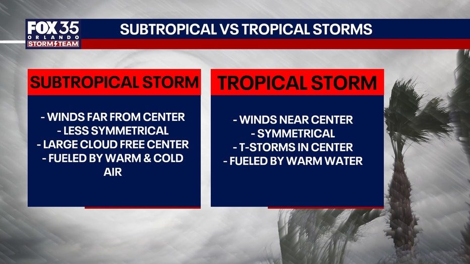
"Subtropical Storm Josephine is basically a weather hybrid. Unlike a traditional tropical storm that gets all its energy entirely from warm ocean waters, Josephine is partially tropical and partially non-tropical. It started as a nor'easter and gradually acquired tropical characteristics. It split from its connected fronts this afternoon, and it is now being fueled by a mix of warm ocean moisture (tropical) and the clash between hot and cold air masses (non-tropical)," explained Laurel Blanchard. "Because of this hybrid nature, its strongest winds are spread out much farther from the storm's center than a typical tropical cyclone. It will still hold the same wind strength of a hurricane, but not have the same organization as it continues to follow up the US and Canada Coast."
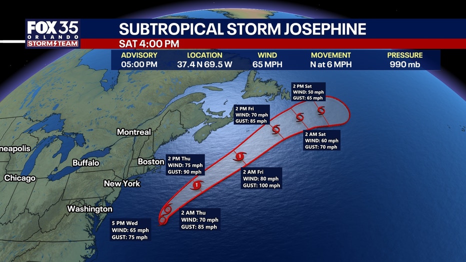
Some strengthening is expected, although Josephine is forecast to remain a subtropical storm through early Thursday. Further strengthening is likely by late Thursday as the system transitions into a post-tropical cyclone with hurricane-force winds, the hurricane center said.
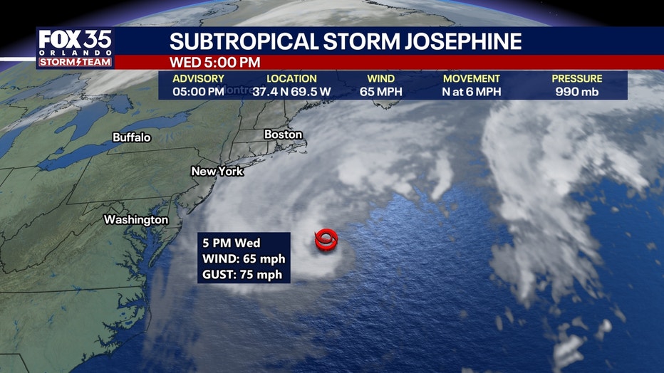
Winds of at least 40 mph extend as far as 415 miles from the storm's center.
No coastal watches or warnings were in effect as of Wednesday evening.
Dangerous surf and coastal flooding possible
Despite the storm's forecast track away from the United States, Josephine is generating hazards along portions of the East Coast.
Gale-force wind gusts are possible along parts of the northeastern U.S. coast through Thursday, according to the hurricane center.
Minor to locally moderate coastal flooding is ongoing along portions of the Mid-Atlantic coast and is expected to continue through the rest of the week around high tide.
Large swells generated by Josephine are affecting much of the eastern U.S. seaboard and parts of Atlantic Canada. The swells could create life-threatening surf and rip current conditions, forecasters warned.
Residents and visitors are advised to monitor updates from their local National Weather Service offices.
Florida impacts?
Subtropical Storm Josephine is expected to move northeast away from the United States later this week, posing no direct threat to Florida.
Another disturbance has low chance of development
The hurricane center is also monitoring a trough of low pressure several hundred miles east-southeast of Bermuda that is producing disorganized showers and thunderstorms.
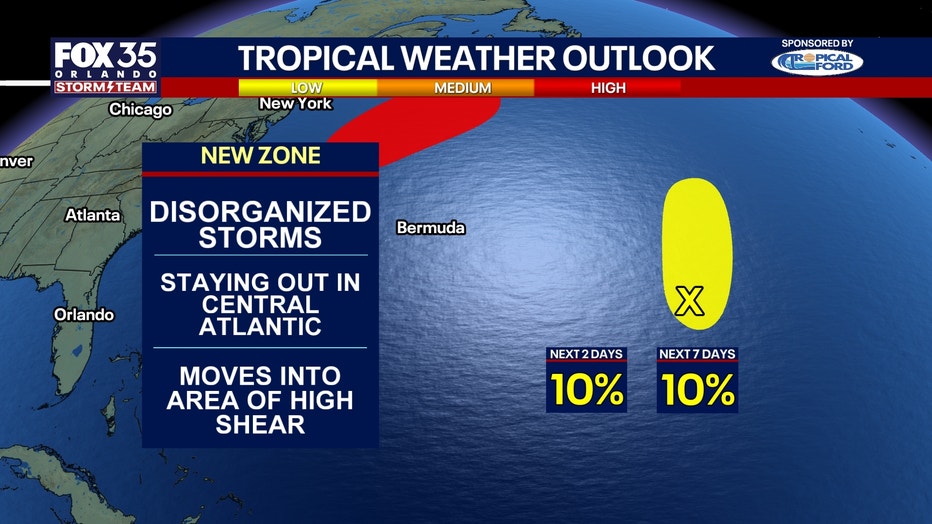
Some development is possible over the next day or two as the system moves slowly north-northeastward. However, upper-level winds are expected to become unfavorable for further development by the weekend.
The system has a 10% chance of developing into a tropical or subtropical cyclone within the next 48 hours and a 10% chance over the next seven days, according to the hurricane center.
The Source: This story was written based on information released by the National Hurricane Center and from information provided by the FOX 35 Storm Team.