

TIMELINE: Here's when the winter storm will bring freezing temperatures to Central Florida

TIMELINE: Here's when Central Florida will be impacted by major winter storm
FOX 35 Storm Team Chief Meteorologist Jayme King has a look at your freezing holiday forecast.
ORLANDO, Fla. - A major "once in a generation" winter storm that is slamming the U.S. with bitterly cold temperatures is expected to bring Central Florida the chilliest Christmas in more than thirty years.
Freeze warnings and watches have been issued across most of the state as temperatures are forecast to drop into the 20s and 30s – with wind chills in the teens in some areas.
So when will you need your winter coat? FOX 35 is timing out the chilly temperatures for you to make sure you and your family are prepared this holiday weekend.
Friday will be a more comfortable day in the high 60s and low 70s. It's when Santa Claus is preparing to take flight around the world that the freezing cold temperatures move in.
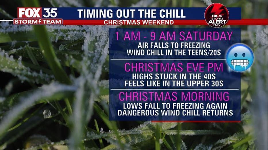
CHRISTMAS EVE FORECAST
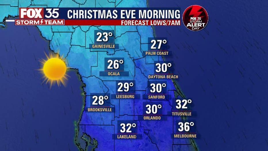
On Saturday – Christmas Eve – between 1 a.m. and 9 a.m. air falls to freezing and wind chills in the teens and 20s are expected. Wake up temps Christmas Eve morning will be down in the 20s and 30s all across the viewing area with highs only in the 40s and low 50s.
Christmas Eve night will see highs only in the 40s, with ‘feels like temperatures’ in the upper 30s.
RELATED: Central Florida freeze: 5 P's to help you prepare for chilly weather
CHRISTMAS DAY FORECAST
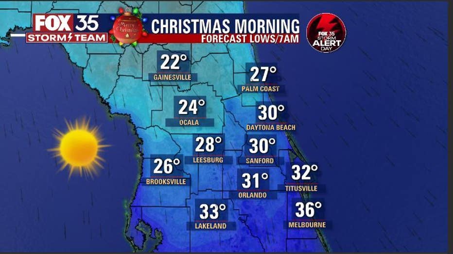
On Christmas Day, lows fall to freezing levels again and dangerous wind chills return. Christmas Day brings similar temps with freeze warnings looking likely then as well. Wind-chills or "feels like" temps will range from the teens to 20s during the morning hours.
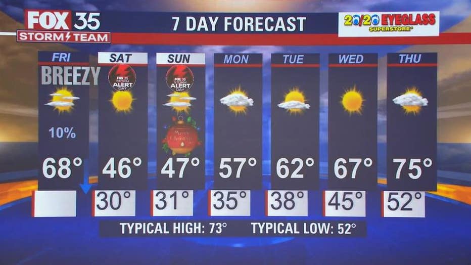
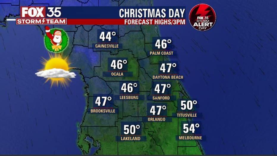
Wake-up temperatures on Christmas Day will be in the 20s and 30s – 31 in Orlando, 22 in Gainesville, 24 in Ocala. Highs will be stuck in the mid-40s with lots of sunshine.