

Next cold front incoming, will drop temperatures into the 30s

Weather Report: January 31st
FOX 35 meteorologist Allison Gargaro gives the latest on the weather in Central Florida.
ORLANDO, Fla. - Are you dizzy from the up and down temperatures yet?
Central Florida has been on a rollercoaster of temperatures for the past few weeks, and you can expect more of the same in our 7-day forecast.
High pressure is dominating this weekend, bringing warm temperatures. By Sunday, highs will be in the upper-70s.
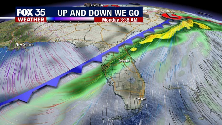
However, these warm temperatures won't last long. The region's next cold front arrives late Sunday night into early Monday morning.
This front is associated with a major low-pressure system bringing heavy snow and gusty winds to the midwest and northeast. Central Florida will see the return of winter-like temperatures at the start of the week.
WEATHER ALERTS: Download the FOX 35 Weather App to track the tropics on your phone, receive severe weather alerts, and get the latest daily forecasts
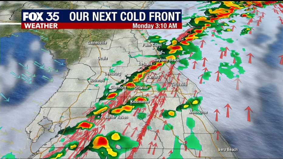
The showers, with the possibility of a lightning strike or two, arrive in north-Central Florida after 8 p.m. this evening. The rain moves into the Orlando metro after midnight and moves across coastal Brevard County at sunrise. These showers will be pushing offshore by the time you head to work on Monday morning.
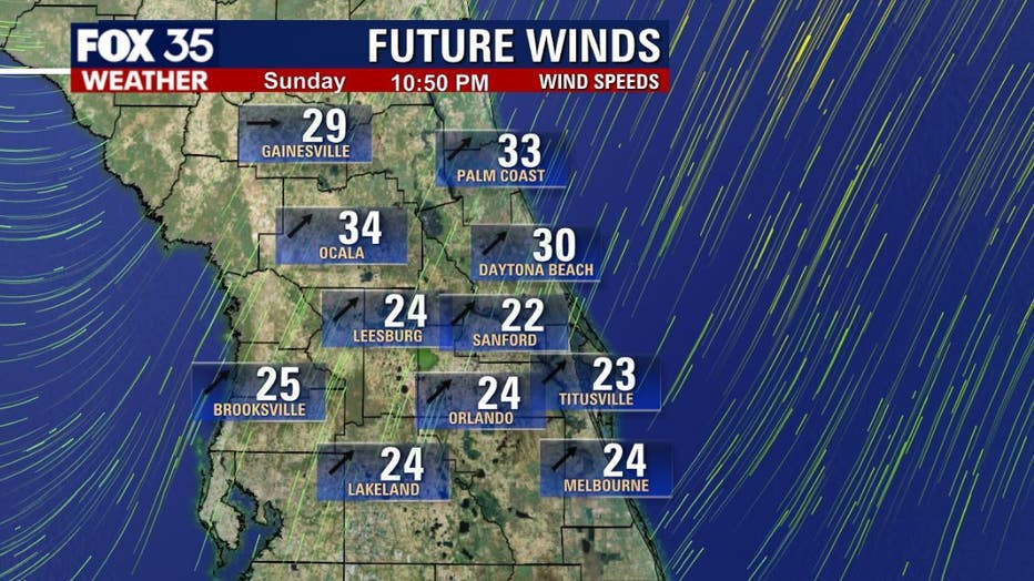
On the back end of this front, we will see gusty winds, up to 25 to 35 mph and cooler air.
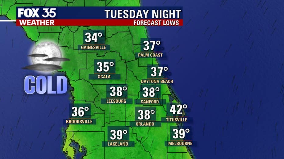
Highs on Monday drop into the low-60s and down to the mid-50s by Tuesday. Overnight lows Tuesday and Wednesday mornings will be in the 30s.
Watch FOX 35 for the latest weather updates.