

Warm day ahead before pre-Christmas showers move into Central Florida

Weather Forecast: December 17, 2021
FOX 35 Storm Team Chief Meteorologist Jayme King has the forecast.
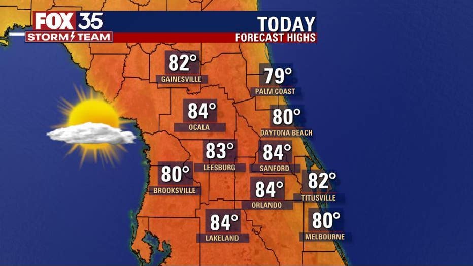
ORLANDO, Fla. - Happy Friday! Central Florida will remain rather toasty as we close out the work week.
Highs soar into the 80s all across the viewing area, sunshine prevails coupled with just a bit of cloud cover as we head into the afternoon hours.

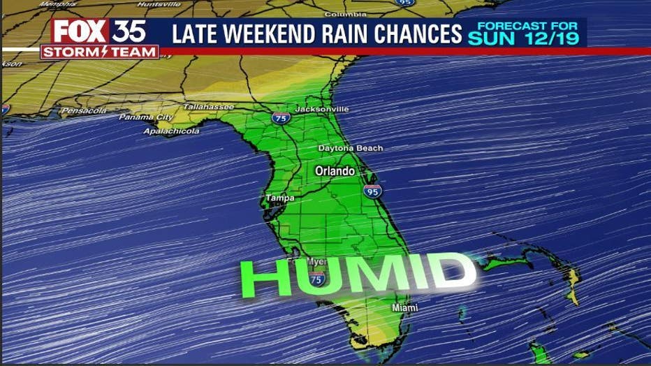
Pre-Christmas showers expected for Central Florida
FOX 35 Storm Team Chief Meteorologist Jayme King has the forecast.
Skies are rain free but that trend will be changing soon!
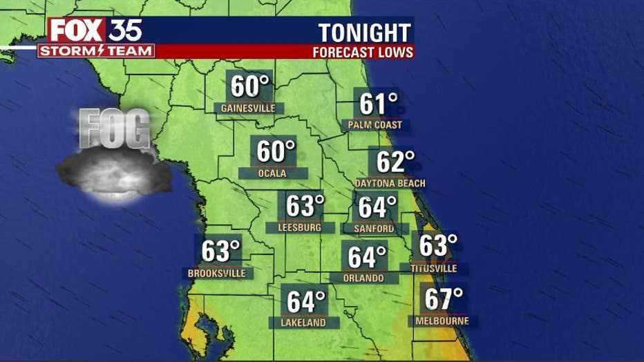
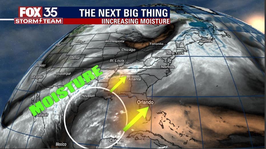
Tonight, expect some patchy fog, some of which could be locally dense, especially over the northern counties. A cold front will approach Florida late in the day Saturday and a moisture increase is already evident over the Southwest Gulf of Mexico. This boost in moisture will topple the dry air in place today with a modest increase in shower activity Saturday afternoon and evening, chance near 20% or so.
WEATHER ALERTS: Download the FOX 35 Storm Team Weather app for live radar, severe weather alerts, and daily forecast reports on your phone
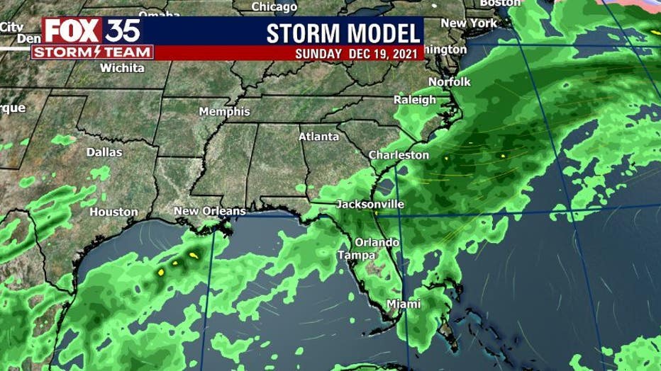
Sunday brings more clouds and an increase in shower activity, coverage looks to be in the 40% range with Monday looking identical.
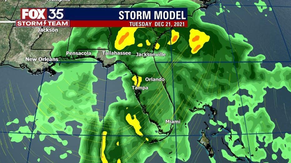
Late Monday night into Tuesday could trend much stormier as low pressure develops in the Gulf and moves across Florida. Some of the storms Tuesday could become strong and we'll be tracking. Stay tuned!
Watch FOX 35 News for the latest weather updates.