

Warm days, cooler nights in the 50s and 60s this weekend in Central Florida

Weather Forecast: Oct. 7, 2022
Orlando and Central Florida will see increased humidity in the wake of Tropical Storm Julia. While Julia is far from Florida and will not directly impact the state, it will funnel in tropical moisture beginning on Sunday.
ORLANDO, Fla. - Tonight's low: 65 degrees | Tomorrow's high: 85 degrees | Rain: 0%
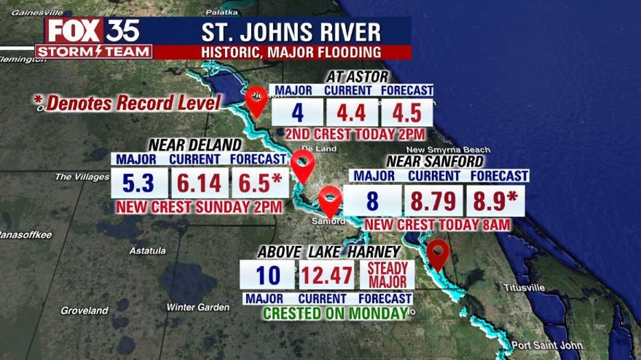
Main weather concerns: It will be a dry weekend across central Florida. Lots of sunshine and light winds continue for all areas. Highs will reach the mid-upper 80s this afternoon. Flood issues continue in the middle of the St. Johns River through the late week/this weekend above Lake Harney, near DeLand, and at Astor.
BEACHES:
The beaches will have beautiful clear skies and light winds. Highs will reach the low 80s with overnight lows in the mid-60s. Rip current risk remains high. Surf is in the 2-3' range in a mix of swell. Surf temps are in the upper 70s. Don't forget your sunscreen. Identical conditions are expected for the weekend! Enjoy!
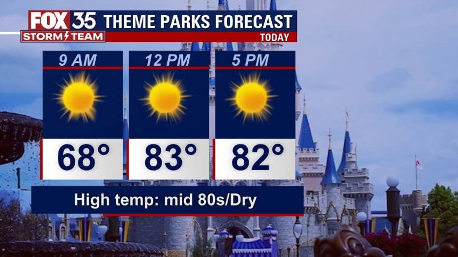
THEME PARKS:
If you are heading out to the theme parks, the weather will be great. Sunshine and dry skies prevail with highs in the mid-80s. Pack your hat, sunglasses, and plenty of water.
OUTLOOK:
The extended outlook for Central Florida weather looks great. Dry skies and sunshine will continue through at least the start of the weekend. Longer-term forecast calls for a few showers around by late weekend into early next week.
TROPICS:
The FOX 35 STORM TEAM is currently tracking Tropical Storm Julia in the Southern Caribbean. The system is forecast to become a hurricane late Saturday or early Sunday before landfall in Central America, around Nicaragua, late this weekend.
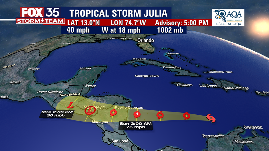
Damaging winds and heavy flooding will result as the system impacts land in the coming days. Outside of this system, the tropics remain quiet overall.