

Weekend outlook: Heat, storms and rip current risk

Weather Forecast: September 11, 2021
FOX 35 Storm Team Meteorologist Allison Gargaro has the forecast.
ORLANDO, Fla. - Central Florida will start the weekend on a cloudy note.
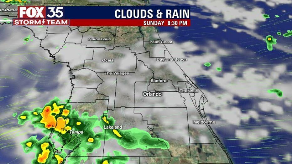
Mostly cloudy skies will prevail through the early afternoon hours on Saturday. Showers and storms will begin to move inland, from east to west across the peninsula, mainly after 2 p.m.
RELATED: Buckle up, Florida: NOAA says September is the most hurricane-prone month

There is a chance for brief heavy downpours, frequent lightning and gusty winds.
WEATHER ALERTS: Download the FOX 35 Storm Team Weather app for live radar, severe weather alerts, and daily forecast reports on your phone
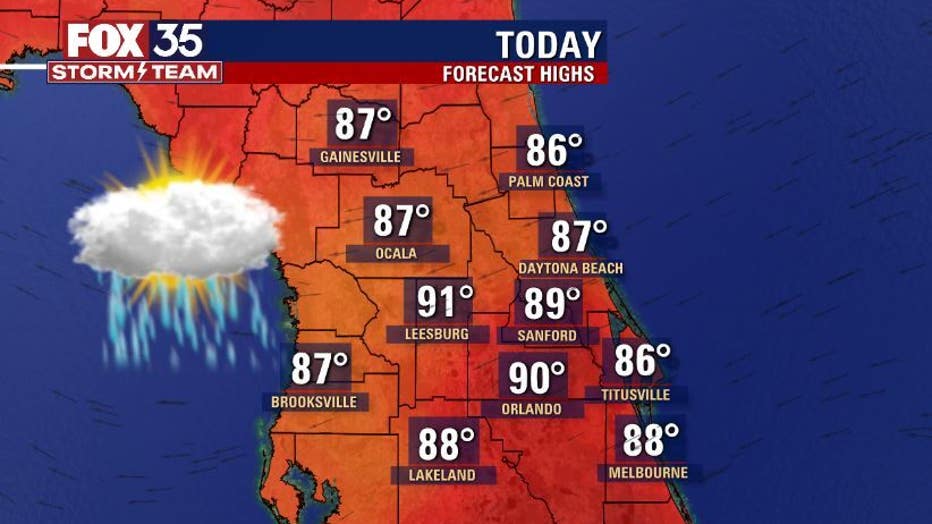
Storm coverage today will be 50%, but activity decreases on Sunday to 40%. Most of the storms Sunday afternoon will be centered on the west side of the peninsula. Afternoon highs on Saturday and Sunday will be in the upper-80s and low-90s.
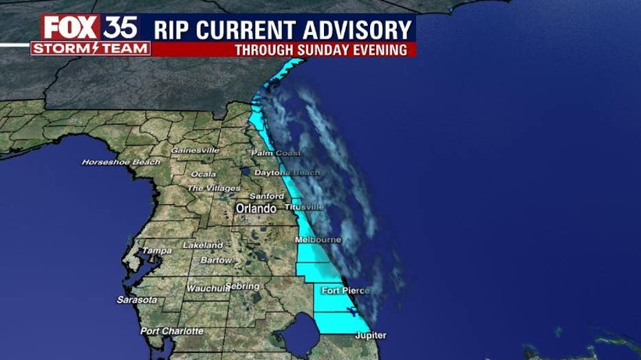
If you are planning on heading to the beach, there is a high risk for rip currents along the east coast through Sunday evening.
"A HIGH risk of rip currents continues at area beaches. Entering the water is highly discouraged," the National Weather Service in Melbourne said Saturday.
It is not recommended to enter the surf, but if you do, make sure it is near an open lifeguard stand.
Stay weather aware, and remember, when thunder roars, go indoors.